

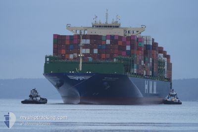
HMM AQUAMARINE
Cargo

Current Trip
| Time Travelled | 33 days |
|---|---|
| Remaining Time | 9 days |
| Distance Travelled | 6230.71 nm |
| Remaining Distance | 4578.45 nm |
| AVG Speed | 11.5 Knots |
| MAX Speed | 20.1 Knots |
| AVG Wind | 11.4 knots |
| MAX Wind | 24.8 knots |
| MIN Temp | 10.7°C / 51.26°F |
| MAX Temp | 22.4°C / 72.32°F |
| Draught | 14.3 m |
| Position Received | 21 h, 24 m ago |
Current Position
| Longitude | 141.91480° |
|---|---|
| Latitude | 41.63994° |
| Status | Under way using engine |
| Speed | 18 Knots |
| Course | 86.5° |
| Area | North Pacific Ocean |
| Station | T-AIS |
| Position Received | 21 h, 24 m ago |
Information
The current position of HMM AQUAMARINE is in North Pacific Ocean with coordinates 41.63994° / 141.91480° as reported on 2025-06-07 17:45 by AIS to our vessel tracker app. The vessel's current speed is 18 Knots and is heading at the port of LOS ANGELES. The estimated time of arrival as calculated by MyShipTracking vessel tracking app is 2025-06-17 22:27 LT
The vessel HMM AQUAMARINE (IMO: 9944479, MMSI: 636023891) is a Cargo It's sailing under the flag of [LR] Liberia.
In this page you can find informations about the vessels current position, last detected port calls, and current voyage information. If the vessels is not in coverage by AIS you will find the latest position.
The current position of HMM AQUAMARINE is detected by our AIS receivers and we are not responsible for the reliability of the data. The last position was recorded while the vessel was in Coverage by the Ais receivers of our vessel tracking app.
The current draught of HMM AQUAMARINE as reported by AIS is 14.3 meters
Weather
| Temperature | 13.4°C / 56.12°F |
|---|---|
| Wind Speed | 9 knots |
| Direction | 240° WSW |
| Pressure | 1006.9 hPa |
| Humidity | 90.3 % |
| Cloud Coverage | 100 % |


Featured Company
Last Port Calls
| Port | Arrival | Departure | Time In Port |
|---|---|---|---|
| 2025-05-03 15:22 | 2025-05-05 17:32 | 2 d | |
| 2025-04-23 03:04 | 2025-04-30 19:21 | 7 d |
Most Visited Ports (Last year)
| Port | Arrivals | |
|---|---|---|
| 4 | ||
| 4 | ||
| 4 | ||
| 4 | ||
| 1 | ||
| 1 |
Last Trips
| Origin | Departure | Destination | Arrival | Distance | |
|---|---|---|---|---|---|
| 2025-04-30 19:21 | 2025-05-03 15:22 | 478.27 nm | |||
| 2025-03-11 09:44 | 2025-04-23 03:04 | 10373.67 nm |
Events
| Time | Event | Details | Position / Dest | Info |
|---|---|---|---|---|
| 2025-06-07 17:45 | OUT of Coverage |
41.63994 / 141.91480
North Pacific Ocean
KRPUS>USLAX
|
Speed: 18 kn Course: 86.5° |
|
| 2025-06-07 16:16 | Change Sea Area | Japanese part of the North Pacific Ocean Japanese part of the Japan Sea |
41.61535 / 141.31357
North Pacific Ocean
KRPUS>USLAX
|
Speed: 17.9 kn Course: 89.1° |
| 2025-06-07 11:39 | IN Coverage |
40.99344 / 139.72607
Japan Sea
KRPUS>USLAX
|
Speed: 16.5 kn Course: 56.7° |
|
| 2025-06-06 00:14 | OUT of Coverage |
34.85669 / 129.42843
Japan Sea
KRPUS>USLAX
|
Speed: 18.9 kn Course: 58.5° |
|
| 2025-06-05 23:31 | Change Sea Area | Japanese part of the Japan Sea South Korean part of the Japan Sea |
34.79082 / 129.17778
Japan Sea
KRPUS>USLAX
|
Speed: 18.4 kn Course: 82.4° |
| 2025-06-05 22:23 | Draught Changed | 14.3 12.2 |
34.92101 / 128.86065
KRPUS>USLAX
|
Speed: 15.5 kn Course: 136.8° |
| 2025-06-05 22:23 | Destination Changed | KRPUS>USLAX KRKAN>KRPUS |
34.92101 / 128.86065
KRPUS>USLAX
|
Speed: 15.5 kn Course: 136.8° |
| 2025-06-05 22:23 | ETA Changed | 2025/06/19 13:00 2025/06/04 07:00 |
34.92101 / 128.86065
KRPUS>USLAX
|
Speed: 15.5 kn Course: 136.8° |
| 2025-06-05 21:57 | IN Coverage |
35.00232 / 128.79297
Japan Sea
|
Speed: 11.3 kn Course: 163.9° |
|
| 2025-06-04 07:20 | OUT of Coverage |
35.01926 / 128.79573
Japan Sea
KRKAN>KRPUS
|
Speed: 11.9 kn Course: 337.9° |