

HOHEPLATE
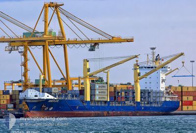
Container Ship

Current Trip
| Trip Time | 3 days |
|---|---|
| Trip Distance | 956.00 nm |
| AVG Speed | 8.8 Knots |
| MAX Speed | 14.5 Knots |
| Draught | 8.2 m |
| AVG Wind | 12 knots |
| MAX Wind | 18.3 knots |
| MIN Temp | 26.1°C / 78.98°F |
| MAX Temp | 28.9°C / 84.02°F |
| Position Received | 7 h, 30 m ago |
Current Position
| Longitude | -70.01574° |
|---|---|
| Latitude | 18.39702° |
| Status | Under way using engine |
| Speed | 6.2 Knots |
| Course | 355.4° |
| Area | Caribbean Sea |
| Station | T-AIS |
| Position Received | 7 h, 30 m ago |
Information
The current position of HOHEPLATE is in Caribbean Sea with coordinates 18.39702° / -70.01574° as reported on 2025-05-28 20:11 by AIS to our vessel tracker app. The vessel's current speed is 6.2 Knots and is currently inside the port of RIO HAINA.
The vessel HOHEPLATE (IMO: 9366237, MMSI: 305236000) is a Container Ship that was built in 2007 ( 18 years old ). It's sailing under the flag of [AG] Antigua Barbuda.
In this page you can find informations about the vessels current position, last detected port calls, and current voyage information. If the vessels is not in coverage by AIS you will find the latest position.
The current position of HOHEPLATE is detected by our AIS receivers and we are not responsible for the reliability of the data. The last position was recorded while the vessel was in Coverage by the Ais receivers of our vessel tracking app.
The current draught of HOHEPLATE as reported by AIS is 8.2 meters
Weather
| Temperature | 23.5°C / 74.3°F |
|---|---|
| Wind Speed | 5 knots |
| Direction | 342° NNW |
| Pressure | 1019.9 hPa |
| Humidity | 86.6 % |
| Cloud Coverage | 100 % |


Featured Company
Last Port Calls
| Port | Arrival | Departure | Time In Port |
|---|---|---|---|
| 2025-05-28 20:26 | |||
| 2025-05-24 20:52 | 2025-05-25 08:40 | 11 h | |
| 2025-05-24 11:32 | |||
| 2025-05-24 10:57 | 2025-05-24 11:06 | 8 m | |
| 2025-05-20 04:27 | 2025-05-21 01:25 | 20 h | |
| 2025-05-18 22:58 | 2025-05-19 20:24 | 21 h | |
| 2025-05-16 18:20 | 2025-05-17 05:05 | 10 h | |
| 2025-05-13 03:38 | 2025-05-13 14:27 | 10 h | |
| 2025-05-12 12:12 | 2025-05-13 03:34 | 15 h | |
| 2025-05-12 11:54 | 2025-05-12 11:58 | 3 m |
Most Visited Ports (Last year)
| Port | Arrivals | |
|---|---|---|
| 37 | ||
| 37 | ||
| 21 | ||
| 15 | ||
| 14 | ||
| 8 |
Last Trips
| Origin | Departure | Destination | Arrival | Distance | |
|---|---|---|---|---|---|
| 2025-05-25 04:40 | 2025-05-28 16:26 | 956.00 nm | |||
| 2025-05-24 07:06 | 2025-05-24 16:52 | 2.06 nm | |||
| 2025-05-24 07:06 | 2025-05-24 07:32 | 0.76 nm | |||
| 2025-05-20 20:25 | 2025-05-24 06:57 | 1094.40 nm | |||
| 2025-05-19 15:24 | 2025-05-19 23:27 | 88.73 nm | |||
| 2025-05-17 01:05 | 2025-05-18 17:58 | 594.15 nm | |||
| 2025-05-13 10:27 | 2025-05-16 14:20 | 944.84 nm | |||
| 2025-05-12 23:34 | 2025-05-12 23:38 | 0.48 nm | |||
| 2025-05-12 07:58 | 2025-05-12 08:12 | 0.73 nm | |||
| 2025-05-08 20:27 | 2025-05-12 07:54 | 1090.33 nm |
Events
| Time | Event | Details | Position / Dest | Info |
|---|---|---|---|---|
| 2025-05-28 20:41 | STOP Moving |
18.42615 / -70.01728
[DO] RIO HAINA
|
Speed: Course: -1° |
|
| 2025-05-28 20:26 | PORT ARRIVAL |
|
18.42064 / -70.01872
[DO] RIO HAINA
|
Speed: 6.3 kn Course: 357° |
| 2025-05-28 20:16 | Status Changed | Default Under way using engine |
18.40513 / -70.01665
DOHAI
|
Speed: 6.2 kn Course: 355.4° |
| 2025-05-28 20:11 | OUT of Coverage |
18.39702 / -70.01574
Caribbean Sea
[DO] RIO HAINA
|
Speed: 6.2 kn Course: 355.4° |
|
| 2025-05-28 17:38 | Status Changed | Under way using engine Default |
18.32090 / -69.98019
DOHAI
|
Speed: 4.5 kn Course: -1° |
| 2025-05-28 17:25 | Status Changed | Default Under way using engine |
18.33407 / -69.99116
DOHAI
|
Speed: 4.8 kn Course: 12.1° |
| 2025-05-28 16:18 | Status Changed | Under way using engine Default |
18.27942 / -70.02487
DOHAI
|
Speed: 5.4 kn Course: 56° |
| 2025-05-28 16:05 | Status Changed | Default Under way using engine |
18.26549 / -70.03909
DOHAI
|
Speed: 6.2 kn Course: 7.9° |
| 2025-05-28 15:50 | Status Changed | Under way using engine Default |
18.23964 / -70.04261
DOHAI
|
Speed: 2.7 kn Course: -1° |
| 2025-05-28 15:04 | Status Changed | Default Under way using engine |
18.24973 / -70.04800
DOHAI
|
Speed: 4.9 kn Course: 264.7° |