
HYPERION RAY
Cargo
Current Trip
| Time Travelled | 1 day |
|---|---|
| Remaining Time | 10 h, 40 mins |
| Distance Travelled | 475.85 nm |
| Remaining Distance | 145.58 nm |
| AVG Speed | 14.8 Knots |
| MAX Speed | 19.6 Knots |
| AVG Wind | 13.8 knots |
| MAX Wind | 24 knots |
| MIN Temp | 6.6°C / 43.88°F |
| MAX Temp | 9.7°C / 49.46°F |
| Draught | 8.7 m |
| Position Received | 35 m ago |
Current Position
| Longitude | 4.16348° |
|---|---|
| Latitude | 53.06278° |
| Status | Under way using engine |
| Speed | 13.1 Knots |
| Course | 228.9° |
| Area | North Sea |
| Station | T-AIS |
| Position Received | 35 m ago |
Info
Information
The current position of HYPERION RAY is in North Sea with coordinates 53.06278° / 4.16348° as reported on 2025-12-17 18:38 by AIS to our vessel tracker app. The vessel's current speed is 13.1 Knots and is heading at the port of ANTWERP. The estimated time of arrival as calculated by MyShipTracking vessel tracking app is 2025-12-18 06:54 LT
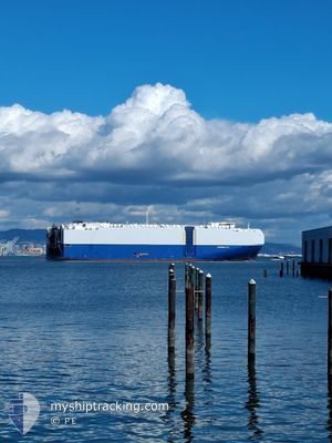
The vessel HYPERION RAY (IMO: 9690559, MMSI: 311000322) is a Cargo It's sailing under the flag of [BS] Bahamas.
In this page you can find informations about the vessels current position, last detected port calls, and current voyage information. If the vessels is not in coverage by AIS you will find the latest position.
The current position of HYPERION RAY is detected by our AIS receivers and we are not responsible for the reliability of the data. The last position was recorded while the vessel was in Coverage by the Ais receivers of our vessel tracking app.
The current draught of HYPERION RAY as reported by AIS is 8.7 meters
Weather
| Temperature | 9.7°C / 49.46°F |
|---|---|
| Wind Speed | 24 knots |
| Direction | 201° SSW |
| Pressure | 1013.7 hPa |
| Humidity | 85.1 % |
| Cloud Coverage | 91 % |
Featured Company
Last Port Calls
| Port | Arrival | Departure | Time In Port |
|---|---|---|---|
| 2025-12-15 13:33 | 2025-12-16 16:14 | 1 d | |
| 2025-12-12 23:21 | 2025-12-13 23:06 | 23 h | |
| 2025-12-09 10:23 | 2025-12-10 03:21 | 16 h | |
| 2025-10-30 11:21 | 2025-10-30 16:22 | 5 h | |
| 2025-10-28 10:49 | 2025-10-29 20:35 | 1 d | |
| 2025-10-25 07:48 | 2025-10-25 19:00 | 11 h | |
| 2025-10-10 11:52 | 2025-10-24 09:40 | 13 d | |
| 2025-10-03 16:56 | 2025-10-03 23:40 | 6 h | |
| 2025-10-01 15:33 | 2025-10-02 19:44 | 1 d |
Most Visited Ports (Last year)
| Port | Arrivals | |
|---|---|---|
| 4 | ||
| 4 | ||
| 3 | ||
| 3 | ||
| 2 | ||
| 2 |
Last Trips
| Origin | Departure | Destination | Arrival | Distance | |
|---|---|---|---|---|---|
| 2025-12-13 23:06 | 2025-12-15 13:33 | 563.63 nm | |||
| 2025-12-10 03:21 | 2025-12-12 23:21 | 441.44 nm | |||
| 2025-10-30 16:22 | 2025-12-09 10:23 | 14045.43 nm | |||
| 2025-10-29 20:35 | 2025-10-30 11:21 | 64.06 nm | |||
| 2025-10-25 19:00 | 2025-10-28 10:49 | 706.48 nm | |||
| 2025-10-24 09:40 | 2025-10-25 07:48 | 197.12 nm | |||
| 2025-10-03 23:40 | 2025-10-10 11:52 | 443.93 nm | |||
| 2025-10-02 19:44 | 2025-10-03 16:56 | 310.46 nm | |||
| 2025-09-04 22:50 | 2025-10-01 15:33 | 9914.14 nm |
Events
| Time | Event | Details | Position / Dest | Info |
|---|---|---|---|---|
| 2025-12-17 18:46 | Status Changed | Default Under way using engine |
53.04512 / 4.12987
BEANR
|
Speed: 13.1 kn Course: 228.9° |
| 2025-12-17 18:33 | Status Changed | Under way using engine Default |
53.07679 / 4.19020
BEANR
|
Speed: 13.2 kn Course: 228° |
| 2025-12-17 18:26 | Status Changed | Default Under way using engine |
53.09320 / 4.22024
BEANR
|
Speed: 12.9 kn Course: 227.9° |
| 2025-12-17 16:13 | Status Changed | Under way using engine Default |
53.51360 / 4.58730
BEANR
|
Speed: 13 kn Course: 199° |
| 2025-12-17 16:07 | Status Changed | Default Under way using engine |
53.53333 / 4.59833
BEANR
|
Speed: 13.2 kn Course: 199.6° |
| 2025-12-17 15:39 | Draught Changed | 8.7 9.3 |
53.63656 / 4.66130
BEANR
|
Speed: 13.4 kn Course: 199.9° |
| 2025-12-17 15:39 | ETA Changed | 2025/12/18 02:00 2025/12/18 06:35 |
53.63656 / 4.66130
BEANR
|
Speed: 13.4 kn Course: 199.9° |
| 2025-12-17 15:25 | Status Changed | Under way using engine Default |
53.68051 / 4.68832
BEANR
|
Speed: 13.1 kn Course: 201° |
| 2025-12-17 15:06 | Status Changed | Default Under way using engine |
53.74579 / 4.72897
BEANR
|
Speed: 13.2 kn Course: 200.1° |
| 2025-12-17 15:04 | Change Sea Area | Dutch part of the North Sea German part of the North Sea |
53.75267 / 4.73326
North Sea
BEANR
|
Speed: 13.2 kn Course: 200.1° |