
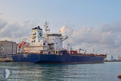
ICHESIA M
Oil/Chemical Tanker
Current Trip
| Time Travelled | 12 h, 25 mins |
|---|---|
| Remaining Time | --- |
| Distance Travelled | 71.03 nm |
| Remaining Distance | 4.52 nm |
| AVG Speed | 10.4 Knots |
| MAX Speed | 13.2 Knots |
| AVG Wind | 15.7 knots |
| MAX Wind | 25.5 knots |
| MIN Temp | 0.5°C / 32.9°F |
| MAX Temp | 7.7°C / 45.86°F |
| Draught | 6.7 m |
| Position Received | 1 m ago |
Current Position
| Longitude | 13.68470° |
|---|---|
| Latitude | 45.62459° |
| Status | At anchor |
| Speed | |
| Course | 76° |
| Area | Adriatic Sea |
| Station | T-AIS |
| Position Received | 1 m ago |
Info
Information
The current position of ICHESIA M is in Adriatic Sea with coordinates 45.62459° / 13.68470° as reported on 2026-01-04 23:03 by AIS to our vessel tracker app. The vessel's current speed is 0 Knots and is heading at the port of TRIESTE. The estimated time of arrival as calculated by MyShipTracking vessel tracking app is 2026-01-04 18:00 LT
The vessel ICHESIA M (IMO: 9436678, MMSI: 247433700) is a Oil/Chemical Tanker that was built in 2009 ( 17 years old ). It's sailing under the flag of [IT] Italy.
In this page you can find informations about the vessels current position, last detected port calls, and current voyage information. If the vessels is not in coverage by AIS you will find the latest position.
The current position of ICHESIA M is detected by our AIS receivers and we are not responsible for the reliability of the data. The last position was recorded while the vessel was in Coverage by the Ais receivers of our vessel tracking app.
The current draught of ICHESIA M as reported by AIS is 6.7 meters
Weather
| Temperature | -0.5°C / 31.1°F |
|---|---|
| Wind Speed | 5 knots |
| Direction | 71° ENE |
| Pressure | 1010.5 hPa |
| Humidity | 73.7 % |
| Cloud Coverage | 100 % |
Featured Company
Last Port Calls
| Port | Arrival | Departure | Time In Port |
|---|---|---|---|
| 2026-01-02 08:51 | 2026-01-04 11:40 | 2 d | |
| 2025-12-27 11:57 | 2025-12-29 09:48 | 1 d | |
| 2025-12-20 09:27 | 2025-12-22 08:56 | 1 d | |
| 2025-12-14 15:07 | 2025-12-15 18:17 | 1 d | |
| 2025-12-06 19:25 | 2025-12-07 10:49 | 15 h | |
| 2025-12-05 11:04 | 2025-12-06 09:16 | 22 h | |
| 2025-12-01 07:37 | 2025-12-03 09:34 | 2 d | |
| 2025-11-24 15:47 | 2025-11-26 21:47 | 2 d | |
| 2025-11-14 13:51 | 2025-11-21 12:20 | 6 d | |
| 2025-11-10 12:36 | 2025-11-10 15:15 | 2 h |
Last Trips
| Origin | Departure | Destination | Arrival | Distance | |
|---|---|---|---|---|---|
| 2025-12-29 09:48 | 2026-01-02 08:51 | 1001.73 nm | |||
| 2025-12-22 08:56 | 2025-12-27 11:57 | 316.67 nm | |||
| 2025-12-15 18:17 | 2025-12-20 09:27 | 314.43 nm | |||
| 2025-12-07 10:49 | 2025-12-14 15:07 | 964.71 nm | |||
| 2025-12-06 09:16 | 2025-12-06 19:25 | 127.79 nm | |||
| 2025-12-03 09:34 | 2025-12-05 11:04 | 78.94 nm | |||
| 2025-11-26 21:47 | 2025-12-01 07:37 | 979.53 nm | |||
| 2025-11-21 12:20 | 2025-11-24 15:47 | 576.24 nm | |||
| 2025-11-10 15:15 | 2025-11-14 13:51 | 266.88 nm | |||
| 2025-10-25 17:42 | 2025-11-10 12:36 | 993.82 nm |
Events
| Time | Event | Details | Position / Dest | Info |
|---|---|---|---|---|
| 2026-01-04 22:44 | ETA Changed | 2026/01/04 17:00 |
45.62457 / 13.68459
IT TRS
|
Speed: 0.2 kn Course: 76° |
| 2026-01-04 22:33 | Status Changed | At anchor Default |
45.62458 / 13.68472
IT TRS
|
Speed: 0.2 kn Course: 73° |
| 2026-01-04 22:30 | Status Changed | Default At anchor |
45.62452 / 13.68463
IT TRS
|
Speed: 0.1 kn Course: 75° |
| 2026-01-04 22:20 | ETA Changed | 2026/01/04 17:00 |
45.62453 / 13.68470
IT TRS
|
Speed: 0.1 kn Course: 72° |
| 2026-01-04 19:57 | Status Changed | At anchor Default |
45.62458 / 13.68467
IT TRS
|
Speed: Course: 76° |
| 2026-01-04 19:54 | Status Changed | Default At anchor |
45.62454 / 13.68464
IT TRS
|
Speed: 0.1 kn Course: 80° |
| 2026-01-04 18:14 | ETA Changed | 2026/01/04 17:00 |
45.62462 / 13.68478
IT TRS
|
Speed: 0.1 kn Course: 76° |
| 2026-01-04 17:33 | STOP Moving | 3.57 nm, West of TRIESTE |
45.62464 / 13.68473
IT TRS
|
Speed: 0.3 kn Course: 74° |
| 2026-01-04 17:25 | Status Changed | At anchor Under way using engine |
45.62558 / 13.68627
IT TRS
|
Speed: 0.6 kn Course: 90° |
| 2026-01-04 17:01 | Change Sea Area | Italian part of the Adriatic Sea Slovenian part of the Adriatic Sea |
45.62248 / 13.66418
Adriatic Sea
IT TRS
|
Speed: 8.2 kn Course: 78.7° |