

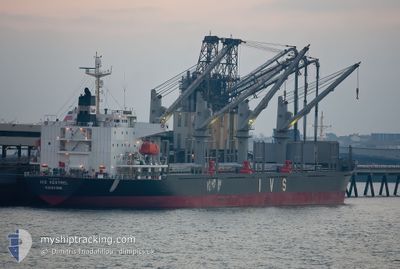
IVS KESTREL
Cargo

Current Trip
| Trip Time | 8 days |
|---|---|
| Trip Distance | 1110.88 nm |
| AVG Speed | 10 Knots |
| MAX Speed | 15.7 Knots |
| Draught | 6.7 m |
| AVG Wind | 13.5 knots |
| MAX Wind | 34 knots |
| MIN Temp | 14.8°C / 58.64°F |
| MAX Temp | 24°C / 75.2°F |
| Position Received | 3 d ago |
Current Position
| Longitude | 128.78802° |
|---|---|
| Latitude | 34.64829° |
| Status | Under way using engine |
| Speed | 11.8 Knots |
| Course | 230.1° |
| Area | Japan Sea |
| Station | T-AIS |
| Position Received | 3 d ago |
Information
The current position of IVS KESTREL is in Japan Sea with coordinates 34.64829° / 128.78802° as reported on 2025-05-29 18:52 by AIS to our vessel tracker app. The vessel's current speed is 11.8 Knots and is currently inside the port of PYEONGTAEK.
The vessel IVS KESTREL (IMO: 9700926, MMSI: 538010647) is a Cargo It's sailing under the flag of [MH] Marshall Is.
In this page you can find informations about the vessels current position, last detected port calls, and current voyage information. If the vessels is not in coverage by AIS you will find the latest position.
The current position of IVS KESTREL is detected by our AIS receivers and we are not responsible for the reliability of the data. The last position was recorded while the vessel was in Coverage by the Ais receivers of our vessel tracking app.
The current draught of IVS KESTREL as reported by AIS is 6.7 meters
Weather
| Temperature | 16.1°C / 60.98°F |
|---|---|
| Wind Speed | 4 knots |
| Direction | 294° WNW |
| Pressure | 1001.5 hPa |
| Humidity | 75.2 % |
| Cloud Coverage | 100 % |


Featured Company
Last Port Calls
| Port | Arrival | Departure | Time In Port |
|---|---|---|---|
| 2025-05-31 10:31 | |||
| 2025-05-19 08:24 | 2025-05-23 06:14 | 3 d | |
| 2025-05-16 07:10 | 2025-05-18 14:14 | 2 d | |
| 2025-05-09 18:21 | 2025-05-13 23:21 | 4 d | |
| 2025-05-04 21:47 | 2025-05-08 01:00 | 3 d | |
| 2025-04-28 22:58 | 2025-04-30 19:34 | 1 d |
Last Trips
| Origin | Departure | Destination | Arrival | Distance | |
|---|---|---|---|---|---|
| 2025-05-23 06:14 | 2025-05-31 10:31 | 1110.88 nm | |||
| 2025-05-18 14:14 | 2025-05-19 08:24 | 203.88 nm | |||
| 2025-05-13 23:21 | 2025-05-16 07:10 | 605.73 nm | |||
| 2025-05-08 01:00 | 2025-05-09 18:21 | 515.99 nm | |||
| 2025-04-30 19:34 | 2025-05-04 21:47 | 552.18 nm | |||
| 2025-03-26 08:13 | 2025-04-28 22:58 | 7436.35 nm |
Events
| Time | Event | Details | Position / Dest | Info |
|---|---|---|---|---|
| 2025-05-31 02:17 | STOP Moving |
36.98327 / 126.76165
[KR] PYEONGTAEK
|
Speed: Course: 114° |
|
| 2025-05-31 01:31 | PORT ARRIVAL |
|
37.00494 / 126.71088
[KR] PYEONGTAEK
|
Speed: 12.5 kn Course: 151° |
| 2025-05-29 18:58 | Status Changed | Default Under way using engine |
34.63535 / 128.76819
KR PTK
|
Speed: 11.8 kn Course: 230.1° |
| 2025-05-29 18:52 | OUT of Coverage |
34.64829 / 128.78802
Japan Sea
KR PTK
|
Speed: 11.8 kn Course: 230.1° |
|
| 2025-05-29 18:46 | Status Changed | Under way using engine Default |
34.66154 / 128.80759
KR PTK
|
Speed: 11.8 kn Course: 219° |
| 2025-05-29 18:37 | Status Changed | Default Under way using engine |
34.68227 / 128.82858
KR PTK
|
Speed: 11.8 kn Course: 203.6° |
| 2025-05-29 18:06 | ETA Changed | 2025/05/31 03:00 2025/05/31 06:00 |
34.78129 / 128.86758
KR PTK
|
Speed: 11.9 kn Course: 198.9° |
| 2025-05-29 16:17 | Draught Changed | 6.7 7.5 |
35.04107 / 129.01784
KR PTK
|
Speed: 6.5 kn Course: 146° |
| 2025-05-29 16:17 | Destination Changed | KR PTK KR PUS |
35.04107 / 129.01784
KR PTK
|
Speed: 6.5 kn Course: 146° |
| 2025-05-29 16:17 | ETA Changed | 2025/05/31 06:00 2025/05/25 21:00 |
35.04107 / 129.01784
KR PTK
|
Speed: 6.5 kn Course: 146° |