
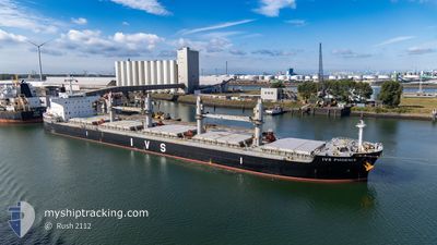
IVS PHOENIX
Cargo
Current Trip
| Time Travelled | 5 days |
|---|---|
| Remaining Time | --- |
| Distance Travelled | 688.31 nm |
| Remaining Distance | --- |
| AVG Speed | 11.6 Knots |
| MAX Speed | 15.1 Knots |
| AVG Wind | 17.3 knots |
| MAX Wind | 30 knots |
| MIN Temp | 14°C / 57.2°F |
| MAX Temp | 23.2°C / 73.76°F |
| Draught | 12.4 m |
| Position Received | 18 h, 5 m ago |
Current Position
| Longitude | 113.79946° |
|---|---|
| Latitude | 22.26820° |
| Status | Under way using engine |
| Speed | 10.6 Knots |
| Course | 170.6° |
| Area | South China Sea |
| Station | T-AIS |
| Position Received | 18 h, 5 m ago |
Info
Information
The current position of IVS PHOENIX is in South China Sea with coordinates 22.26820° / 113.79946° as reported on 2025-12-16 06:06 by AIS to our vessel tracker app. The vessel's current speed is 10.6 Knots and is heading at the port of JURONG ISLAND. The estimated time of arrival as calculated by MyShipTracking vessel tracking app is 2025-12-21 11:00 LT
The vessel IVS PHOENIX (IMO: 9774862, MMSI: 538009610) is a Cargo It's sailing under the flag of [MH] Marshall Is.
In this page you can find informations about the vessels current position, last detected port calls, and current voyage information. If the vessels is not in coverage by AIS you will find the latest position.
The current position of IVS PHOENIX is detected by our AIS receivers and we are not responsible for the reliability of the data. The last position was recorded while the vessel was in Coverage by the Ais receivers of our vessel tracking app.
The current draught of IVS PHOENIX as reported by AIS is 12.4 meters
Weather
| Temperature | 23.2°C / 73.76°F |
|---|---|
| Wind Speed | 21 knots |
| Direction | 42° NE |
| Pressure | 1018 hPa |
| Humidity | 70 % |
| Cloud Coverage | 3 % |
Featured Company
Last Port Calls
| Port | Arrival | Departure | Time In Port |
|---|---|---|---|
| 2025-12-03 10:25 | 2025-12-11 18:57 | 8 d | |
| 2025-10-20 16:53 | 2025-10-21 15:53 | 23 h | |
| 2025-10-07 17:09 | 2025-10-15 20:21 | 8 d |
Last Trips
| Origin | Departure | Destination | Arrival | Distance | |
|---|---|---|---|---|---|
| 2025-10-21 15:53 | 2025-12-03 10:25 | 8569.59 nm | |||
| 2025-10-15 20:21 | 2025-10-20 16:53 | 807.32 nm | |||
| 2025-09-15 14:48 | 2025-10-07 17:09 | 6233.08 nm |
Events
| Time | Event | Details | Position / Dest | Info |
|---|---|---|---|---|
| 2025-12-16 06:13 | Status Changed | Default Under way using engine |
22.24649 / 113.80595
SGP
|
Speed: 10.6 kn Course: 170.6° |
| 2025-12-16 06:06 | OUT of Coverage |
22.26820 / 113.79946
South China Sea
SGP
|
Speed: 10.6 kn Course: 170.6° |
|
| 2025-12-16 03:31 | Draught Changed | 12.4 7.4 |
22.73336 / 113.66109
SGP
|
Speed: 10.4 kn Course: 143.2° |
| 2025-12-16 03:31 | Destination Changed | SGP CN DGG |
22.73336 / 113.66109
SGP
|
Speed: 10.4 kn Course: 143.2° |
| 2025-12-16 03:31 | ETA Changed | 2025/12/21 03:00 2025/12/13 10:30 |
22.73336 / 113.66109
SGP
|
Speed: 10.4 kn Course: 143.2° |
| 2025-12-16 03:30 | Status Changed | Under way using engine Default |
22.73371 / 113.66081
CN DGG
|
Speed: 10.3 kn Course: 145° |
| 2025-12-16 03:26 | Status Changed | Default Under way using engine |
22.74432 / 113.65264
CN DGG
|
Speed: 10.3 kn Course: 145.2° |
| 2025-12-16 03:25 | Status Changed | Under way using engine Default |
22.74510 / 113.65205
CN DGG
|
Speed: 10.2 kn Course: 146° |
| 2025-12-16 03:14 | Status Changed | Default Under way using engine |
22.77220 / 113.63216
CN DGG
|
Speed: 10.3 kn Course: 147.1° |
| 2025-12-16 03:13 | Status Changed | Under way using engine Default |
22.77543 / 113.62988
CN DGG
|
Speed: 10.2 kn Course: 147° |