

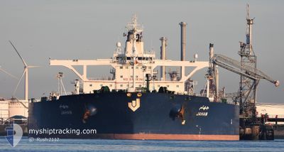
JAHAM
Crude Oil Tanker

Current Trip
| Time Travelled | 10 h, 51 mins |
|---|---|
| Remaining Time | --- |
| Distance Travelled | 96.35 nm |
| Remaining Distance | --- |
| AVG Speed | 12.8 Knots |
| MAX Speed | 12.8 Knots |
| AVG Wind | 9.5 knots |
| MAX Wind | 12 knots |
| MIN Temp | 26.4°C / 79.52°F |
| MAX Temp | 32.7°C / 90.86°F |
| Draught | 20.8 m |
| Position Received | 2 d ago |
Current Position
| Longitude | 37.65248° |
|---|---|
| Latitude | 23.75539° |
| Status | Under way using engine |
| Speed | 1.8 Knots |
| Course | 234° |
| Area | Red Sea |
| Station | T-AIS |
| Position Received | 2 d ago |
Information
The current position of JAHAM is in Red Sea with coordinates 23.75539° / 37.65248° as reported on 2025-05-18 22:15 by AIS to our vessel tracker app. The vessel's current speed is 1.8 Knots
The vessel JAHAM (IMO: 9378541, MMSI: 403589000) is a Crude Oil Tanker that was built in 2008 ( 17 years old ). It's sailing under the flag of [SA] Saudi Arabia.
In this page you can find informations about the vessels current position, last detected port calls, and current voyage information. If the vessels is not in coverage by AIS you will find the latest position.
The current position of JAHAM is detected by our AIS receivers and we are not responsible for the reliability of the data. The last position was recorded while the vessel was in Coverage by the Ais receivers of our vessel tracking app.
The current draught of JAHAM as reported by AIS is 20.8 meters
Weather
| Temperature | 26.2°C / 79.16°F |
|---|---|
| Wind Speed | 10 knots |
| Direction | 326° NW |
| Pressure | 1006.5 hPa |
| Humidity | 86.9 % |
| Cloud Coverage | --- |


Featured Company
Last Port Calls
| Port | Arrival | Departure | Time In Port |
|---|---|---|---|
| 2025-05-20 14:44 | 2025-05-21 13:49 | 23 h | |
| 2025-05-19 15:58 | 2025-05-20 12:27 | 20 h | |
| 2025-04-29 23:01 | 2025-05-01 09:22 | 1 d | |
| 2025-04-08 20:48 | 2025-04-10 20:07 | 1 d |
Most Visited Ports (Last year)
| Port | Arrivals | |
|---|---|---|
| 6 | ||
| 4 | ||
| 4 | ||
| 1 |
Last Trips
| Origin | Departure | Destination | Arrival | Distance | |
|---|---|---|---|---|---|
| 2025-05-20 12:27 | 2025-05-20 14:44 | 14.33 nm | |||
| 2025-05-01 09:22 | 2025-05-19 15:58 | 4362.11 nm | |||
| 2025-04-10 20:07 | 2025-04-29 23:01 | 3841.28 nm | |||
| 2025-02-04 15:55 | 2025-04-08 20:48 | 4924.53 nm |
Events
| Time | Event | Details | Position / Dest | Info |
|---|---|---|---|---|
| 2025-05-21 16:17 | Draught Changed | 20.8 11 |
22.95575 / 38.34343
SA GIZ
|
Speed: 18.8 kn Course: 99° |
| 2025-05-21 16:17 | Destination Changed | SA GIZ SA YNB |
22.95575 / 38.34343
SA GIZ
|
Speed: 18.8 kn Course: 99° |
| 2025-05-21 16:17 | ETA Changed | 2025/05/23 11:00 2025/05/16 18:00 |
22.95575 / 38.34343
SA GIZ
|
Speed: 18.8 kn Course: 99° |
| 2025-05-21 10:49 | PORT DEPARTURE |
|
23.78646 / 38.38055
SA YNB
|
Speed: Course: 315° |
| 2025-05-20 11:45 | STOP Moving |
23.80516 / 38.40309
[SA] AL MUAJJIZ
|
Speed: 0.3 kn Course: 316° |
|
| 2025-05-20 11:44 | PORT ARRIVAL |
|
23.80516 / 38.40309
[SA] AL MUAJJIZ
|
Speed: 0.7 kn Course: 310° |
| 2025-05-20 09:28 | START Moving | 1.34 nm, South East of YANBU |
23.93380 / 38.22338
SA YNB
|
Speed: 5.2 kn Course: 165° |
| 2025-05-20 09:27 | PORT DEPARTURE |
|
23.93380 / 38.22338
SA YNB
|
Speed: 3 kn Course: 227° |
| 2025-05-19 12:58 | PORT ARRIVAL |
|
23.93988 / 38.22828
[SA] YANBU
|
Speed: 3.8 kn Course: 7° |
| 2025-05-18 22:15 | OUT of Coverage |
23.75539 / 37.65248
Red Sea
|
Speed: 1.8 kn Course: 180.1° |