
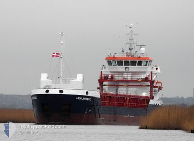
JAN-LAURENZ
Cargo
Current Trip
| Time Travelled | 3 days |
|---|---|
| Remaining Time | --- |
| Distance Travelled | 695.04 nm |
| Remaining Distance | --- |
| AVG Speed | 6.4 Knots |
| MAX Speed | 10.5 Knots |
| AVG Wind | 21.6 knots |
| MAX Wind | 32.7 knots |
| MIN Temp | 10.4°C / 50.72°F |
| MAX Temp | 18.6°C / 65.48°F |
| Draught | 5.7 m |
| Position Received | 1 m ago |
Current Position
| Longitude | 17.91927° |
|---|---|
| Latitude | 36.43595° |
| Status | Under way using engine |
| Speed | 8.4 Knots |
| Course | 271.8° |
| Area | Mediterranean Sea - Eastern Basin |
| Station | T-AIS |
| Position Received | 1 m ago |
Info
Information
The current position of JAN-LAURENZ is in Mediterranean Sea - Eastern Basin with coordinates 36.43595° / 17.91927° as reported on 2025-03-14 20:52 by AIS to our vessel tracker app. The vessel's current speed is 8.4 Knots and is heading at the port of BELFAST. The estimated time of arrival as calculated by MyShipTracking vessel tracking app is 2025-03-26 05:00 LT
The vessel JAN-LAURENZ (IMO: 9953937, MMSI: 275540000) is a Cargo It's sailing under the flag of [LV] Latvia.
In this page you can find informations about the vessels current position, last detected port calls, and current voyage information. If the vessels is not in coverage by AIS you will find the latest position.
The current position of JAN-LAURENZ is detected by our AIS receivers and we are not responsible for the reliability of the data. The last position was recorded while the vessel was in Coverage by the Ais receivers of our vessel tracking app.
The current draught of JAN-LAURENZ as reported by AIS is 5.7 meters
Weather
| Temperature | 18.6°C / 65.48°F |
|---|---|
| Wind Speed | 19 knots |
| Direction | 164° SSE |
| Pressure | 1013.4 hPa |
| Humidity | 73.1 % |
| Cloud Coverage | 5 % |
Featured Company
Last Port Calls
| Port | Arrival | Departure | Time In Port |
|---|---|---|---|
| 2025-03-09 07:49 | 2025-03-11 04:58 | 1 d | |
| 2025-03-07 06:47 | 2025-03-09 04:18 | 1 d | |
| 2025-02-10 05:33 | 2025-02-12 18:37 | 2 d | |
| 2025-02-07 06:03 | 2025-02-07 18:05 | 12 h | |
| 2025-02-02 14:48 | 2025-02-05 18:34 | 3 d | |
| 2025-01-27 03:43 | 2025-01-30 08:23 | 3 d | |
| 2025-01-13 08:58 | 2025-01-15 05:28 | 1 d |
Most Visited Ports (Last year)
| Port | Arrivals | |
|---|---|---|
| 4 | ||
| 2 | ||
| 2 | ||
| 2 | ||
| 2 | ||
| 1 |
Last Trips
| Origin | Departure | Destination | Arrival | Distance | |
|---|---|---|---|---|---|
| 2025-03-09 04:18 | 2025-03-09 07:49 | 5.06 nm | |||
| 2025-02-12 18:37 | 2025-03-07 06:47 | 4409.76 nm | |||
| 2025-02-07 18:05 | 2025-02-10 05:33 | 490.18 nm | |||
| 2025-02-05 18:34 | 2025-02-07 06:03 | 270.24 nm | |||
| 2025-01-30 08:23 | 2025-02-02 14:48 | 110.79 nm | |||
| 2025-01-15 05:28 | 2025-01-27 03:43 | 2501.98 nm | |||
| 2024-12-31 14:40 | 2025-01-13 08:58 | 447.08 nm |
Events
| Time | Event | Details | Position / Dest | Info |
|---|---|---|---|---|
| 2025-03-14 20:40 | Status Changed | Under way using engine Default |
36.43478 / 17.95539
TR DIL>GB BEL
|
Speed: 8.5 kn Course: 273° |
| 2025-03-14 20:34 | Status Changed | Default Under way using engine |
36.43411 / 17.97395
TR DIL>GB BEL
|
Speed: 8.4 kn Course: 271.3° |
| 2025-03-14 19:20 | Status Changed | Under way using engine Default |
36.43241 / 18.19040
TR DIL>GB BEL
|
Speed: 8.7 kn Course: 275° |
| 2025-03-14 19:10 | Status Changed | Default Under way using engine |
36.43046 / 18.22135
TR DIL>GB BEL
|
Speed: 8.6 kn Course: 274.7° |
| 2025-03-14 19:00 | Status Changed | Under way using engine Default |
36.42820 / 18.25212
TR DIL>GB BEL
|
Speed: 8.8 kn Course: 274° |
| 2025-03-14 18:58 | Status Changed | Default Under way using engine |
36.42781 / 18.25714
TR DIL>GB BEL
|
Speed: 8.8 kn Course: 277.4° |
| 2025-03-14 18:57 | Status Changed | Under way using engine Default |
36.42767 / 18.25915
TR DIL>GB BEL
|
Speed: 8.7 kn Course: 276° |
| 2025-03-14 18:57 | Change Sea Area | Italian part of the Mediterranean Sea - Eastern Basin Greek part of the Mediterranean Sea - Eastern Basin |
36.42767 / 18.25915
Mediterranean Sea - Eastern Basin
TR DIL>GB BEL
|
Speed: 8.8 kn Course: 277.4° |
| 2025-03-14 18:42 | IN Coverage |
36.42767 / 18.25915
Mediterranean Sea - Eastern Basin
TR DIL>GB BEL
|
Speed: 8.8 kn Course: 277.4° |
|
| 2025-03-14 16:26 | OUT of Coverage |
36.41043 / 18.70388
Mediterranean Sea - Eastern Basin
TR DIL>GB BEL
|
Speed: 8.4 kn Course: 271° |