

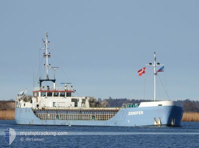
JENNIFER
General Cargo

Current Trip
| Time Travelled | 1 day |
|---|---|
| Remaining Time | --- |
| Distance Travelled | 203.80 nm |
| Remaining Distance | --- |
| AVG Speed | 7.6 Knots |
| MAX Speed | 8.1 Knots |
| AVG Wind | 11.1 knots |
| MAX Wind | 17.8 knots |
| MIN Temp | 9.9°C / 49.82°F |
| MAX Temp | 16.3°C / 61.34°F |
| Draught | 2.4 m |
| Position Received | 2 m ago |
Current Position
| Longitude | 14.62164° |
|---|---|
| Latitude | 53.49623° |
| Status | Moored |
| Speed | |
| Course | 211° |
| Area | Baltic Sea |
| Station | T-AIS |
| Position Received | 2 m ago |
Information
The current position of JENNIFER is in Baltic Sea with coordinates 53.49623° / 14.62164° as reported on 2025-05-28 01:25 by AIS to our vessel tracker app. The vessel's current speed is 0 Knots
The vessel JENNIFER (IMO: 8404496, MMSI: 268251601) is a General Cargo that was built in 1984 ( 41 years old ). It's sailing under the flag of [SM] San Marino.
In this page you can find informations about the vessels current position, last detected port calls, and current voyage information. If the vessels is not in coverage by AIS you will find the latest position.
The current position of JENNIFER is detected by our AIS receivers and we are not responsible for the reliability of the data. The last position was recorded while the vessel was in Coverage by the Ais receivers of our vessel tracking app.
The current draught of JENNIFER as reported by AIS is 2.4 meters
Weather
| Temperature | 13.9°C / 57.02°F |
|---|---|
| Wind Speed | 8 knots |
| Direction | 206° SSW |
| Pressure | 1011.7 hPa |
| Humidity | 85.2 % |
| Cloud Coverage | 100 % |


Featured Company
Last Port Calls
| Port | Arrival | Departure | Time In Port |
|---|---|---|---|
| 2025-05-26 14:45 | |||
| 2025-05-20 21:22 | 2025-05-21 19:40 | 22 h | |
| 2025-05-16 04:35 | 2025-05-16 14:48 | 10 h | |
| 2025-05-13 05:34 | 2025-05-13 18:36 | 13 h | |
| 2025-05-10 14:02 | 2025-05-11 22:17 | 1 d | |
| 2025-05-08 06:37 | 2025-05-09 01:53 | 19 h | |
| 2025-05-01 16:38 | 2025-05-06 12:05 | 4 d | |
| 2025-04-29 23:55 | 2025-04-30 19:08 | 19 h | |
| 2025-04-27 19:00 | 2025-04-28 14:36 | 19 h | |
| 2025-04-27 18:51 | 2025-04-27 18:57 | 5 m |
Last Trips
| Origin | Departure | Destination | Arrival | Distance | |
|---|---|---|---|---|---|
| 2025-05-16 16:48 | 2025-05-20 23:22 | 331.08 nm | |||
| 2025-05-13 20:36 | 2025-05-16 06:35 | 286.43 nm | |||
| 2025-05-12 00:17 | 2025-05-13 07:34 | 167.57 nm | |||
| 2025-05-09 03:53 | 2025-05-10 16:02 | 270.30 nm | |||
| 2025-05-06 14:05 | 2025-05-08 08:37 | 224.94 nm | |||
| 2025-04-30 21:08 | 2025-05-01 18:38 | 158.00 nm | |||
| 2025-04-28 16:36 | 2025-04-30 01:55 | 168.43 nm | |||
| 2025-04-27 20:57 | 2025-04-27 21:00 | 1.06 nm | |||
| 2025-04-27 20:48 | 2025-04-27 20:51 | --- | |||
| 2025-04-24 06:21 | 2025-04-25 13:44 | 231.59 nm |
Events
| Time | Event | Details | Position / Dest | Info |
|---|---|---|---|---|
| 2025-05-27 19:23 | Status Changed | Moored Under way using engine |
53.49621 / 14.62167
PLSZZ
|
Speed: 1.3 kn Course: 216° |
| 2025-05-27 19:23 | STOP Moving | 4.17 nm, South of PORT MORSKI POLICE |
53.49621 / 14.62167
PLSZZ
|
Speed: Course: 211° |
| 2025-05-27 18:10 | IN Coverage |
53.62297 / 14.58219
Baltic Sea
PLSZZ
|
Speed: 7.8 kn Course: 167.9° |
|
| 2025-05-27 13:03 | OUT of Coverage |
54.14965 / 14.53143
Baltic Sea
PLSZZ
|
Speed: 7.7 kn Course: 235.5° |
|
| 2025-05-27 05:02 | Detected in Sea | Polish part of the Baltic Sea |
54.92351 / 15.52262
Baltic Sea
PLSZZ
|
Speed: 7.7 kn Course: 188.7° |
| 2025-05-27 00:14 | Detected in Sea | Danish part of the Kattegat |
55.49973 / 15.86023
Kattegat
PLSZZ
|
Speed: 7.6 kn Course: 202° |
| 2025-05-26 16:11 | Draught Changed | 2.4 3.5 |
56.49191 / 16.29405
PLSZZ
|
Speed: 7.4 kn Course: 179° |
| 2025-05-26 16:11 | Destination Changed | PLSZZ SEKLR |
56.49191 / 16.29405
PLSZZ
|
Speed: 7.4 kn Course: 179° |
| 2025-05-26 16:11 | ETA Changed | 2025/05/28 06:00 2025/05/23 06:00 |
56.49191 / 16.29405
PLSZZ
|
Speed: 7.4 kn Course: 179° |
| 2025-05-26 15:50 | IN Coverage |
56.53419 / 16.30536
Baltic Sea
|
Speed: 7.2 kn Course: 191° |