

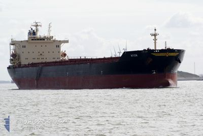
KANG HE 6
Bulk Carrier

Current Trip
| Trip Time | 11 days |
|---|---|
| Trip Distance | 2177.51 nm |
| AVG Speed | 10.3 Knots |
| MAX Speed | 13.7 Knots |
| Draught | 7.5 m |
| AVG Wind | 11.9 knots |
| MAX Wind | 24.9 knots |
| MIN Temp | 12°C / 53.6°F |
| MAX Temp | 26.8°C / 80.24°F |
| Position Received | 2025-04-21 08:38 |
Current Position
| Longitude | 113.95432° |
|---|---|
| Latitude | 22.13305° |
| Status | Under way using engine |
| Speed | 12.4 Knots |
| Course | 92.6° |
| Area | South China Sea |
| Station | T-AIS |
| Position Received | 2025-04-21 08:38 |
Information
The current position of KANG HE 6 is in South China Sea with coordinates 22.13305° / 113.95432° as reported on 2025-04-21 08:38 by AIS to our vessel tracker app. The vessel's current speed is 12.4 Knots and is currently inside the port of CAOFEIDIAN.
The vessel KANG HE 6 (IMO: 9177650, MMSI: 414292000) is a Bulk Carrier that was built in 1999 ( 26 years old ). It's sailing under the flag of [CN] China.
In this page you can find informations about the vessels current position, last detected port calls, and current voyage information. If the vessels is not in coverage by AIS you will find the latest position.
The current position of KANG HE 6 is detected by our AIS receivers and we are not responsible for the reliability of the data. The last position was recorded while the vessel was in Coverage by the Ais receivers of our vessel tracking app.
The current draught of KANG HE 6 as reported by AIS is 7.5 meters
Weather
| Temperature | 19.4°C / 66.92°F |
|---|---|
| Wind Speed | 9 knots |
| Direction | 146° SE |
| Pressure | 1011.9 hPa |
| Humidity | 70.4 % |
| Cloud Coverage | 3 % |


Featured Company
Last Port Calls
| Port | Arrival | Departure | Time In Port |
|---|---|---|---|
| 2025-05-28 01:34 | |||
| 2025-05-12 18:10 | 2025-05-16 02:46 | 3 d | |
| 2025-04-27 16:58 | 2025-04-29 06:21 | 1 d | |
| 2025-04-07 04:25 | 2025-04-11 05:26 | 4 d | |
| 2025-04-03 01:22 | 2025-04-05 17:02 | 2 d | |
| 2025-03-24 08:54 | 2025-03-26 23:30 | 2 d | |
| 2025-03-12 17:17 | 2025-03-14 19:29 | 2 d | |
| 2025-03-07 10:13 | 2025-03-12 08:45 | 4 d |
Most Visited Ports (Last year)
| Port | Arrivals | |
|---|---|---|
| 7 | ||
| 7 | ||
| 3 | ||
| 3 | ||
| 2 | ||
| 2 |
Last Trips
| Origin | Departure | Destination | Arrival | Distance | |
|---|---|---|---|---|---|
| 2025-05-16 02:46 | 2025-05-28 01:34 | 2177.51 nm | |||
| 2025-04-29 06:21 | 2025-05-12 18:10 | 2696.66 nm | |||
| 2025-04-11 05:26 | 2025-04-27 16:58 | 2966.61 nm | |||
| 2025-04-05 17:02 | 2025-04-07 04:25 | 64.73 nm | |||
| 2025-03-26 23:30 | 2025-04-03 01:22 | 1510.76 nm | |||
| 2025-03-14 19:29 | 2025-03-24 08:54 | 1567.11 nm | |||
| 2025-03-12 08:45 | 2025-03-12 17:17 | 62.92 nm | |||
| 2025-01-30 16:53 | 2025-03-07 10:13 | 5682.20 nm |
Events
| Time | Event | Details | Position / Dest | Info |
|---|---|---|---|---|
| 2025-05-27 18:10 | STOP Moving |
38.94288 / 118.44776
[CN] CAOFEIDIAN
|
Speed: 0.3 kn Course: 118° |
|
| 2025-05-27 17:34 | PORT ARRIVAL |
|
38.93463 / 118.44113
[CN] CAOFEIDIAN
|
Speed: 2 kn Course: 38° |
| 2025-05-23 18:38 | START Moving | 8.33 nm, South East of QUANZHOU |
24.71250 / 118.75908
CAOFEIDIAN
|
Speed: 6.8 kn Course: 134° |
| 2025-05-21 09:18 | STOP Moving | 8 nm, South East of QUANZHOU |
24.71897 / 118.75911
CAOFEIDIAN
|
Speed: 0.3 kn Course: 67° |
| 2025-05-21 08:38 | START Moving | 9.85 nm, South East of QUANZHOU |
24.68829 / 118.76926
CAOFEIDIAN
|
Speed: 4.1 kn Course: 334° |
| 2025-05-20 12:42 | STOP Moving | 10.32 nm, South East of QUANZHOU |
24.68053 / 118.77174
CAOFEIDIAN
|
Speed: 0.2 kn Course: 298° |