
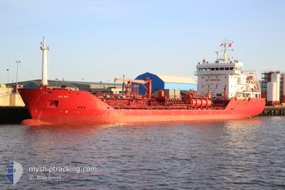
KEY BAY
Oil/Chemical Tanker
Current Trip
| Time Travelled | 2 days |
|---|---|
| Remaining Time | --- |
| Distance Travelled | 527.49 nm |
| Remaining Distance | --- |
| AVG Speed | 11.5 Knots |
| MAX Speed | 13.5 Knots |
| AVG Wind | 21.1 knots |
| MAX Wind | 26 knots |
| MIN Temp | 10.8°C / 51.44°F |
| MAX Temp | 16.5°C / 61.7°F |
| Draught | 5.5 m |
| Position Received | 2 h, 23 m ago |
Current Position
| Longitude | 26.51188° |
|---|---|
| Latitude | 40.24985° |
| Status | Under way using engine |
| Speed | 12.5 Knots |
| Course | 51° |
| Area | Sea of Marmara |
| Station | T-AIS |
| Position Received | 2 h, 23 m ago |
Info
Information
The current position of KEY BAY is in Sea of Marmara with coordinates 40.24985° / 26.51188° as reported on 2026-01-10 14:16 by AIS to our vessel tracker app. The vessel's current speed is 12.5 Knots and is heading at the port of TRABZON. The estimated time of arrival as calculated by MyShipTracking vessel tracking app is 2026-01-14 03:01 LT
The vessel KEY BAY (IMO: 9291561, MMSI: 236446000) is a Oil/Chemical Tanker that was built in 2004 ( 22 years old ). It's sailing under the flag of [GI] Gibraltar.
In this page you can find informations about the vessels current position, last detected port calls, and current voyage information. If the vessels is not in coverage by AIS you will find the latest position.
The current position of KEY BAY is detected by our AIS receivers and we are not responsible for the reliability of the data. The last position was recorded while the vessel was in Coverage by the Ais receivers of our vessel tracking app.
The current draught of KEY BAY as reported by AIS is 5.5 meters
Weather
| Temperature | 15.2°C / 59.36°F |
|---|---|
| Wind Speed | 25 knots |
| Direction | 212° SSW |
| Pressure | 997.2 hPa |
| Humidity | 65.7 % |
| Cloud Coverage | 100 % |
Featured Company
Last Port Calls
| Port | Arrival | Departure | Time In Port |
|---|---|---|---|
| 2026-01-08 17:12 | |||
| 2025-12-29 08:34 | 2025-12-29 22:19 | 13 h | |
| 2025-12-24 11:20 | 2025-12-24 14:12 | 2 h | |
| 2025-12-17 18:09 | 2025-12-18 16:13 | 22 h | |
| 2025-12-13 19:13 | 2025-12-14 10:57 | 15 h | |
| 2025-12-07 12:09 | 2025-12-08 14:31 | 1 d | |
| 2025-12-02 07:17 | 2025-12-04 04:48 | 1 d | |
| 2025-11-30 14:24 | 2025-11-30 19:35 | 5 h | |
| 2025-11-26 10:47 | 2025-11-27 04:38 | 17 h | |
| 2025-11-13 18:48 | 2025-11-15 05:00 | 1 d |
Most Visited Ports (Last year)
| Port | Arrivals | |
|---|---|---|
| 8 | ||
| 7 | ||
| 6 | ||
| 5 | ||
| 4 | ||
| 3 |
Last Trips
| Origin | Departure | Destination | Arrival | Distance | |
|---|---|---|---|---|---|
| 2025-12-24 14:12 | 2025-12-29 08:34 | 1225.24 nm | |||
| 2025-12-18 16:13 | 2025-12-24 11:20 | 943.45 nm | |||
| 2025-12-14 10:57 | 2025-12-17 18:09 | 561.73 nm | |||
| 2025-12-08 14:31 | 2025-12-13 19:13 | 1046.25 nm | |||
| 2025-12-04 04:48 | 2025-12-07 12:09 | 384.60 nm | |||
| 2025-11-30 19:35 | 2025-12-02 07:17 | 246.82 nm | |||
| 2025-11-27 04:38 | 2025-11-30 14:24 | 762.72 nm | |||
| 2025-11-15 05:00 | 2025-11-26 10:47 | 2187.81 nm | |||
| 2025-11-11 23:33 | 2025-11-13 18:48 | 521.68 nm | |||
| 2025-11-09 00:39 | 2025-11-09 01:17 | 4.08 nm |
Events
| Time | Event | Details | Position / Dest | Info |
|---|---|---|---|---|
| 2026-01-10 14:17 | Status Changed | Default Under way using engine |
40.25246 / 26.51594
TRTZX
|
Speed: 12.5 kn Course: 51° |
| 2026-01-10 14:16 | OUT of Coverage |
40.24985 / 26.51188
Sea of Marmara
TRTZX
|
Speed: 12.5 kn Course: 51° |
|
| 2026-01-10 12:31 | Change Sea Area | Turkish part of the Sea of Marmara Turkish part of the Aegean Sea |
40.02030 / 26.19871
Sea of Marmara
TRTZX
|
Speed: 11.4 kn Course: 73° |
| 2026-01-10 12:19 | IN Coverage |
40.01088 / 26.16204
Aegean Sea
TRTZX
|
Speed: 11.3 kn Course: 74° |
|
| 2026-01-10 11:15 | OUT of Coverage |
39.88211 / 25.92278
Aegean Sea
TRTZX
|
Speed: 13.2 kn Course: 34° |
|
| 2026-01-10 10:41 | Change Sea Area | Turkish part of the Aegean Sea Greek part of the Aegean Sea |
39.76712 / 25.91618
Aegean Sea
TRTZX
|
Speed: 11 kn Course: 66° |
| 2026-01-10 06:14 | Status Changed | Under way using engine Default |
39.06670 / 25.36862
TRTZX
|
Speed: 12.8 kn Course: 26° |
| 2026-01-10 06:14 | IN Coverage |
39.06670 / 25.36862
Aegean Sea
TRTZX
|
Speed: 12.5 kn Course: 25° |
|
| 2026-01-10 05:02 | Status Changed | Default Under way using engine |
38.84352 / 25.21644
TRTZX
|
Speed: 13.1 kn Course: 25° |
| 2026-01-10 04:52 | OUT of Coverage |
38.81049 / 25.19495
Aegean Sea
TRTZX
|
Speed: 13.1 kn Course: 25° |