
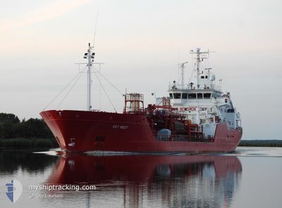
KEY WEST
Oil/Chemical Tanker
Current Trip
| Time Travelled | 1 day |
|---|---|
| Remaining Time | 7 h, 38 mins |
| Distance Travelled | 541.51 nm |
| Remaining Distance | 110.39 nm |
| AVG Speed | 13.2 Knots |
| MAX Speed | 14.8 Knots |
| AVG Wind | 19.4 knots |
| MAX Wind | 25.3 knots |
| MIN Temp | -1.4°C / 29.48°F |
| MAX Temp | 5.6°C / 42.08°F |
| Draught | 5.7 m |
| Position Received | 18 m ago |
Current Position
| Longitude | 4.42038° |
|---|---|
| Latitude | 53.17918° |
| Status | Under way using engine |
| Speed | 13.1 Knots |
| Course | 198.5° |
| Area | North Sea |
| Station | T-AIS |
| Position Received | 18 m ago |
Info
Information
The current position of KEY WEST is in North Sea with coordinates 53.17918° / 4.42038° as reported on 2025-02-10 00:53 by AIS to our vessel tracker app. The vessel's current speed is 13.1 Knots and is heading at the port of DORDRECHT. The estimated time of arrival as calculated by MyShipTracking vessel tracking app is 2025-02-10 08:50 LT
The vessel KEY WEST (IMO: 9020429, MMSI: 236668000) is a Oil/Chemical Tanker that was built in 1992 ( 33 years old ). It's sailing under the flag of [GI] Gibraltar.
In this page you can find informations about the vessels current position, last detected port calls, and current voyage information. If the vessels is not in coverage by AIS you will find the latest position.
The current position of KEY WEST is detected by our AIS receivers and we are not responsible for the reliability of the data. The last position was recorded while the vessel was in Coverage by the Ais receivers of our vessel tracking app.
The current draught of KEY WEST as reported by AIS is 5.7 meters
Weather
| Temperature | 4.3°C / 39.74°F |
|---|---|
| Wind Speed | 25 knots |
| Direction | 73° ENE |
| Pressure | 1032 hPa |
| Humidity | 79.8 % |
| Cloud Coverage | 48 % |
Featured Company
Last Port Calls
| Port | Arrival | Departure | Time In Port |
|---|---|---|---|
| 2025-02-07 22:57 | 2025-02-08 07:28 | 8 h | |
| 2025-02-06 19:58 | 2025-02-07 04:33 | 8 h | |
| 2025-02-06 07:52 | 2025-02-06 16:56 | 9 h | |
| 2025-02-02 09:27 | 2025-02-04 17:01 | 2 d | |
| 2025-01-30 18:52 | 2025-01-31 19:38 | 1 d | |
| 2025-01-29 06:35 | 2025-01-30 18:14 | 1 d | |
| 2025-01-28 16:37 | 2025-01-29 05:47 | 13 h | |
| 2025-01-28 16:23 | |||
| 2025-01-27 06:15 | 2025-01-28 15:49 | 1 d | |
| 2025-01-25 10:08 | 2025-01-25 16:27 | 6 h |
Last Trips
| Origin | Departure | Destination | Arrival | Distance | |
|---|---|---|---|---|---|
| 2025-02-07 05:33 | 2025-02-07 23:57 | 230.28 nm | |||
| 2025-02-06 17:56 | 2025-02-06 20:58 | 40.32 nm | |||
| 2025-02-04 17:01 | 2025-02-06 08:52 | 545.90 nm | |||
| 2025-01-31 20:38 | 2025-02-02 09:27 | 508.26 nm | |||
| 2025-01-30 19:14 | 2025-01-30 19:52 | 2.53 nm | |||
| 2025-01-29 06:47 | 2025-01-29 07:35 | 4.78 nm | |||
| 2025-01-28 16:49 | 2025-01-28 17:37 | 4.86 nm | |||
| 2025-01-28 16:49 | 2025-01-28 17:23 | 4.80 nm | |||
| 2025-01-25 16:27 | 2025-01-27 07:15 | 421.44 nm | |||
| 2025-01-23 11:23 | 2025-01-25 10:08 | 107.67 nm |
Events
| Time | Event | Details | Position / Dest | Info |
|---|---|---|---|---|
| 2025-02-10 00:56 | Status Changed | Default Under way using engine |
53.17141 / 4.41342
NLDOR
|
Speed: 13.1 kn Course: 198.5° |
| 2025-02-10 00:53 | Status Changed | Under way using engine Default |
53.17918 / 4.42038
NLDOR
|
Speed: 14 kn Course: 203° |
| 2025-02-10 00:53 | IN Coverage |
53.17918 / 4.42038
North Sea
NLDOR
|
Speed: 13.1 kn Course: 198.5° |
|
| 2025-02-10 00:53 | Detected in Sea | Dutch part of the North Sea |
53.17918 / 4.42038
North Sea
NLDOR
|
Speed: 13.1 kn Course: 198.5° |
| 2025-02-09 15:52 | OUT of Coverage |
55.17526 / 5.24824
North Sea
NLDOR
|
Speed: 13.3 kn Course: 185.3° |
|
| 2025-02-09 15:35 | Change Sea Area | German part of the North Sea Danish part of the North Sea |
55.23936 / 5.26379
North Sea
NLDOR
|
Speed: 13.3 kn Course: 187.9° |
| 2025-02-09 11:51 | Status Changed | Under way using engine Default |
56.07953 / 5.24859
NLDOR
|
Speed: 13.2 kn Course: 172° |
| 2025-02-09 11:24 | Status Changed | Default Under way using engine |
56.18044 / 5.23269
NLDOR
|
Speed: 13.6 kn Course: 178.1° |
| 2025-02-09 09:55 | ETA Changed | 2025/02/10 10:00 2025/02/10 08:00 |
56.51246 / 5.19842
NLDOR
|
Speed: 13.3 kn Course: 174.8° |
| 2025-02-09 09:26 | Change Sea Area | Danish part of the North Sea Norwegian part of the North Sea |
56.62067 / 5.18659
North Sea
NLDOR
|
Speed: 13.2 kn Course: 174.5° |