

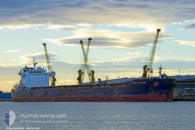
KMAX EMPEROR
Bulk Carrier

Current Trip
| Time Travelled | 3 days |
|---|---|
| Remaining Time | 22 h, 7 mins |
| Distance Travelled | 717.89 nm |
| Remaining Distance | 246.80 nm |
| AVG Speed | 11.4 Knots |
| MAX Speed | 13.4 Knots |
| AVG Wind | 13.8 knots |
| MAX Wind | 21 knots |
| MIN Temp | 17.4°C / 63.32°F |
| MAX Temp | 22.5°C / 72.5°F |
| Draught | 14.4 m |
| Position Received | 2025-05-04 02:20 |
Current Position
| Longitude | 104.33738° |
|---|---|
| Latitude | 1.29078° |
| Status | Under way using engine |
| Speed | 12.3 Knots |
| Course | 62° |
| Area | Singapore Strait |
| Station | T-AIS |
| Position Received | 2025-05-04 02:20 |
Information
The current position of KMAX EMPEROR is in Singapore Strait with coordinates 1.29078° / 104.33738° as reported on 2025-05-04 02:20 by AIS to our vessel tracker app. The vessel's current speed is 12.3 Knots and is heading at the port of QINGDAO. The estimated time of arrival as calculated by MyShipTracking vessel tracking app is 2025-06-08 08:47 LT
The vessel KMAX EMPEROR (IMO: 9477426, MMSI: 636022143) is a Bulk Carrier that was built in 2011 ( 14 years old ). It's sailing under the flag of [LR] Liberia.
In this page you can find informations about the vessels current position, last detected port calls, and current voyage information. If the vessels is not in coverage by AIS you will find the latest position.
The current position of KMAX EMPEROR is detected by our AIS receivers and we are not responsible for the reliability of the data. The last position was recorded while the vessel was in Coverage by the Ais receivers of our vessel tracking app.
The current draught of KMAX EMPEROR as reported by AIS is 14.4 meters
Weather
| Temperature | 22.3°C / 72.14°F |
|---|---|
| Wind Speed | 8 knots |
| Direction | 82° E |
| Pressure | 1007.1 hPa |
| Humidity | 96.4 % |
| Cloud Coverage | 100 % |


Featured Company
Last Port Calls
| Port | Arrival | Departure | Time In Port |
|---|---|---|---|
| 2025-05-31 16:10 | 2025-06-04 09:46 | 3 d | |
| 2025-05-14 13:14 | 2025-05-17 12:38 | 2 d | |
| 2025-04-20 18:57 | 2025-04-23 09:38 | 2 d | |
| 2025-04-06 20:14 | 2025-04-08 13:21 | 1 d |
Last Trips
| Origin | Departure | Destination | Arrival | Distance | |
|---|---|---|---|---|---|
| 2025-05-17 12:38 | 2025-05-31 16:10 | 591.69 nm | |||
| 2025-04-23 09:38 | 2025-05-14 13:14 | 5475.74 nm | |||
| 2025-04-08 13:21 | 2025-04-20 18:57 | 246.02 nm | |||
| 2025-03-02 00:59 | 2025-04-06 20:14 | 8029.77 nm |
Events
| Time | Event | Details | Position / Dest | Info |
|---|---|---|---|---|
| 2025-06-06 19:30 | START Moving |
31.26007 / 122.49123
QINGDAO
|
Speed: 3.1 kn Course: 312° |
|
| 2025-06-06 10:06 | STOP Moving |
31.26260 / 122.49005
QINGDAO
|
Speed: 0.2 kn Course: 147° |
|
| 2025-06-04 01:46 | PORT DEPARTURE |
|
38.91903 / 117.87952
QINGDAO
|
Speed: 11.7 kn Course: 110° |
| 2025-06-04 01:15 | START Moving |
38.94992 / 117.76798
[CN] TIANJIN
|
Speed: 5.1 kn Course: 108° |
|
| 2025-05-31 08:10 | STOP Moving |
38.94738 / 117.76152
[CN] TIANJIN
|
Speed: 0.3 kn Course: 290° |
|
| 2025-05-31 08:10 | PORT ARRIVAL |
|
38.94738 / 117.76152
[CN] TIANJIN
|
Speed: 0.6 kn Course: 286° |
| 2025-05-31 06:10 | START Moving | 18.35 nm, South East of TIANJIN |
38.85451 / 118.10415
QINGDAO
|
Speed: 4.5 kn Course: 232° |