
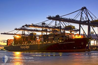
KUALA LUMPUR EXPRESS
Container Ship
Current Trip
| Time Travelled | 7 days |
|---|---|
| Remaining Time | --- |
| Distance Travelled | 1951.30 nm |
| Remaining Distance | 23.39 nm |
| AVG Speed | 11.5 Knots |
| MAX Speed | 20 Knots |
| AVG Wind | 13.1 knots |
| MAX Wind | 24 knots |
| MIN Temp | 5.3°C / 41.54°F |
| MAX Temp | 27.4°C / 81.32°F |
| Draught | 11.4 m |
| Position Received | 6 m ago |
Current Position
| Longitude | -73.60617° |
|---|---|
| Latitude | 40.48158° |
| Status | At anchor |
| Speed | |
| Course | 255° |
| Area | North Atlantic Ocean |
| Station | T-AIS |
| Position Received | 6 m ago |
Info
Information
The current position of KUALA LUMPUR EXPRESS is in North Atlantic Ocean with coordinates 40.48158° / -73.60617° as reported on 2026-01-08 07:40 by AIS to our vessel tracker app. The vessel's current speed is 0 Knots and is heading at the port of NEW YORK. The estimated time of arrival as calculated by MyShipTracking vessel tracking app is 2026-01-09 07:00 LT
The vessel KUALA LUMPUR EXPRESS (IMO: 9343730, MMSI: 218284000) is a Container Ship that was built in 2007 ( 19 years old ). It's sailing under the flag of [DE] Germany.
In this page you can find informations about the vessels current position, last detected port calls, and current voyage information. If the vessels is not in coverage by AIS you will find the latest position.
The current position of KUALA LUMPUR EXPRESS is detected by our AIS receivers and we are not responsible for the reliability of the data. The last position was recorded while the vessel was in Coverage by the Ais receivers of our vessel tracking app.
The current draught of KUALA LUMPUR EXPRESS as reported by AIS is 11.4 meters
Weather
| Temperature | 5.8°C / 42.44°F |
|---|---|
| Wind Speed | 14 knots |
| Direction | 309° NW |
| Pressure | 1017.3 hPa |
| Humidity | 77.6 % |
| Cloud Coverage | 28 % |
Featured Company
Last Port Calls
| Port | Arrival | Departure | Time In Port |
|---|---|---|---|
| 2025-12-31 07:20 | 2026-01-01 01:31 | 18 h | |
| 2025-12-06 18:39 | 2025-12-08 01:41 | 1 d | |
| 2025-12-03 21:25 | 2025-12-04 22:29 | 1 d | |
| 2025-11-09 12:10 | 2025-11-11 03:06 | 1 d |
Last Trips
| Origin | Departure | Destination | Arrival | Distance | |
|---|---|---|---|---|---|
| 2025-12-08 10:41 | 2025-12-31 02:20 | 8668.21 nm | |||
| 2025-12-05 06:29 | 2025-12-07 03:39 | 522.33 nm | |||
| 2025-11-10 19:06 | 2025-12-04 05:25 | 6654.04 nm | |||
| 2025-10-27 05:39 | 2025-11-09 04:10 | 3345.80 nm |
Events
| Time | Event | Details | Position / Dest | Info |
|---|---|---|---|---|
| 2026-01-08 07:37 | Status Changed | At anchor Default |
40.48161 / -73.60620
USNYC
|
Speed: Course: 255° |
| 2026-01-08 07:30 | Status Changed | Default At anchor |
40.48000 / -73.60500
USNYC
|
Speed: 0.1 kn Course: 258° |
| 2026-01-08 06:18 | Status Changed | At anchor Default |
40.48143 / -73.60636
USNYC
|
Speed: Course: 256° |
| 2026-01-08 06:12 | Status Changed | Default At anchor |
40.48160 / -73.60632
USNYC
|
Speed: Course: 257° |
| 2026-01-08 06:01 | Status Changed | At anchor Default |
40.48158 / -73.60618
USNYC
|
Speed: 0.2 kn Course: 267° |
| 2026-01-08 05:54 | Status Changed | Default At anchor |
40.48000 / -73.60500
USNYC
|
Speed: 0.2 kn Course: 282° |
| 2026-01-08 05:39 | Status Changed | At anchor Default |
40.48038 / -73.60662
USNYC
|
Speed: Course: 287° |
| 2026-01-08 05:36 | Status Changed | Default At anchor |
40.48033 / -73.60653
USNYC
|
Speed: 0.1 kn Course: 287° |
| 2026-01-08 05:24 | Status Changed | At anchor Default |
40.48087 / -73.60621
USNYC
|
Speed: Course: -1° |
| 2026-01-08 05:21 | Status Changed | Default At anchor |
40.48000 / -73.60500
USNYC
|
Speed: 0.1 kn Course: 262° |