

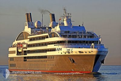
L'AUSTRAL
Passengers Ship

Current Trip
| Time Travelled | 9 h, 49 mins |
|---|---|
| Remaining Time | --- |
| Distance Travelled | 96.61 nm |
| Remaining Distance | --- |
| AVG Speed | 12.9 Knots |
| MAX Speed | 14.9 Knots |
| AVG Wind | 8.3 knots |
| MAX Wind | 22.4 knots |
| MIN Temp | 14.6°C / 58.28°F |
| MAX Temp | 20°C / 68°F |
| Draught | 5 m |
| Position Received | 1 h, 32 m ago |
Current Position
| Longitude | 20.53470° |
|---|---|
| Latitude | 38.52418° |
| Status | Under way using engine |
| Speed | 10.4 Knots |
| Course | 269.1° |
| Area | Ionian Sea |
| Station | T-AIS |
| Position Received | 1 h, 32 m ago |
Information
The current position of L'AUSTRAL is in Ionian Sea with coordinates 38.52418° / 20.53470° as reported on 2025-05-25 23:30 by AIS to our vessel tracker app. The vessel's current speed is 10.4 Knots and is heading at the port of PARGA. The estimated time of arrival as calculated by MyShipTracking vessel tracking app is 2025-05-27 04:00 LT
The vessel L'AUSTRAL (IMO: 9502518, MMSI: 578000700) is a Passengers Ship that was built in 2010 ( 15 years old ). It's sailing under the flag of [WF] Wallis Futuna Is.
In this page you can find informations about the vessels current position, last detected port calls, and current voyage information. If the vessels is not in coverage by AIS you will find the latest position.
The current position of L'AUSTRAL is detected by our AIS receivers and we are not responsible for the reliability of the data. The last position was recorded while the vessel was in Coverage by the Ais receivers of our vessel tracking app.
The current draught of L'AUSTRAL as reported by AIS is 5 meters
Weather
| Temperature | 18.7°C / 65.66°F |
|---|---|
| Wind Speed | 18 knots |
| Direction | 334° NNW |
| Pressure | 1010.1 hPa |
| Humidity | 71.7 % |
| Cloud Coverage | --- |


Featured Company
Last Port Calls
| Port | Arrival | Departure | Time In Port |
|---|---|---|---|
| 2025-05-25 08:22 | 2025-05-25 15:14 | 6 h | |
| 2025-05-24 03:22 | 2025-05-24 16:38 | 13 h | |
| 2025-05-23 04:23 | 2025-05-23 15:09 | 10 h | |
| 2025-05-21 03:32 | 2025-05-21 18:07 | 14 h | |
| 2025-05-20 03:46 | 2025-05-20 17:12 | 13 h | |
| 2025-05-18 04:18 | 2025-05-18 15:03 | 10 h | |
| 2025-05-17 03:10 | 2025-05-17 16:01 | 12 h | |
| 2025-05-16 04:35 | 2025-05-16 18:06 | 13 h | |
| 2025-05-13 04:06 | 2025-05-13 15:42 | 11 h | |
| 2025-05-12 03:36 | 2025-05-12 14:06 | 10 h |
Last Trips
| Origin | Departure | Destination | Arrival | Distance | |
|---|---|---|---|---|---|
| 2025-05-24 19:38 | 2025-05-25 11:22 | 76.82 nm | |||
| 2025-05-23 18:09 | 2025-05-24 06:22 | 97.24 nm | |||
| 2025-05-21 21:07 | 2025-05-23 07:23 | 223.93 nm | |||
| 2025-05-20 20:12 | 2025-05-21 06:32 | 128.27 nm | |||
| 2025-05-18 18:03 | 2025-05-20 06:46 | 188.14 nm | |||
| 2025-05-17 19:01 | 2025-05-18 07:18 | 161.77 nm | |||
| 2025-05-16 21:06 | 2025-05-17 06:10 | 70.44 nm | |||
| 2025-05-13 18:42 | 2025-05-16 07:35 | 621.46 nm | |||
| 2025-05-12 17:06 | 2025-05-13 07:06 | 176.66 nm | |||
| 2025-05-11 14:16 | 2025-05-12 06:36 | 98.44 nm |
Events
| Time | Event | Details | Position / Dest | Info |
|---|---|---|---|---|
| 2025-05-25 23:38 | Status Changed | Default Under way using engine |
38.53143 / 20.50601
GRPAR
|
Speed: 10.4 kn Course: 269.1° |
| 2025-05-25 23:30 | OUT of Coverage |
38.52418 / 20.53470
Ionian Sea
GRPAR
|
Speed: 10.4 kn Course: 269.1° |
|
| 2025-05-25 22:32 | Status Changed | Under way using engine Default |
38.46333 / 20.76319
GRPAR
|
Speed: 14 kn Course: 311° |
| 2025-05-25 22:15 | Status Changed | Default Under way using engine |
38.42085 / 20.82119
GRPAR
|
Speed: 13.9 kn Course: 311.7° |
| 2025-05-25 17:11 | Destination Changed | GRPAR GR ITA |
38.31667 / 22.09728
GRPAR
|
Speed: 11 kn Course: 290.7° |
| 2025-05-25 17:11 | ETA Changed | 2025/05/27 04:00 2025/05/26 12:00 |
38.31667 / 22.09728
GRPAR
|
Speed: 11 kn Course: 290.7° |
| 2025-05-25 16:48 | Status Changed | Under way using engine Default |
38.29205 / 22.18348
GR ITA
|
Speed: 11.4 kn Course: 264° |
| 2025-05-25 16:48 | IN Coverage |
38.29205 / 22.18348
Ionian Sea
GR ITA
|
Speed: 11.1 kn Course: 281.9° |
|
| 2025-05-25 15:14 | PORT DEPARTURE |
|
38.30938 / 22.39914
GR ITA
|
Speed: Course: 195° |
| 2025-05-25 14:20 | OUT of Coverage |
38.42933 / 22.42379
Ionian Sea
[GR] ITEA
|
Speed: Course: 276.4° |