
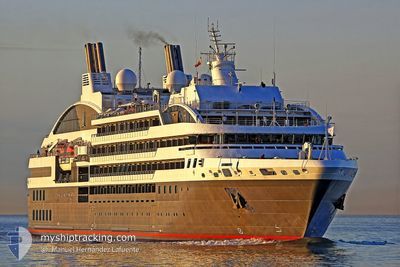
L'AUSTRAL
Passengers Ship
Current Trip
MELCHIOR ISLAND
| Time Travelled | 3 days |
|---|---|
| Remaining Time | --- |
| Distance Travelled | 718.65 nm |
| Remaining Distance | --- |
| AVG Speed | 12.2 Knopen |
| MAX Speed | 16.2 Knopen |
| AVG Wind | 10 knots |
| MAX Wind | 27 knots |
| MIN Temp | -10.9°C / 12.38°F |
| MAX Temp | 8.4°C / 47.12°F |
| Diepgang | 5 M |
| Positie ontvangen | 2 d geleden |
Current Position
| Lengtegraad | -65.85946° |
|---|---|
| Breedtegraat | -56.66624° |
| Status | Under way using engine |
| Snelheid | 13.3 Knopen |
| Koers | 164.7° |
| Gebied | South Atlantic Ocean |
| Station | T-AIS |
| Positie ontvangen | 2 d geleden |
Info
Information
The current position of L'AUSTRAL is in South Atlantic Ocean with coordinates -56.66624° / -65.85946° as reported on 2025-02-10 09:29 by AIS to our vessel tracker app. The vessel's current speed is 13.3 Knopen
The vessel L'AUSTRAL (IMO: 9502518, MMSI: 578000700) is a Passengers Ship that was built in 2010 ( 15 Jaar oud ). It's sailing under the flag of [WF] Wallis Futuna Is.
In this page you can find informations about the vessels current position, last detected port calls, and current voyage information. If the vessels is not in coverage by AIS you will find the latest position.
The current position of L'AUSTRAL is detected by our AIS receivers and we are not responsible for the reliability of the data. The last position was recorded while the vessel was in Coverage by the Ais receivers of our vessel tracking app.
The current draught of L'AUSTRAL as reported by AIS is 5 meters
Weather
| Temperature | -6.9°C / 19.58°F |
|---|---|
| Wind Speed | 8 knots |
| Direction | 97° E |
| Pressure | 997 hPa |
| Humidity | 78.7 % |
| Cloud Coverage | 100 % |
Featured Company
Last Port Calls
| Port | Arrival | Departure | Time In Port |
|---|---|---|---|
| 2025-02-08 21:13 | 2025-02-09 22:07 | 1 d | |
| 2025-01-30 01:48 | 2025-01-30 22:51 | 21 h | |
| 2025-01-11 21:25 | 2025-01-12 22:13 | 1 d | |
| 2025-01-01 21:26 | 2025-01-02 21:37 | 1 d | |
| 2024-12-23 01:06 | 2024-12-23 22:23 | 21 h | |
| 2024-12-05 22:43 | 2024-12-06 22:31 | 23 h |
Last Trips
| Origin | Departure | Destination | Arrival | Distance | |
|---|---|---|---|---|---|
| 2025-01-30 19:51 | 2025-02-08 18:13 | 1587.68 nm | |||
| 2025-01-12 19:13 | 2025-01-29 22:48 | 3404.58 nm | |||
| 2025-01-02 18:37 | 2025-01-11 18:25 | 1704.20 nm | |||
| 2024-12-23 19:23 | 2025-01-01 18:26 | 1687.72 nm | |||
| 2024-12-06 19:31 | 2024-12-22 22:06 | 3308.43 nm | |||
| 2024-11-26 19:35 | 2024-12-05 19:43 | 1829.57 nm |
Events
| Tijd | Evenement | Details | Positie / Bestemming | Info |
|---|---|---|---|---|
| 2025-02-13 01:21 | Stop beweging |
-64.76919 / -62.79796
MELCHIOR ISLAND
|
Snelheid: 0.1 kn Koers: 121° |
|
| 2025-02-12 21:58 | Start beweging |
-64.65028 / -62.61776
MELCHIOR ISLAND
|
Snelheid: 3.2 kn Koers: 358° |
|
| 2025-02-12 17:00 | Stop beweging |
-64.67434 / -62.62205
MELCHIOR ISLAND
|
Snelheid: 0.3 kn Koers: 339° |
|
| 2025-02-12 15:12 | Start beweging |
-64.83523 / -62.58013
MELCHIOR ISLAND
|
Snelheid: 10.3 kn Koers: 305° |
|
| 2025-02-12 09:56 | Stop beweging |
-64.84274 / -62.54753
MELCHIOR ISLAND
|
Snelheid: 0.1 kn Koers: 165° |
|
| 2025-02-12 08:52 | Start beweging |
-64.78806 / -62.72857
MELCHIOR ISLAND
|
Snelheid: 6 kn Koers: 150° |
|
| 2025-02-12 02:29 | Stop beweging |
-64.76249 / -62.78524
MELCHIOR ISLAND
|
Snelheid: 0.2 kn Koers: 155° |
|
| 2025-02-10 09:34 | Status Changed | Default Under way using engine |
-56.68274 / -65.84900
MELCHIOR ISLAND
|
Snelheid: 13.3 kn Koers: 164.7° |
| 2025-02-10 09:29 | Buitenbereik |
-56.66624 / -65.85946
South Atlantic Ocean
MELCHIOR ISLAND
|
Snelheid: 13.3 kn Koers: 164.7° |
|
| 2025-02-10 08:15 | Wijzig zee gebeid | Argentinean part of the South Atlantic Ocean Chilean (disputed - Chilean point of view) part of the South Atlantic Ocean |
-56.38972 / -65.94011
South Atlantic Ocean
MELCHIOR ISLAND
|
Snelheid: 13.6 kn Koers: 173.1° |