
LONIAN
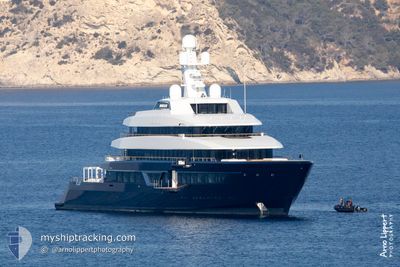
Pleasure Craft
Current Trip
FLAMINCO PANAMA
| Time Travelled | 31 days |
|---|---|
| Remaining Time | --- |
| Distance Travelled | 1542.04 nm |
| Remaining Distance | --- |
| AVG Speed | 10.5 Knots |
| MAX Speed | 15.6 Knots |
| AVG Wind | 14 knots |
| MAX Wind | 23 knots |
| MIN Temp | 22.3°C / 72.14°F |
| MAX Temp | 31.6°C / 88.88°F |
| Draught | 4 m |
| Position Received | 2 d ago |
Current Position
| Longitude | -80.57847° |
|---|---|
| Latitude | 7.08035° |
| Status | Under way using engine |
| Speed | 11 Knots |
| Course | 269° |
| Area | North Pacific Ocean |
| Station | T-AIS |
| Position Received | 2 d ago |
Info
Information
The current position of LONIAN is in North Pacific Ocean with coordinates 7.08035° / -80.57847° as reported on 2025-02-05 05:24 by AIS to our vessel tracker app. The vessel's current speed is 11 Knots
The vessel LONIAN (IMO: 9800087, MMSI: 319139700) is a Pleasure Craft It's sailing under the flag of [KY] Cayman Is.
In this page you can find informations about the vessels current position, last detected port calls, and current voyage information. If the vessels is not in coverage by AIS you will find the latest position.
The current position of LONIAN is detected by our AIS receivers and we are not responsible for the reliability of the data. The last position was recorded while the vessel was in Coverage by the Ais receivers of our vessel tracking app.
The current draught of LONIAN as reported by AIS is 4 meters
Weather
| Temperature | 27.4°C / 81.32°F |
|---|---|
| Wind Speed | 11 knots |
| Direction | 13° NNE |
| Pressure | 1010.4 hPa |
| Humidity | 70.5 % |
| Cloud Coverage | 8 % |
Featured Company
Last Port Calls
| Port | Arrival | Departure | Time In Port |
|---|---|---|---|
| 2025-01-06 13:01 | 2025-01-06 20:53 | 7 h | |
| 2024-12-16 20:32 | 2024-12-19 12:33 | 2 d | |
| 2024-12-07 01:27 | 2024-12-16 20:10 | 9 d | |
| 2024-12-07 01:15 |
Most Visited Ports (Last year)
| Port | Arrivals | |
|---|---|---|
| 2 | ||
| 2 | ||
| 2 | ||
| 1 | ||
| 1 | ||
| 1 |
Last Trips
| Origin | Departure | Destination | Arrival | Distance | |
|---|---|---|---|---|---|
| 2024-12-19 07:33 | 2025-01-06 09:01 | 1356.24 nm | |||
| 2024-12-16 15:10 | 2024-12-16 15:32 | 1.45 nm | |||
| 2024-11-21 13:24 | 2024-12-06 20:27 | 528.95 nm | |||
| 2024-11-21 13:24 | 2024-12-06 20:15 | 528.58 nm |
Events
| Time | Event | Details | Position / Dest | Info |
|---|---|---|---|---|
| 2025-02-05 05:24 | OUT of Coverage |
7.08035 / -80.57847
North Pacific Ocean
|
Speed: 11 kn Course: 269° |
|
| 2025-02-05 04:28 | IN Coverage |
7.08388 / -80.40431
North Pacific Ocean
|
Speed: 11 kn Course: 268.1° |
|
| 2025-02-04 21:03 | OUT of Coverage |
8.19049 / -79.62822
North Pacific Ocean
|
Speed: 12.4 kn Course: 193° |
|
| 2025-02-04 17:42 | START Moving | 4.99 nm, North of TABOGUILLA |
8.88749 / -79.49375
FLAMINCO PANAMA
|
Speed: 11.8 kn Course: 170.6° |
| 2025-02-04 17:18 | Status Changed | Under way using engine At anchor |
8.91633 / -79.51239
FLAMINCO PANAMA
|
Speed: 0.4 kn Course: 23° |
| 2025-02-04 15:48 | IN Coverage |
8.91563 / -79.51225
North Pacific Ocean
|
Speed: Course: 249.6° |
|
| 2025-02-04 14:24 | OUT of Coverage |
8.91550 / -79.51219
North Pacific Ocean
|
Speed: Course: 255.8° |
|
| 2025-02-02 07:18 | IN Coverage |
8.91596 / -79.51206
North Pacific Ocean
|
Speed: Course: 1.1° |
|
| 2025-02-02 06:18 | OUT of Coverage |
8.91601 / -79.51211
North Pacific Ocean
|
Speed: 0.2 kn Course: 304.5° |
|
| 2025-02-01 14:55 | IN Coverage |
8.91579 / -79.51177
North Pacific Ocean
|
Speed: 0.2 kn Course: 353.5° |