
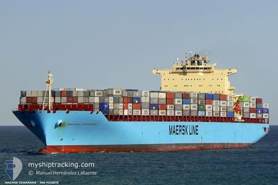
LUANDA EXPRESS
Container Ship
Current Trip
CGPNR
| Time Travelled | 4 days |
|---|---|
| Remaining Time | --- |
| Distance Travelled | 2066.85 nm |
| Remaining Distance | --- |
| AVG Speed | 19.7 Knots |
| MAX Speed | 21.9 Knots |
| AVG Wind | 14.4 knots |
| MAX Wind | 26 knots |
| MIN Temp | 16.4°C / 61.52°F |
| MAX Temp | 25.6°C / 78.08°F |
| Draught | 14.4 m |
| Position Received | 2 d ago |
Current Position
| Longitude | 17.66124° |
|---|---|
| Latitude | -33.80388° |
| Status | Under way using engine |
| Speed | 20 Knots |
| Course | 156.4° |
| Area | South Atlantic Ocean |
| Station | T-AIS |
| Position Received | 2 d ago |
Info
Information
The current position of LUANDA EXPRESS is in South Atlantic Ocean with coordinates -33.80388° / 17.66124° as reported on 2026-01-05 12:22 by AIS to our vessel tracker app. The vessel's current speed is 20 Knots
The vessel LUANDA EXPRESS (IMO: 9330070, MMSI: 636092986) is a Container Ship that was built in 2007 ( 19 years old ). It's sailing under the flag of [LR] Liberia.
In this page you can find informations about the vessels current position, last detected port calls, and current voyage information. If the vessels is not in coverage by AIS you will find the latest position.
The current position of LUANDA EXPRESS is detected by our AIS receivers and we are not responsible for the reliability of the data. The last position was recorded while the vessel was in Coverage by the Ais receivers of our vessel tracking app.
The current draught of LUANDA EXPRESS as reported by AIS is 14.4 meters
Weather
| Temperature | 25.9°C / 78.62°F |
|---|---|
| Wind Speed | 12 knots |
| Direction | 117° ESE |
| Pressure | 1015.9 hPa |
| Humidity | 76.4 % |
| Cloud Coverage | 100 % |
Featured Company
Last Port Calls
| Port | Arrival | Departure | Time In Port |
|---|---|---|---|
| 2026-01-03 06:23 | 2026-01-04 00:11 | 17 h | |
| 2025-12-26 07:59 | 2025-12-28 13:03 | 2 d | |
| 2025-12-22 11:18 | 2025-12-26 01:57 | 3 d | |
| 2025-12-19 17:41 | 2025-12-21 17:49 | 2 d | |
| 2025-11-29 06:42 | 2025-11-29 20:42 | 13 h | |
| 2025-11-27 07:21 | 2025-11-27 20:13 | 12 h | |
| 2025-11-21 17:20 | 2025-11-22 08:36 | 15 h | |
| 2025-11-14 12:00 | 2025-11-15 02:44 | 14 h | |
| 2025-11-12 02:52 | 2025-11-13 04:52 | 1 d |
Most Visited Ports (Last year)
| Port | Arrivals | |
|---|---|---|
| 8 | ||
| 7 | ||
| 5 | ||
| 4 | ||
| 4 | ||
| 4 |
Last Trips
| Origin | Departure | Destination | Arrival | Distance | |
|---|---|---|---|---|---|
| 2025-12-28 14:03 | 2026-01-03 08:23 | 961.41 nm | |||
| 2025-12-26 02:57 | 2025-12-26 08:59 | 8.79 nm | |||
| 2025-12-21 18:49 | 2025-12-22 12:18 | 303.07 nm | |||
| 2025-11-30 04:42 | 2025-12-19 18:41 | 7561.89 nm | |||
| 2025-11-28 04:13 | 2025-11-29 14:42 | 218.36 nm | |||
| 2025-11-22 16:36 | 2025-11-27 15:21 | 1484.73 nm | |||
| 2025-11-15 10:44 | 2025-11-22 01:20 | 1071.79 nm | |||
| 2025-11-13 12:52 | 2025-11-14 20:00 | 421.78 nm | |||
| 2025-11-01 04:25 | 2025-11-12 10:52 | 2551.25 nm |
Events
| Time | Event | Details | Position / Dest | Info |
|---|---|---|---|---|
| 2026-01-05 12:28 | Status Changed | Default Under way using engine |
-33.83521 / 17.67723
CGPNR
|
Speed: 20 kn Course: 156.4° |
| 2026-01-05 12:22 | OUT of Coverage |
-33.80388 / 17.66124
South Atlantic Ocean
|
Speed: 20 kn Course: 156.4° |
|
| 2026-01-05 12:16 | Change Sea Area | South African part of the South Atlantic Ocean Malaysian part of the Singapore Strait |
-33.77303 / 17.64529
South Atlantic Ocean
|
Speed: 20.1 kn Course: 157.1° |
| 2026-01-05 12:15 | Status Changed | Under way using engine Default |
-33.76791 / 17.64265
CGPNR
|
Speed: 20 kn Course: 157° |
| 2026-01-05 12:15 | IN Coverage |
-33.77303 / 17.64529
South Atlantic Ocean
|
Speed: 20.1 kn Course: 157.1° |
|
| 2026-01-04 00:11 | PORT DEPARTURE |
|
-22.92867 / 14.49675
CGPNR
|
Speed: 7.3 kn Course: 3° |
| 2026-01-03 23:56 | START Moving |
-22.95081 / 14.49009
[NA] WALVIS BAY
|
Speed: 3.1 kn Course: 58° |
|
| 2026-01-03 06:52 | STOP Moving |
-22.95168 / 14.48547
[NA] WALVIS BAY
|
Speed: 0.2 kn Course: 24° |
|
| 2026-01-03 06:23 | PORT ARRIVAL |
|
-22.93908 / 14.49634
[NA] WALVIS BAY
|
Speed: 7.3 kn Course: 182° |
| 2026-01-03 04:28 | START Moving | 6.53 nm, North of WALVIS BAY |
-22.83066 / 14.50900
CGPNR
|
Speed: 5 kn Course: 286° |