
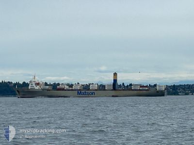
MAHIMAHI
Container Ship
Current Trip
| Trip Time | 4 days |
|---|---|
| Trip Distance | 2251.07 nm |
| AVG Speed | 18.3 Knots |
| MAX Speed | 22.1 Knots |
| Draught | 10.9 m |
| AVG Wind | 11.4 knots |
| MAX Wind | 26.2 knots |
| MIN Temp | 12.5°C / 54.5°F |
| MAX Temp | 23°C / 73.4°F |
| Position Received | 1 m ago |
Current Position
| Longitude | -157.87597° |
|---|---|
| Latitude | 21.31082° |
| Status | Moored |
| Speed | |
| Course | 124° |
| Area | North Pacific Ocean |
| Station | T-AIS |
| Position Received | 1 m ago |
Info
Information
The current position of MAHIMAHI is in North Pacific Ocean with coordinates 21.31082° / -157.87597° as reported on 2025-02-07 05:32 by AIS to our vessel tracker app. The vessel's current speed is 0 Knots and is currently inside the port of HONOLULU .
The vessel MAHIMAHI (IMO: 7907996, MMSI: 366563000) is a Container Ship that was built in 1983 ( 42 years old ). It's sailing under the flag of [US] USA.
In this page you can find informations about the vessels current position, last detected port calls, and current voyage information. If the vessels is not in coverage by AIS you will find the latest position.
The current position of MAHIMAHI is detected by our AIS receivers and we are not responsible for the reliability of the data. The last position was recorded while the vessel was in Coverage by the Ais receivers of our vessel tracking app.
The current draught of MAHIMAHI as reported by AIS is 10.9 meters
Weather
| Temperature | 23°C / 73.4°F |
|---|---|
| Wind Speed | 5 knots |
| Direction | 62° ENE |
| Pressure | 1016.1 hPa |
| Humidity | 72.3 % |
| Cloud Coverage | 51 % |
Featured Company
Last Port Calls
| Port | Arrival | Departure | Time In Port |
|---|---|---|---|
| 2025-02-06 05:35 | |||
| 2025-01-31 09:12 | 2025-02-01 12:40 | 1 d | |
| 2025-01-29 09:22 | 2025-01-30 02:47 | 17 h | |
| 2025-01-23 02:09 | 2025-01-24 21:41 | 1 d | |
| 2025-01-17 09:09 | 2025-01-18 12:29 | 1 d | |
| 2025-01-15 09:18 | 2025-01-16 02:18 | 16 h | |
| 2025-01-09 02:31 | 2025-01-10 14:29 | 1 d | |
| 2025-01-02 22:12 | 2025-01-04 12:39 | 1 d | |
| 2024-12-31 09:23 | 2024-12-31 23:37 | 14 h | |
| 2024-12-28 13:05 | 2024-12-29 02:11 | 13 h |
Most Visited Ports (Last year)
| Port | Arrivals | |
|---|---|---|
| 22 | ||
| 21 | ||
| 13 | ||
| 9 | ||
| 1 |
Last Trips
| Origin | Departure | Destination | Arrival | Distance | |
|---|---|---|---|---|---|
| 2025-02-01 04:40 | 2025-02-05 19:35 | 2251.07 nm | |||
| 2025-01-29 18:47 | 2025-01-31 01:12 | 396.96 nm | |||
| 2025-01-24 11:41 | 2025-01-29 01:22 | 2101.23 nm | |||
| 2025-01-18 04:29 | 2025-01-22 16:09 | 2267.01 nm | |||
| 2025-01-15 18:18 | 2025-01-17 01:09 | 513.65 nm | |||
| 2025-01-10 04:29 | 2025-01-15 01:18 | 2185.93 nm | |||
| 2025-01-04 04:39 | 2025-01-08 16:31 | 2272.12 nm | |||
| 2024-12-31 15:37 | 2025-01-02 14:12 | 480.53 nm | |||
| 2024-12-28 18:11 | 2024-12-31 01:23 | 950.85 nm | |||
| 2024-12-23 03:33 | 2024-12-28 05:05 | 2545.58 nm |
Events
| Time | Event | Details | Position / Dest | Info |
|---|---|---|---|---|
| 2025-02-06 07:07 | ETA Changed | 2026/01/12 10:30 2026/01/06 06:00 |
21.31085 / -157.87605
[US] HONOLULU
|
Speed: Course: 124° |
| 2025-02-06 07:00 | Destination Changed | USOAK USHNL |
21.31077 / -157.87596
[US] HONOLULU
|
Speed: Course: 124° |
| 2025-02-06 06:23 | Status Changed | Moored Under way using engine |
21.31075 / -157.87602
[US] HONOLULU
|
Speed: Course: 124° |
| 2025-02-06 06:12 | STOP Moving |
21.31082 / -157.87597
[US] HONOLULU
|
Speed: 0.3 kn Course: 125° |
|
| 2025-02-06 05:35 | PORT ARRIVAL |
|
21.29532 / -157.87109
[US] HONOLULU
|
Speed: 7.5 kn Course: 28.1° |
| 2025-02-06 02:33 | ETA Changed | 2026/01/06 06:00 2026/01/06 03:00 |
21.42445 / -157.20053
USHNL
|
Speed: 16.4 kn Course: 243.8° |
| 2025-02-06 01:51 | Change Sea Area | United States (Hawaii) part of the North Pacific Ocean United States part of the North Pacific Ocean |
21.51604 / -157.00501
North Pacific Ocean
|
Speed: 19.5 kn Course: 243.5° |
| 2025-02-06 01:51 | IN Coverage |
21.51604 / -157.00501
North Pacific Ocean
|
Speed: 19.5 kn Course: 243.5° |
|
| 2025-02-06 01:50 | Status Changed | Under way using engine Default |
21.51871 / -156.99930
USHNL
|
Speed: 19.8 kn Course: 243° |
| 2025-02-01 18:23 | OUT of Coverage |
33.00122 / -119.51312
North Pacific Ocean
|
Speed: 17.5 kn Course: 256.7° |