
MANUEL
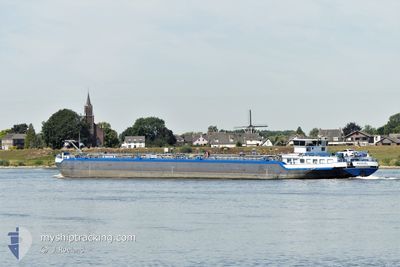
Tanker A
Current Trip
| Time Travelled | 2 days |
|---|---|
| Remaining Time | --- |
| Distance Travelled | 126.69 nm |
| Remaining Distance | --- |
| AVG Speed | 5.5 Knots |
| MAX Speed | 8 Knots |
| AVG Wind | 5.8 knots |
| MAX Wind | 9 knots |
| MIN Temp | 9.7°C / 49.46°F |
| MAX Temp | 20.8°C / 69.44°F |
| Draught | 2.3 m |
| Position Received | 1 d ago |
Current Position
| Longitude | 7.31883° |
|---|---|
| Latitude | 50.49767° |
| Status | Under way using engine |
| Speed | 5.9 Knots |
| Course | 131.8° |
| Area | North Sea |
| Station | T-AIS |
| Position Received | 1 d ago |
Information
The current position of MANUEL is in North Sea with coordinates 50.49767° / 7.31883° as reported on 2025-05-11 11:09 by AIS to our vessel tracker app. The vessel's current speed is 5.9 Knots
The vessel MANUEL (MMSI: 211442250) is a Tanker A It's sailing under the flag of [DE] Germany.
In this page you can find informations about the vessels current position, last detected port calls, and current voyage information. If the vessels is not in coverage by AIS you will find the latest position.
The current position of MANUEL is detected by our AIS receivers and we are not responsible for the reliability of the data. The last position was recorded while the vessel was in Coverage by the Ais receivers of our vessel tracking app.
The current draught of MANUEL as reported by AIS is 2.3 meters
Weather
| Temperature | 20.8°C / 69.44°F |
|---|---|
| Wind Speed | 8 knots |
| Direction | 127° SE |
| Pressure | 1014.2 hPa |
| Humidity | 34 % |
| Cloud Coverage | 3 % |
Featured Company
Last Port Calls
| Port | Arrival | Departure | Time In Port |
|---|---|---|---|
| 2025-05-10 12:42 | 2025-05-10 13:37 | 55 m | |
| 2025-05-09 18:36 | 2025-05-10 02:18 | 7 h | |
| 2025-05-06 06:01 | 2025-05-09 16:42 | 3 d | |
| 2025-05-04 22:50 | 2025-05-05 07:45 | 8 h | |
| 2025-05-04 12:40 | 2025-05-04 14:20 | 1 h | |
| 2025-05-04 09:05 | |||
| 2025-05-02 23:25 | 2025-05-03 07:05 | 7 h | |
| 2025-04-30 18:31 | 2025-05-02 21:02 | 2 d | |
| 2025-04-30 12:42 | 2025-04-30 15:05 | 2 h | |
| 2025-04-28 07:59 | 2025-04-29 08:04 | 1 d |
Most Visited Ports (Last year)
| Port | Arrivals | |
|---|---|---|
| 34 | ||
| 30 | ||
| 21 | ||
| 14 | ||
| 14 | ||
| 13 |
Last Trips
| Origin | Departure | Destination | Arrival | Distance | |
|---|---|---|---|---|---|
| 2025-05-10 02:18 | 2025-05-10 12:42 | 73.29 nm | |||
| 2025-05-09 16:42 | 2025-05-09 18:36 | 17.02 nm | |||
| 2025-05-05 07:45 | 2025-05-06 06:01 | 143.86 nm | |||
| 2025-05-04 14:20 | 2025-05-04 22:50 | 43.13 nm | |||
| 2025-05-04 09:05 | 2025-05-04 12:40 | 4.41 nm | |||
| 2025-05-02 21:02 | 2025-05-02 23:25 | 23.23 nm | |||
| 2025-04-30 15:05 | 2025-04-30 18:31 | 18.72 nm | |||
| 2025-04-29 08:04 | 2025-04-30 12:42 | 5.99 nm | |||
| 2025-04-27 23:13 | 2025-04-28 07:59 | 42.03 nm | |||
| 2025-04-27 10:13 | 2025-04-27 22:27 | 72.94 nm |
Events
| Time | Event | Details | Position / Dest | Info |
|---|---|---|---|---|
| 2025-05-11 11:19 | Status Changed | Default Under way using engine |
50.48555 / 7.33475
BENDORF
|
Speed: 5.9 kn Course: 131.8° |
| 2025-05-11 11:09 | OUT of Coverage |
50.49767 / 7.31883
North Sea
BENDORF
|
Speed: 5.9 kn Course: 131.8° |
|
| 2025-05-11 10:19 | Status Changed | Under way using engine Default |
50.56330 / 7.27642
BENDORF
|
Speed: 5.5 kn Course: 152° |
| 2025-05-11 10:18 | Status Changed | Default Under way using engine |
50.56498 / 7.27494
BENDORF
|
Speed: 6.7 kn Course: 99° |
| 2025-05-10 20:21 | ETA Changed | 2025/05/11 18:00 2025/05/12 10:00 |
51.37199 / 6.68926
BENDORF
|
Speed: 5.8 kn Course: 263.1° |
| 2025-05-10 17:09 | IN Coverage |
51.57612 / 6.64783
North Sea
BENDORF
|
Speed: 4.9 kn Course: 66.9° |
|
| 2025-05-10 12:52 | OUT of Coverage |
51.82372 / 6.25925
North Sea
BENDORF
|
Speed: 6.5 kn Course: 126.4° |
|
| 2025-05-10 11:37 | PORT DEPARTURE |
|
51.86398 / 6.06654
BENDORF
|
Speed: 6.7 kn Course: 122.3° |
| 2025-05-10 11:30 | START Moving |
51.86991 / 6.04644
[NL] MILLINGEN AAN DE RIJN
|
Speed: 6.8 kn Course: 102.6° |
|
| 2025-05-10 10:43 | STOP Moving |
51.87032 / 6.04234
[NL] MILLINGEN AAN DE RIJN
|
Speed: 0.2 kn Course: 511° |