

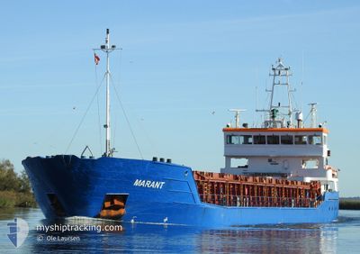
MARANT
General Cargo

Current Trip
ES SVQ>ORDER
| Time Travelled | 1 day |
|---|---|
| Remaining Time | --- |
| Distance Travelled | 67.02 nm |
| Remaining Distance | --- |
| AVG Speed | 9.3 Knots |
| MAX Speed | 13 Knots |
| AVG Wind | 9 knots |
| MAX Wind | 15 knots |
| MIN Temp | 18.7°C / 65.66°F |
| MAX Temp | 27.1°C / 80.78°F |
| Draught | 3.6 m |
| Position Received | 1 d ago |
Current Position
| Longitude | -6.67715° |
|---|---|
| Latitude | 36.77339° |
| Status | Under way using engine |
| Speed | 10.8 Knots |
| Course | 306.2° |
| Area | North Atlantic Ocean |
| Station | T-AIS |
| Position Received | 1 d ago |
Information
The current position of MARANT is in North Atlantic Ocean with coordinates 36.77339° / -6.67715° as reported on 2025-05-20 14:27 by AIS to our vessel tracker app. The vessel's current speed is 10.8 Knots
The vessel MARANT (IMO: 9280689, MMSI: 205050000) is a General Cargo that was built in 2006 ( 19 years old ). It's sailing under the flag of [BE] Belgium.
In this page you can find informations about the vessels current position, last detected port calls, and current voyage information. If the vessels is not in coverage by AIS you will find the latest position.
The current position of MARANT is detected by our AIS receivers and we are not responsible for the reliability of the data. The last position was recorded while the vessel was in Coverage by the Ais receivers of our vessel tracking app.
The current draught of MARANT as reported by AIS is 3.6 meters
Weather
| Temperature | 20.1°C / 68.18°F |
|---|---|
| Wind Speed | 7 knots |
| Direction | 270° W |
| Pressure | 1015.6 hPa |
| Humidity | 78.2 % |
| Cloud Coverage | --- |


Featured Company
Last Port Calls
| Port | Arrival | Departure | Time In Port |
|---|---|---|---|
| 2025-05-17 16:07 | 2025-05-20 10:54 | 2 d | |
| 2025-05-13 07:30 | 2025-05-13 22:48 | 15 h | |
| 2025-05-04 15:44 | 2025-05-08 15:09 | 3 d | |
| 2025-04-18 07:19 | 2025-04-26 15:37 | 8 d | |
| 2025-04-16 09:01 | 2025-04-17 22:56 | 1 d | |
| 2025-04-13 14:26 | 2025-04-13 18:10 | 3 h | |
| 2025-04-07 07:14 | 2025-04-07 15:08 | 7 h | |
| 2025-04-02 20:53 | 2025-04-05 10:23 | 2 d | |
| 2025-03-29 19:15 | 2025-03-31 19:42 | 1 d | |
| 2025-03-19 14:04 | 2025-03-21 09:46 | 1 d |
Most Visited Ports (Last year)
| Port | Arrivals | |
|---|---|---|
| 9 | ||
| 3 | ||
| 3 | ||
| 2 | ||
| 2 | ||
| 2 |
Last Trips
| Origin | Departure | Destination | Arrival | Distance | |
|---|---|---|---|---|---|
| 2025-05-13 22:48 | 2025-05-17 16:07 | 915.50 nm | |||
| 2025-05-08 15:09 | 2025-05-13 07:30 | 1069.56 nm | |||
| 2025-04-26 15:37 | 2025-05-04 15:44 | 1713.48 nm | |||
| 2025-04-17 22:56 | 2025-04-18 07:19 | 85.24 nm | |||
| 2025-04-13 18:10 | 2025-04-16 09:01 | 7.63 nm | |||
| 2025-04-07 15:08 | 2025-04-13 14:26 | 1232.01 nm | |||
| 2025-04-05 10:23 | 2025-04-07 07:14 | 312.42 nm | |||
| 2025-03-31 19:42 | 2025-04-02 20:53 | 277.20 nm | |||
| 2025-03-21 09:46 | 2025-03-29 19:15 | 1613.84 nm | |||
| 2025-03-17 21:24 | 2025-03-19 14:04 | 331.60 nm |
Events
| Time | Event | Details | Position / Dest | Info |
|---|---|---|---|---|
| 2025-05-20 15:28 | STOP Moving | 19.33 nm, South of HUELVA |
36.82576 / -6.83073
ES SVQ>ORDER
|
Speed: 0.3 kn Course: 264° |
| 2025-05-20 14:27 | Status Changed | Default Under way using engine |
36.77428 / -6.67868
ES SVQ>ORDER
|
Speed: 10.8 kn Course: 306.2° |
| 2025-05-20 14:27 | OUT of Coverage |
36.77339 / -6.67715
North Atlantic Ocean
ES SVQ>ORDER
|
Speed: 10.8 kn Course: 306.2° |
|
| 2025-05-20 13:51 | Draught Changed | 3.6 3.7 |
36.76872 / -6.54309
ES SVQ>ORDER
|
Speed: 10.6 kn Course: 273.7° |
| 2025-05-20 13:51 | Destination Changed | ES SVQ>ORDER ES SVQ>ES SVQ |
36.76872 / -6.54309
ES SVQ>ORDER
|
Speed: 10.6 kn Course: 273.7° |
| 2025-05-20 13:46 | Status Changed | Under way using engine Default |
36.76797 / -6.52644
ES SVQ>ES SVQ
|
Speed: 10.7 kn Course: 274° |
| 2025-05-20 13:40 | Status Changed | Default Under way using engine |
36.76664 / -6.50518
ES SVQ>ES SVQ
|
Speed: 10.6 kn Course: 268.9° |
| 2025-05-20 12:43 | Status Changed | Under way using engine Default |
36.82621 / -6.35369
ES SVQ>ES SVQ
|
Speed: 12.2 kn Course: 189° |
| 2025-05-20 12:43 | IN Coverage |
36.82524 / -6.35319
North Atlantic Ocean
ES SVQ>ES SVQ
|
Speed: 12.7 kn Course: 151.8° |
|
| 2025-05-20 09:33 | OUT of Coverage |
37.22750 / -6.06536
North Atlantic Ocean
ES SVQ>ES SVQ
|
Speed: 9.3 kn Course: 196.6° |