
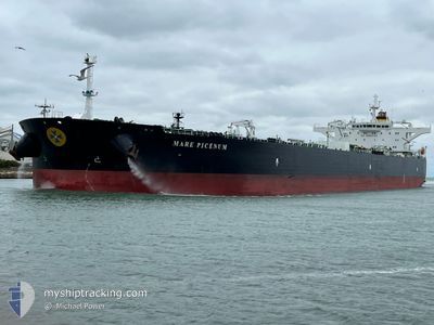
MARE PICENUM
Crude Oil Tanker
Current Trip
| Time Travelled | 20 days |
|---|---|
| Remaining Time | --- |
| Distance Travelled | 4655.87 nm |
| Remaining Distance | --- |
| AVG Speed | 9.8 Knots |
| MAX Speed | 15 Knots |
| AVG Wind | 16.5 knots |
| MAX Wind | 39 knots |
| MIN Temp | 4.9°C / 40.82°F |
| MAX Temp | 27.5°C / 81.5°F |
| Draught | 8.8 m |
| Position Received | 1 d ago |
Current Position
| Longitude | -17.50159° |
|---|---|
| Latitude | 8.45465° |
| Status | Under way using engine |
| Speed | 10.3 Knots |
| Course | 140.1° |
| Area | North Atlantic Ocean |
| Station | T-AIS |
| Position Received | 1 d ago |
Info
Information
The current position of MARE PICENUM is in North Atlantic Ocean with coordinates 8.45465° / -17.50159° as reported on 2025-12-21 03:23 by AIS to our vessel tracker app. The vessel's current speed is 10.3 Knots and is heading at the port of TERNEUZEN. The estimated time of arrival as calculated by MyShipTracking vessel tracking app is 2025-12-28 01:00 LT
The vessel MARE PICENUM (IMO: 9449405, MMSI: 247293200) is a Crude Oil Tanker that was built in 2011 ( 14 years old ). It's sailing under the flag of [IT] Italy.
In this page you can find informations about the vessels current position, last detected port calls, and current voyage information. If the vessels is not in coverage by AIS you will find the latest position.
The current position of MARE PICENUM is detected by our AIS receivers and we are not responsible for the reliability of the data. The last position was recorded while the vessel was in Coverage by the Ais receivers of our vessel tracking app.
The current draught of MARE PICENUM as reported by AIS is 8.8 meters
Weather
| Temperature | 27.3°C / 81.14°F |
|---|---|
| Wind Speed | 1 knots |
| Direction | 320° NW |
| Pressure | 1008.5 hPa |
| Humidity | 69.2 % |
| Cloud Coverage | 31 % |
Featured Company
Events
| Time | Event | Details | Position / Dest | Info |
|---|---|---|---|---|
| 2025-12-21 03:26 | Status Changed | Default Under way using engine |
8.44805 / -17.49604
FOR ORDERS
|
Speed: 10.3 kn Course: 140.1° |
| 2025-12-21 03:23 | OUT of Coverage |
8.45465 / -17.50159
North Atlantic Ocean
FOR ORDERS
|
Speed: 10.3 kn Course: 140.1° |
|
| 2025-12-21 03:22 | Status Changed | Under way using engine Default |
8.45754 / -17.50404
FOR ORDERS
|
Speed: 10.2 kn Course: 140° |
| 2025-12-21 03:20 | Status Changed | Default Under way using engine |
8.46198 / -17.50778
FOR ORDERS
|
Speed: 10.3 kn Course: 139.6° |
| 2025-12-20 23:08 | ETA Changed | 2025/12/28 00:00 2025/12/11 12:00 |
9.03354 / -17.96463
FOR ORDERS
|
Speed: 10.4 kn Course: 139.7° |
| 2025-12-20 23:03 | Change Sea Area | Guinean part of the North Atlantic Ocean Guinea Bissau part of the North Atlantic Ocean |
9.04522 / -17.97442
North Atlantic Ocean
|
Speed: 10.6 kn Course: 139.8° |
| 2025-12-20 22:46 | Change Sea Area | Guinea Bissau part of the North Atlantic Ocean Senegalese part of the North Atlantic Ocean |
9.08428 / -18.00609
North Atlantic Ocean
|
Speed: 10.5 kn Course: 141° |
| 2025-12-20 22:44 | Status Changed | Under way using engine Default |
9.08995 / -18.01075
FOR ORDERS
|
Speed: 10.3 kn Course: 142° |
| 2025-12-20 22:35 | IN Coverage |
9.08428 / -18.00609
North Atlantic Ocean
|
Speed: 10.5 kn Course: 141° |
|
| 2025-12-19 22:09 | OUT of Coverage |
12.22604 / -19.57327
North Atlantic Ocean
|
Speed: 10.3 kn Course: 180.6° |