
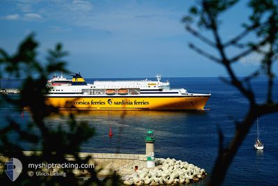
MEGA EXPRESS FIVE
Ro-Ro/Passenger Ship
Current Trip
| Time Travelled | 22 h, 31 mins |
|---|---|
| Remaining Time | --- |
| Distance Travelled | 142.90 nm |
| Remaining Distance | --- |
| AVG Speed | 14.7 Knots |
| MAX Speed | 15.4 Knots |
| AVG Wind | 7.7 knots |
| MAX Wind | 10 knots |
| MIN Temp | 12.4°C / 54.32°F |
| MAX Temp | 13.1°C / 55.58°F |
| Draught | 6.5 m |
| Position Received | 13 h, 20 m ago |
Current Position
| Longitude | 8.36867° |
|---|---|
| Latitude | 41.83150° |
| Status | Under way using engine |
| Speed | 15.1 Knots |
| Course | 124° |
| Area | Mediterranean Sea - Western Basin |
| Station | T-AIS |
| Position Received | 13 h, 20 m ago |
Info
Information
The current position of MEGA EXPRESS FIVE is in Mediterranean Sea - Western Basin with coordinates 41.83150° / 8.36867° as reported on 2025-02-05 04:20 by AIS to our vessel tracker app. The vessel's current speed is 15.1 Knots
The vessel MEGA EXPRESS FIVE (IMO: 9035101, MMSI: 247183200) is a Ro-Ro/Passenger Ship that was built in 1993 ( 32 years old ). It's sailing under the flag of [IT] Italy.
In this page you can find informations about the vessels current position, last detected port calls, and current voyage information. If the vessels is not in coverage by AIS you will find the latest position.
The current position of MEGA EXPRESS FIVE is detected by our AIS receivers and we are not responsible for the reliability of the data. The last position was recorded while the vessel was in Coverage by the Ais receivers of our vessel tracking app.
The current draught of MEGA EXPRESS FIVE as reported by AIS is 6.5 meters
Weather
| Temperature | 7.6°C / 45.68°F |
|---|---|
| Wind Speed | 4 knots |
| Direction | 81° E |
| Pressure | 1028.3 hPa |
| Humidity | 80.1 % |
| Cloud Coverage | --- |
Featured Company
Last Port Calls
| Port | Arrival | Departure | Time In Port |
|---|---|---|---|
| 2025-02-04 05:43 | 2025-02-04 19:10 | 13 h | |
| 2025-02-01 05:43 | 2025-02-02 19:11 | 1 d | |
| 2025-01-30 05:41 | 2025-01-30 19:22 | 13 h | |
| 2025-01-28 05:40 | 2025-01-28 19:28 | 13 h | |
| 2025-01-27 10:58 | 2025-01-27 13:46 | 2 h | |
| 2025-01-26 06:54 | 2025-01-26 19:08 | 12 h | |
| 2025-01-25 05:52 | 2025-01-25 19:08 | 13 h | |
| 2025-01-24 05:39 | 2025-01-24 19:09 | 13 h | |
| 2025-01-22 05:46 | 2025-01-22 19:03 | 13 h | |
| 2025-01-20 05:58 | 2025-01-20 19:04 | 13 h |
Most Visited Ports (Last year)
| Port | Arrivals | |
|---|---|---|
| 135 | ||
| 92 | ||
| 74 | ||
| 24 | ||
| 24 | ||
| 12 |
Last Trips
| Origin | Departure | Destination | Arrival | Distance | |
|---|---|---|---|---|---|
| 2025-02-02 20:11 | 2025-02-04 06:43 | 357.60 nm | |||
| 2025-01-30 20:22 | 2025-02-01 06:43 | 385.74 nm | |||
| 2025-01-28 20:28 | 2025-01-30 06:41 | 300.48 nm | |||
| 2025-01-27 14:46 | 2025-01-28 06:40 | 163.74 nm | |||
| 2025-01-26 20:08 | 2025-01-27 11:58 | 197.69 nm | |||
| 2025-01-25 20:08 | 2025-01-26 07:54 | 152.24 nm | |||
| 2025-01-24 20:09 | 2025-01-25 06:52 | 152.03 nm | |||
| 2025-01-22 20:03 | 2025-01-24 06:39 | 281.44 nm | |||
| 2025-01-20 20:04 | 2025-01-22 06:46 | 290.56 nm | |||
| 2025-01-19 19:04 | 2025-01-20 06:58 | 197.64 nm |
Events
| Time | Event | Details | Position / Dest | Info |
|---|---|---|---|---|
| 2025-02-05 04:28 | Status Changed | Default Under way using engine |
41.81433 / 8.40300
FRAJA
|
Speed: 15.1 kn Course: 124° |
| 2025-02-05 04:20 | OUT of Coverage |
41.83150 / 8.36867
Mediterranean Sea - Western Basin
FRAJA
|
Speed: 15.1 kn Course: 124° |
|
| 2025-02-05 04:15 | Status Changed | Under way using engine Default |
41.84483 / 8.34267
FRAJA
|
Speed: 15.1 kn Course: 125° |
| 2025-02-05 04:03 | Status Changed | Default Under way using engine |
41.87250 / 8.28867
FRAJA
|
Speed: 14.3 kn Course: 125° |
| 2025-02-05 02:42 | Status Changed | Under way using engine Default |
42.06317 / 7.92867
FRAJA
|
Speed: 14.2 kn Course: 122° |
| 2025-02-05 02:27 | Status Changed | Default Under way using engine |
42.09683 / 7.85967
FRAJA
|
Speed: 14.5 kn Course: 122° |
| 2025-02-05 02:23 | Status Changed | Under way using engine Default |
42.10467 / 7.84300
FRAJA
|
Speed: 14.8 kn Course: 123° |
| 2025-02-05 02:03 | IN Coverage |
42.10467 / 7.84300
Mediterranean Sea - Western Basin
FRAJA
|
Speed: 14.5 kn Course: 122° |
|
| 2025-02-05 00:42 | Status Changed | Default Under way using engine |
42.33250 / 7.37267
FRAJA
|
Speed: 15.2 kn Course: 128° |
| 2025-02-05 00:23 | OUT of Coverage |
42.38117 / 7.28700
Mediterranean Sea - Western Basin
FRAJA
|
Speed: 15.2 kn Course: 128° |