
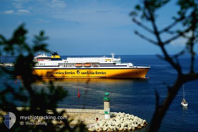
MEGA EXPRESS FIVE
Ro-Ro/Passenger Ship
Current Trip
FRPVO
| Time Travelled | 27 mins |
|---|---|
| Remaining Time | --- |
| Distance Travelled | 3.86 nm |
| Remaining Distance | --- |
| AVG Speed | 15.8 Knopen |
| MAX Speed | 15.9 Knopen |
| AVG Wind | 9.9 knots |
| MAX Wind | 10 knots |
| MIN Temp | 12.9°C / 55.22°F |
| MAX Temp | 13.1°C / 55.58°F |
| Diepgang | 6.5 M |
| Positie ontvangen | 7 m geleden |
Current Position
| Lengtegraad | 9.39783° |
|---|---|
| Breedtegraat | 41.59383° |
| Status | Under way using engine |
| Snelheid | 15.7 Knopen |
| Koers | 134° |
| Gebied | Mediterranean Sea - Western Basin |
| Station | T-AIS |
| Positie ontvangen | 7 m geleden |
Info
Information
The current position of MEGA EXPRESS FIVE is in Mediterranean Sea - Western Basin with coordinates 41.59383° / 9.39783° as reported on 2025-02-07 13:11 by AIS to our vessel tracker app. The vessel's current speed is 15.7 Knopen
The vessel MEGA EXPRESS FIVE (IMO: 9035101, MMSI: 247183200) is a Ro-Ro/Passenger Ship that was built in 1993 ( 32 Jaar oud ). It's sailing under the flag of [IT] Italy.
In this page you can find informations about the vessels current position, last detected port calls, and current voyage information. If the vessels is not in coverage by AIS you will find the latest position.
The current position of MEGA EXPRESS FIVE is detected by our AIS receivers and we are not responsible for the reliability of the data. The last position was recorded while the vessel was in Coverage by the Ais receivers of our vessel tracking app.
The current draught of MEGA EXPRESS FIVE as reported by AIS is 6.5 meters
Weather
| Temperature | 12.9°C / 55.22°F |
|---|---|
| Wind Speed | 10 knots |
| Direction | 42° NE |
| Pressure | 1024.3 hPa |
| Humidity | 71.8 % |
| Cloud Coverage | 19 % |
Featured Company
Last Port Calls
| Port | Arrival | Departure | Time In Port |
|---|---|---|---|
| 2025-02-07 12:29 | 2025-02-07 13:52 | 1 h | |
| 2025-02-06 06:44 | 2025-02-06 20:02 | 13 h | |
| 2025-02-05 20:01 | |||
| 2025-02-04 06:43 | 2025-02-04 20:10 | 13 h | |
| 2025-02-01 06:43 | 2025-02-02 20:11 | 1 d | |
| 2025-01-30 06:41 | 2025-01-30 20:22 | 13 h | |
| 2025-01-28 06:40 | 2025-01-28 20:28 | 13 h | |
| 2025-01-27 11:58 | 2025-01-27 14:46 | 2 h | |
| 2025-01-26 07:54 | 2025-01-26 20:08 | 12 h | |
| 2025-01-25 06:52 | 2025-01-25 20:08 | 13 h |
Most Visited Ports (Last year)
| Port | Arrivals | |
|---|---|---|
| 135 | ||
| 92 | ||
| 74 | ||
| 25 | ||
| 24 | ||
| 12 |
Last Trips
| Origin | Departure | Destination | Arrival | Distance | |
|---|---|---|---|---|---|
| 2025-02-06 20:02 | 2025-02-07 12:29 | 213.79 nm | |||
| 2025-02-05 20:01 | 2025-02-06 06:44 | 152.63 nm | |||
| 2025-02-02 20:11 | 2025-02-04 06:43 | 357.60 nm | |||
| 2025-01-30 20:22 | 2025-02-01 06:43 | 385.74 nm | |||
| 2025-01-28 20:28 | 2025-01-30 06:41 | 300.48 nm | |||
| 2025-01-27 14:46 | 2025-01-28 06:40 | 163.74 nm | |||
| 2025-01-26 20:08 | 2025-01-27 11:58 | 197.69 nm | |||
| 2025-01-25 20:08 | 2025-01-26 07:54 | 152.24 nm | |||
| 2025-01-24 20:09 | 2025-01-25 06:52 | 152.03 nm | |||
| 2025-01-22 20:03 | 2025-01-24 06:39 | 281.44 nm |
Events
| Tijd | Evenement | Details | Positie / Bestemming | Info |
|---|---|---|---|---|
| 2025-02-07 13:11 | Wijzig zee gebeid | French part of the Tyrrhenian Sea French part of the Mediterranean Sea - Western Basin |
41.59383 / 9.39783
Tyrrhenian Sea
FRPVO
|
Snelheid: 15.7 kn Koers: 134° |
| 2025-02-07 13:11 | Status Changed | Under way using engine Default |
41.59417 / 9.39733
FRPVO
|
Snelheid: 9.4 kn Koers: 44° |
| 2025-02-07 13:11 | Binnenbereik |
41.59383 / 9.39783
Tyrrhenian Sea
FRPVO
|
Snelheid: 15.7 kn Koers: 134° |
|
| 2025-02-07 12:52 | Start beweging | 1.31 nm, North East of PORTO VECCHIO |
41.60483 / 9.31350
FRPVO
|
Snelheid: 9.4 kn Koers: 44° |
| 2025-02-07 12:52 | Vertrekhaven |
|
41.60483 / 9.31350
FRPVO
|
Snelheid: 2.6 kn Koers: 23° |
| 2025-02-07 11:48 | Stop beweging |
41.58866 / 9.29350
[FR] PORTO VECCHIO
|
Snelheid: 0.1 kn Koers: 41° |
|
| 2025-02-07 11:29 | Aankomsthaven |
|
41.58866 / 9.29250
[FR] PORTO VECCHIO
|
Snelheid: 8.1 kn Koers: 224° |
| 2025-02-07 08:05 | Buitenbereik |
41.39667 / 8.84533
Mediterranean Sea - Western Basin
FRPVO
|
Snelheid: 16.4 kn Koers: 142° |
|
| 2025-02-07 07:13 | Destination Changed | FRPVO FRAJA |
41.59667 / 8.66667
FRPVO
|
Snelheid: 17.1 kn Koers: 160° |
| 2025-02-07 07:13 | ETA Changed | 2025/02/07 11:45 2025/02/07 05:30 |
41.59667 / 8.66667
FRPVO
|
Snelheid: 17.1 kn Koers: 160° |