
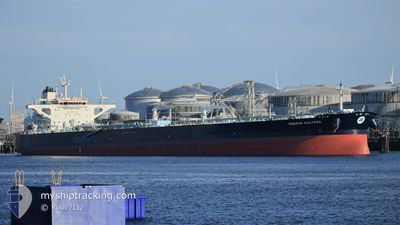
MINERVA KALYPSO
Tanker
Current Trip
| Time Travelled | --- |
|---|---|
| Remaining Time | 8 days |
| Distance Travelled | 5841.62 nm |
| Remaining Distance | 2721.13 nm |
| AVG Speed | 10.8 Knots |
| MAX Speed | 15.5 Knots |
| AVG Wind | 7.1 knots |
| MAX Wind | 23 knots |
| MIN Temp | 21.8°C / 71.24°F |
| MAX Temp | 29.1°C / 84.38°F |
| Draught | 15.5 m |
| Position Received | 5 h, 2 m ago |
Current Position
| Longitude | 104.65800° |
|---|---|
| Latitude | 1.56971° |
| Status | Under way using engine |
| Speed | 12.4 Knots |
| Course | 32.5° |
| Area | South China Sea |
| Station | T-AIS |
| Position Received | 5 h, 2 m ago |
Info
Information
The current position of MINERVA KALYPSO is in South China Sea with coordinates 1.56971° / 104.65800° as reported on 2025-12-18 07:48 by AIS to our vessel tracker app. The vessel's current speed is 12.4 Knots and is heading at the port of TIANJIN. The estimated time of arrival as calculated by MyShipTracking vessel tracking app is 2025-12-27 06:54 LT
The vessel MINERVA KALYPSO (IMO: 9785225, MMSI: 241502000) is a Tanker It's sailing under the flag of [GR] Greece.
In this page you can find informations about the vessels current position, last detected port calls, and current voyage information. If the vessels is not in coverage by AIS you will find the latest position.
The current position of MINERVA KALYPSO is detected by our AIS receivers and we are not responsible for the reliability of the data. The last position was recorded while the vessel was in Coverage by the Ais receivers of our vessel tracking app.
The current draught of MINERVA KALYPSO as reported by AIS is 15.5 meters
Weather
| Temperature | 26.9°C / 80.42°F |
|---|---|
| Wind Speed | 15 knots |
| Direction | 21° NNE |
| Pressure | 1008.4 hPa |
| Humidity | 83.5 % |
| Cloud Coverage | 100 % |
Featured Company
Last Port Calls
Most Visited Ports (Last year)
| Port | Arrivals | |
|---|---|---|
| 2 | ||
| 2 | ||
| 2 | ||
| 1 | ||
| 1 | ||
| 1 |
Last Trips
| Origin | Departure | Destination | Arrival | Distance |
|---|
Events
| Time | Event | Details | Position / Dest | Info |
|---|---|---|---|---|
| 2025-12-18 07:54 | Status Changed | Default Under way using engine |
1.58574 / 104.66825
CNTXG
|
Speed: 12.4 kn Course: 32.5° |
| 2025-12-18 07:48 | OUT of Coverage |
1.56971 / 104.65800
South China Sea
CNTXG
|
Speed: 12.4 kn Course: 32.5° |
|
| 2025-12-18 07:47 | Status Changed | Under way using engine Default |
1.56684 / 104.65618
CNTXG
|
Speed: 12.4 kn Course: 33° |
| 2025-12-18 07:30 | Status Changed | Default Under way using engine |
1.51736 / 104.62131
CNTXG
|
Speed: 12.1 kn Course: 45.7° |
| 2025-12-18 07:24 | Status Changed | Under way using engine Default |
1.50388 / 104.60856
CNTXG
|
Speed: 12 kn Course: 49° |
| 2025-12-18 07:21 | Status Changed | Default Under way using engine |
1.49676 / 104.60078
CNTXG
|
Speed: 12 kn Course: 48.6° |
| 2025-12-18 07:20 | Status Changed | Under way using engine Default |
1.49418 / 104.59783
CNTXG
|
Speed: 11.8 kn Course: 52° |
| 2025-12-18 07:10 | Status Changed | Default Under way using engine |
1.47473 / 104.57159
CNTXG
|
Speed: 11.6 kn Course: 56.8° |
| 2025-12-18 06:06 | Change Sea Area | Malaysian part of the South China Sea Malaysian part of the Singapore Strait |
1.33522 / 104.38462
South China Sea
CNTXG
|
Speed: 14.3 kn Course: 46.9° |
| 2025-12-18 05:07 | Change Sea Area | Malaysian part of the Singapore Strait Indonesian part of the Singapore Strait |
1.25999 / 104.16995
Singapore Strait
CNTXG
|
Speed: 13.7 kn Course: 90.1° |