
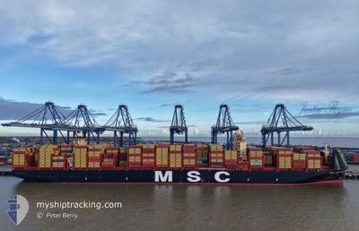
MSC ALESSIA
Cargo
Current Trip
| Trip Time | 15 h, 55 mins |
|---|---|
| Trip Distance | 126.24 nm |
| AVG Speed | 10.8 Knots |
| MAX Speed | 17.5 Knots |
| Draught | 13.7 m |
| AVG Wind | 11.1 knots |
| MAX Wind | 15 knots |
| MIN Temp | 4.7°C / 40.46°F |
| MAX Temp | 6.8°C / 44.24°F |
| Position Received | 20 m ago |
Current Position
| Longitude | 21.14267° |
|---|---|
| Latitude | 55.67674° |
| Status | Moored |
| Speed | |
| Course | 349° |
| Area | Baltic Sea |
| Station | T-AIS |
| Position Received | 20 m ago |
Info
Information
The current position of MSC ALESSIA is in Baltic Sea with coordinates 55.67674° / 21.14267° as reported on 2025-12-16 09:31 by AIS to our vessel tracker app. The vessel's current speed is 0 Knots and is currently inside the port of KLAIPEDA.
The vessel MSC ALESSIA (IMO: 9987330, MMSI: 636025327) is a Cargo It's sailing under the flag of [LR] Liberia.
In this page you can find informations about the vessels current position, last detected port calls, and current voyage information. If the vessels is not in coverage by AIS you will find the latest position.
The current position of MSC ALESSIA is detected by our AIS receivers and we are not responsible for the reliability of the data. The last position was recorded while the vessel was in Coverage by the Ais receivers of our vessel tracking app.
The current draught of MSC ALESSIA as reported by AIS is 13.7 meters
Weather
| Temperature | 5.1°C / 41.18°F |
|---|---|
| Wind Speed | 10 knots |
| Direction | 194° SSW |
| Pressure | 1018.7 hPa |
| Humidity | 84.6 % |
| Cloud Coverage | 3 % |
Featured Company
Last Port Calls
| Port | Arrival | Departure | Time In Port |
|---|---|---|---|
| 2025-12-16 07:16 | |||
| 2025-12-13 07:57 | 2025-12-15 14:21 | 2 d | |
| 2025-12-05 01:08 | 2025-12-07 13:29 | 2 d | |
| 2025-10-31 05:48 | 2025-11-03 02:52 | 2 d | |
| 2025-10-22 22:33 | 2025-10-23 11:52 | 13 h | |
| 2025-10-06 19:52 | 2025-10-09 04:22 | 2 d | |
| 2025-10-06 08:32 | 2025-10-06 19:17 | 10 h |
Last Trips
| Origin | Departure | Destination | Arrival | Distance | |
|---|---|---|---|---|---|
| 2025-12-15 14:21 | 2025-12-16 07:16 | 126.24 nm | |||
| 2025-12-07 13:29 | 2025-12-13 07:57 | 1164.57 nm | |||
| 2025-11-03 02:52 | 2025-12-05 01:08 | 11755.48 nm | |||
| 2025-10-23 11:52 | 2025-10-31 05:48 | 1440.67 nm | |||
| 2025-10-09 04:22 | 2025-10-22 22:33 | 2536.25 nm | |||
| 2025-10-06 19:17 | 2025-10-06 19:52 | 2.08 nm | |||
| 2025-09-07 13:16 | 2025-10-06 08:32 | 11468.73 nm |
Events
| Time | Event | Details | Position / Dest | Info |
|---|---|---|---|---|
| 2025-12-16 05:52 | Status Changed | Moored Under way using engine |
55.67672 / 21.14263
[LT] KLAIPEDA
|
Speed: 0.1 kn Course: 349° |
| 2025-12-16 05:34 | STOP Moving |
55.67594 / 21.14236
[LT] KLAIPEDA
|
Speed: 0.3 kn Course: 347° |
|
| 2025-12-16 05:16 | PORT ARRIVAL |
|
55.66896 / 21.14203
[LT] KLAIPEDA
|
Speed: 0.6 kn Course: 47° |
| 2025-12-16 02:16 | Change Sea Area | Lithuanian part of the Baltic Sea Polish part of the Baltic Sea |
55.76706 / 20.61081
Baltic Sea
LYKLJ
|
Speed: 8.5 kn Course: 107° |
| 2025-12-16 02:14 | IN Coverage |
55.76706 / 20.61081
Baltic Sea
LYKLJ
|
Speed: 8.5 kn Course: 107° |
|
| 2025-12-15 15:37 | OUT of Coverage |
54.84641 / 18.99634
Baltic Sea
LYKLJ
|
Speed: 12 kn Course: 357.1° |
|
| 2025-12-15 13:21 | PORT DEPARTURE |
|
54.53548 / 18.56647
LYKLJ
|
Speed: 6.2 kn Course: 92° |
| 2025-12-15 13:01 | START Moving |
54.54264 / 18.51337
[PL] GDYNIA
|
Speed: 3.3 kn Course: 119° |
|
| 2025-12-15 12:48 | Status Changed | Under way using engine Moored |
54.54420 / 18.51069
[PL] GDYNIA
|
Speed: Course: 116° |
| 2025-12-15 12:29 | Draught Changed | 13.7 13.6 |
54.54419 / 18.51073
[PL] GDYNIA
|
Speed: Course: 116° |