
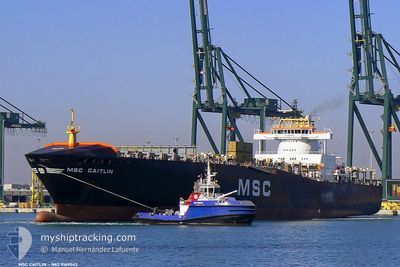
MSC CAITLIN II
Container Ship
Current Trip
| Time Travelled | 10 h, 17 mins |
|---|---|
| Remaining Time | --- |
| Distance Travelled | 113.76 nm |
| Remaining Distance | --- |
| AVG Speed | 11.5 Knots |
| MAX Speed | 12.3 Knots |
| AVG Wind | 5.4 knots |
| MAX Wind | 8 knots |
| MIN Temp | 15.7°C / 60.26°F |
| MAX Temp | 19.3°C / 66.74°F |
| Draught | 10.6 m |
| Position Received | 9 h, 40 m ago |
Current Position
| Longitude | 34.53957° |
|---|---|
| Latitude | 31.87990° |
| Status | Under way using engine |
| Speed | 9.3 Knots |
| Course | 285.5° |
| Area | Mediterranean Sea - Eastern Basin |
| Station | T-AIS |
| Position Received | 9 h, 40 m ago |
Info
Information
The current position of MSC CAITLIN II is in Mediterranean Sea - Eastern Basin with coordinates 31.87990° / 34.53957° as reported on 2025-12-14 17:48 by AIS to our vessel tracker app. The vessel's current speed is 9.3 Knots
The vessel MSC CAITLIN II (IMO: 9169043, MMSI: 636018323) is a Container Ship that was built in 1998 ( 27 years old ). It's sailing under the flag of [LR] Liberia.
In this page you can find informations about the vessels current position, last detected port calls, and current voyage information. If the vessels is not in coverage by AIS you will find the latest position.
The current position of MSC CAITLIN II is detected by our AIS receivers and we are not responsible for the reliability of the data. The last position was recorded while the vessel was in Coverage by the Ais receivers of our vessel tracking app.
The current draught of MSC CAITLIN II as reported by AIS is 10.6 meters
Weather
| Temperature | 18.8°C / 65.84°F |
|---|---|
| Wind Speed | 6 knots |
| Direction | 257° WSW |
| Pressure | 1017.2 hPa |
| Humidity | 59.2 % |
| Cloud Coverage | 17 % |
Featured Company
Last Port Calls
| Port | Arrival | Departure | Time In Port |
|---|---|---|---|
| 2025-12-13 08:57 | 2025-12-14 19:12 | 1 d | |
| 2025-12-11 13:40 | 2025-12-12 04:36 | 14 h | |
| 2025-12-08 17:08 | 2025-12-09 13:17 | 20 h | |
| 2025-12-06 10:34 | 2025-12-07 11:25 | 1 d | |
| 2025-12-03 06:05 | 2025-12-04 02:12 | 20 h | |
| 2025-11-30 16:50 | 2025-12-01 12:30 | 19 h | |
| 2025-11-27 23:49 | 2025-11-28 08:40 | 8 h | |
| 2025-11-25 09:01 | 2025-11-25 23:08 | 14 h | |
| 2025-11-19 20:15 | 2025-11-20 11:16 | 15 h | |
| 2025-11-17 13:32 | 2025-11-18 10:25 | 20 h |
Most Visited Ports (Last year)
| Port | Arrivals | |
|---|---|---|
| 12 | ||
| 11 | ||
| 11 | ||
| 9 | ||
| 9 | ||
| 6 |
Last Trips
| Origin | Departure | Destination | Arrival | Distance | |
|---|---|---|---|---|---|
| 2025-12-12 04:36 | 2025-12-13 08:57 | 87.53 nm | |||
| 2025-12-09 13:17 | 2025-12-11 13:40 | 656.24 nm | |||
| 2025-12-07 11:25 | 2025-12-08 17:08 | 275.41 nm | |||
| 2025-12-04 02:12 | 2025-12-06 10:34 | 743.40 nm | |||
| 2025-12-01 12:30 | 2025-12-03 06:05 | 490.09 nm | |||
| 2025-11-28 08:40 | 2025-11-30 16:50 | 383.66 nm | |||
| 2025-11-25 23:08 | 2025-11-27 23:49 | 517.80 nm | |||
| 2025-11-20 11:16 | 2025-11-25 09:01 | 1662.63 nm | |||
| 2025-11-18 10:25 | 2025-11-19 20:15 | 318.27 nm | |||
| 2025-11-15 15:18 | 2025-11-17 13:32 | 439.78 nm |
Events
| Time | Event | Details | Position / Dest | Info |
|---|---|---|---|---|
| 2025-12-14 17:54 | Status Changed | Default Under way using engine |
31.88409 / 34.52229
ILASH - EGPSE
|
Speed: 9.3 kn Course: 285.5° |
| 2025-12-14 17:48 | OUT of Coverage |
31.87990 / 34.53957
Mediterranean Sea - Eastern Basin
ILASH - EGPSE
|
Speed: 9.3 kn Course: 285.5° |
|
| 2025-12-14 17:42 | ETA Changed | 2025/12/15 06:00 2025/12/15 10:00 |
31.87517 / 34.56004
ILASH - EGPSE
|
Speed: 9.3 kn Course: 285° |
| 2025-12-14 17:12 | PORT DEPARTURE |
|
31.85102 / 34.63985
ILASH - EGPSE
|
Speed: 6.1 kn Course: 349° |
| 2025-12-14 17:01 | START Moving |
31.84144 / 34.64503
[IL] ASHDOD
|
Speed: 3.1 kn Course: 267° |
|
| 2025-12-14 16:54 | Destination Changed | ILASH - EGPSE ILHFA - ILASH |
31.84259 / 34.64943
[IL] ASHDOD
|
Speed: 0.2 kn Course: 268° |
| 2025-12-14 16:54 | ETA Changed | 2025/12/15 10:00 2025/12/12 10:00 |
31.84259 / 34.64943
[IL] ASHDOD
|
Speed: 0.2 kn Course: 268° |
| 2025-12-14 16:47 | Status Changed | Under way using engine Moored |
31.84267 / 34.64945
[IL] ASHDOD
|
Speed: Course: 269° |
| 2025-12-14 16:27 | STOP Moving |
31.84260 / 34.64947
[IL] ASHDOD
|
Speed: Course: 269° |
|
| 2025-12-14 16:05 | START Moving |
31.84186 / 34.65302
[IL] ASHDOD
|
Speed: 5.3 kn Course: 269° |