

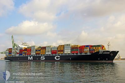
MSC CORUNA
Container Ship

Current Trip
| Time Travelled | 11 days |
|---|---|
| Remaining Time | --- |
| Distance Travelled | 4903.81 nm |
| Remaining Distance | 71.91 nm |
| AVG Speed | 17.2 Knots |
| MAX Speed | 23.8 Knots |
| AVG Wind | 11.9 knots |
| MAX Wind | 26.9 knots |
| MIN Temp | 13.5°C / 56.3°F |
| MAX Temp | 28.1°C / 82.58°F |
| Draught | 11.2 m |
| Position Received | 2 m ago |
Current Position
| Longitude | 2.68281° |
|---|---|
| Latitude | 51.45225° |
| Status | At anchor |
| Speed | |
| Course | 221° |
| Area | North Sea |
| Station | T-AIS |
| Position Received | 2 m ago |
Information
The current position of MSC CORUNA is in North Sea with coordinates 51.45225° / 2.68281° as reported on 2025-05-31 15:06 by AIS to our vessel tracker app. The vessel's current speed is 0 Knots and is heading at the port of ANTWERP. The estimated time of arrival as calculated by MyShipTracking vessel tracking app is 2025-06-01 06:00 LT
The vessel MSC CORUNA (IMO: 9480215, MMSI: 256172000) is a Container Ship that was built in 2011 ( 14 years old ). It's sailing under the flag of [MT] Malta.
In this page you can find informations about the vessels current position, last detected port calls, and current voyage information. If the vessels is not in coverage by AIS you will find the latest position.
The current position of MSC CORUNA is detected by our AIS receivers and we are not responsible for the reliability of the data. The last position was recorded while the vessel was in Coverage by the Ais receivers of our vessel tracking app.
The current draught of MSC CORUNA as reported by AIS is 11.2 meters
Weather
| Temperature | 15.9°C / 60.62°F |
|---|---|
| Wind Speed | 7 knots |
| Direction | 258° WSW |
| Pressure | 1016.2 hPa |
| Humidity | 83.9 % |
| Cloud Coverage | 68 % |


Featured Company
Last Port Calls
| Port | Arrival | Departure | Time In Port |
|---|---|---|---|
| 2025-05-19 04:56 | 2025-05-19 19:48 | 14 h | |
| 2025-05-17 07:00 | 2025-05-18 03:29 | 20 h | |
| 2025-05-12 02:55 | 2025-05-13 19:53 | 1 d | |
| 2025-05-07 18:34 | 2025-05-08 14:01 | 19 h | |
| 2025-04-23 17:52 | 2025-04-24 14:50 | 20 h | |
| 2025-04-21 02:56 | 2025-04-21 19:09 | 16 h | |
| 2025-04-15 22:39 | 2025-04-17 22:28 | 1 d | |
| 2025-04-05 04:14 | 2025-04-05 19:28 | 15 h | |
| 2025-04-02 13:00 | 2025-04-03 02:04 | 13 h | |
| 2025-03-31 13:01 | 2025-04-01 10:28 | 21 h |
Most Visited Ports (Last year)
| Port | Arrivals | |
|---|---|---|
| 7 | ||
| 6 | ||
| 5 | ||
| 5 | ||
| 5 | ||
| 5 |
Last Trips
| Origin | Departure | Destination | Arrival | Distance | |
|---|---|---|---|---|---|
| 2025-05-18 03:29 | 2025-05-19 04:56 | 290.00 nm | |||
| 2025-05-13 19:53 | 2025-05-17 07:00 | 456.22 nm | |||
| 2025-05-08 14:01 | 2025-05-12 02:55 | 550.08 nm | |||
| 2025-04-24 14:50 | 2025-05-07 18:34 | 5681.05 nm | |||
| 2025-04-21 19:09 | 2025-04-23 17:52 | 275.64 nm | |||
| 2025-04-17 22:28 | 2025-04-21 02:56 | 127.92 nm | |||
| 2025-04-05 19:28 | 2025-04-15 22:39 | 4138.92 nm | |||
| 2025-04-03 02:04 | 2025-04-05 04:14 | 901.55 nm | |||
| 2025-04-01 10:28 | 2025-04-02 13:00 | 292.19 nm | |||
| 2025-03-30 10:01 | 2025-03-31 13:01 | 440.69 nm |
Events
| Time | Event | Details | Position / Dest | Info |
|---|---|---|---|---|
| 2025-05-31 13:44 | ETA Changed | 2025/06/01 08:00 2025/06/01 10:00 |
51.44884 / 2.68164
USMOB>BEANR
|
Speed: 0.2 kn Course: 330° |
| 2025-05-31 13:27 | Status Changed | At anchor Default |
51.44852 / 2.68018
USMOB>BEANR
|
Speed: 0.1 kn Course: 194° |
| 2025-05-31 13:24 | Status Changed | Default At anchor |
51.44846 / 2.67993
USMOB>BEANR
|
Speed: 0.1 kn Course: 4° |
| 2025-05-31 12:09 | Status Changed | At anchor Default |
51.44928 / 2.67727
USMOB>BEANR
|
Speed: Course: 62° |
| 2025-05-31 12:06 | Status Changed | Default At anchor |
51.44928 / 2.67724
USMOB>BEANR
|
Speed: Course: 62° |
| 2025-05-31 08:37 | ETA Changed | 2025/06/01 10:00 2025/06/01 04:00 |
51.45034 / 2.67709
USMOB>BEANR
|
Speed: 0.1 kn Course: 98° |
| 2025-05-31 06:12 | Status Changed | At anchor Under way using engine |
51.45091 / 2.68304
USMOB>BEANR
|
Speed: 0.1 kn Course: 249° |
| 2025-05-31 06:10 | STOP Moving | 16.69 nm, North West of OOSTENDE |
51.45092 / 2.68295
USMOB>BEANR
|
Speed: 0.3 kn Course: 233° |
| 2025-05-31 04:07 | Detected in Sea | Belgian part of the North Sea |
51.33026 / 2.36925
North Sea
USMOB>BEANR
|
Speed: 12.3 kn Course: 64° |
| 2025-05-31 01:28 | Change Sea Area | French part of the North Sea French part of the English Channel |
51.00663 / 1.61455
North Sea
USMOB>BEANR
|
Speed: 13.4 kn Course: 41.5° |