
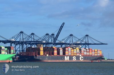
MSC ELOANE
Cargo A
Current Trip
| Time Travelled | 26 days |
|---|---|
| Remaining Time | 3 days |
| Distance Travelled | 11358.93 nm |
| Remaining Distance | 1749.71 nm |
| AVG Speed | 18.5 Knots |
| MAX Speed | 21.9 Knots |
| AVG Wind | 12.6 knots |
| MAX Wind | 30.3 knots |
| MIN Temp | 14.1°C / 57.38°F |
| MAX Temp | 29.3°C / 84.74°F |
| Draught | 13 m |
| Position Received | 7 d ago |
Current Position
| Longitude | 31.95807° |
|---|---|
| Latitude | -29.34802° |
| Status | Under way using engine |
| Speed | 16.4 Knots |
| Course | 45.1° |
| Area | Indian Ocean |
| Station | T-AIS |
| Position Received | 7 d ago |
Information
The current position of MSC ELOANE is in Indian Ocean with coordinates -29.34802° / 31.95807° as reported on 2025-05-25 10:17 by AIS to our vessel tracker app. The vessel's current speed is 16.4 Knots and is heading at the port of SINGAPORE. The estimated time of arrival as calculated by MyShipTracking vessel tracking app is 2025-06-05 07:56 LT
The vessel MSC ELOANE (IMO: 9755957, MMSI: 636017435) is a Cargo A It's sailing under the flag of [LR] Liberia.
In this page you can find informations about the vessels current position, last detected port calls, and current voyage information. If the vessels is not in coverage by AIS you will find the latest position.
The current position of MSC ELOANE is detected by our AIS receivers and we are not responsible for the reliability of the data. The last position was recorded while the vessel was in Coverage by the Ais receivers of our vessel tracking app.
The current draught of MSC ELOANE as reported by AIS is 13 meters
Weather
| Temperature | 29.2°C / 84.56°F |
|---|---|
| Wind Speed | 6 knots |
| Direction | 226° SW |
| Pressure | 1012.3 hPa |
| Humidity | 70 % |
| Cloud Coverage | 21 % |
Featured Company
Most Visited Ports (Last year)
| Port | Arrivals | |
|---|---|---|
| 5 | ||
| 3 | ||
| 3 | ||
| 2 | ||
| 2 | ||
| 2 |
Last Trips
| Origin | Departure | Destination | Arrival | Distance | |
|---|---|---|---|---|---|
| 2025-05-02 23:11 | 2025-05-05 06:32 | 838.95 nm | |||
| 2025-04-26 13:26 | 2025-04-30 04:17 | 160.78 nm | |||
| 2025-04-25 00:52 | 2025-04-25 07:32 | 59.25 nm | |||
| 2025-04-20 22:38 | 2025-04-22 23:17 | 776.37 nm | |||
| 2025-03-20 09:44 | 2025-04-18 00:52 | 12844.74 nm |
Events
| Time | Event | Details | Position / Dest | Info |
|---|---|---|---|---|
| 2025-05-25 10:25 | Status Changed | Default Under way using engine |
-29.32032 / 31.98760
SGSIN
|
Speed: 16.4 kn Course: 45.1° |
| 2025-05-25 10:17 | OUT of Coverage |
-29.34802 / 31.95807
Indian Ocean
SGSIN
|
Speed: 16.4 kn Course: 45.1° |
|
| 2025-05-25 05:10 | ETA Changed | 2025/06/05 13:00 2025/06/05 08:00 |
-30.49898 / 30.86024
SGSIN
|
Speed: 16 kn Course: 36.9° |
| 2025-05-25 04:37 | Status Changed | Under way using engine Default |
-30.62097 / 30.75980
SGSIN
|
Speed: 15.5 kn Course: 36° |
| 2025-05-25 04:32 | Status Changed | Default Under way using engine |
-30.63755 / 30.74655
SGSIN
|
Speed: 15.5 kn Course: 33.2° |
| 2025-05-25 04:17 | Status Changed | Under way using engine Default |
-30.69106 / 30.70420
SGSIN
|
Speed: 15.2 kn Course: 37° |
| 2025-05-25 04:04 | Status Changed | Default Under way using engine |
-30.73799 / 30.66514
SGSIN
|
Speed: 15.3 kn Course: 34.3° |
| 2025-05-25 04:00 | Change Sea Area | South African part of the Indian Ocean South African part of the South Atlantic Ocean |
-30.75062 / 30.65501
Indian Ocean
SGSIN
|
Speed: 15.3 kn Course: 34.3° |
| 2025-05-25 04:00 | Status Changed | Under way using engine Default |
-30.75062 / 30.65501
SGSIN
|
Speed: 15 kn Course: 36° |
| 2025-05-25 03:40 | IN Coverage |
-30.75062 / 30.65501
Indian Ocean
SGSIN
|
Speed: 15.3 kn Course: 34.3° |