

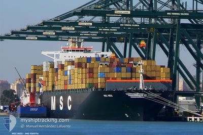
MSC INES
Container Ship

Current Trip
| Time Travelled | 3 days |
|---|---|
| Remaining Time | 4 h, 3 mins |
| Distance Travelled | 1752.23 nm |
| Remaining Distance | 77.87 nm |
| AVG Speed | 17.5 Knots |
| MAX Speed | 21.9 Knots |
| AVG Wind | 16.8 knots |
| MAX Wind | 24.9 knots |
| MIN Temp | 10°C / 50°F |
| MAX Temp | 22.2°C / 71.96°F |
| Draught | 13.4 m |
| Position Received | 1 m ago |
Current Position
| Longitude | 0.19646° |
|---|---|
| Latitude | 38.36715° |
| Status | Under way using engine |
| Speed | 18.4 Knots |
| Course | 33.7° |
| Area | Mediterranean Sea - Western Basin |
| Station | T-AIS |
| Position Received | 1 m ago |
Information
The current position of MSC INES is in Mediterranean Sea - Western Basin with coordinates 38.36715° / 0.19646° as reported on 2025-05-28 05:20 by AIS to our vessel tracker app. The vessel's current speed is 18.4 Knots and is heading at the port of VALENCIA. The estimated time of arrival as calculated by MyShipTracking vessel tracking app is 2025-05-28 11:24 LT
The vessel MSC INES (IMO: 9305714, MMSI: 356112000) is a Container Ship that was built in 2006 ( 19 years old ). It's sailing under the flag of [PA] Panama.
In this page you can find informations about the vessels current position, last detected port calls, and current voyage information. If the vessels is not in coverage by AIS you will find the latest position.
The current position of MSC INES is detected by our AIS receivers and we are not responsible for the reliability of the data. The last position was recorded while the vessel was in Coverage by the Ais receivers of our vessel tracking app.
The current draught of MSC INES as reported by AIS is 13.4 meters
Weather
| Temperature | 20.4°C / 68.72°F |
|---|---|
| Wind Speed | 4 knots |
| Direction | 89° E |
| Pressure | 1022.1 hPa |
| Humidity | 72.6 % |
| Cloud Coverage | 4 % |


Featured Company
Last Port Calls
| Port | Arrival | Departure | Time In Port |
|---|---|---|---|
| 2025-05-22 17:17 | 2025-05-24 11:04 | 1 d | |
| 2025-05-19 21:08 | 2025-05-21 04:18 | 1 d | |
| 2025-05-18 13:34 | 2025-05-19 12:10 | 22 h | |
| 2025-05-11 17:32 | 2025-05-13 01:51 | 1 d | |
| 2025-05-06 21:50 | 2025-05-08 16:58 | 1 d | |
| 2025-05-02 17:46 | 2025-05-05 04:46 | 2 d | |
| 2025-04-30 23:45 | 2025-05-02 12:34 | 1 d | |
| 2025-04-23 00:52 | 2025-04-25 16:25 | 2 d | |
| 2025-04-16 02:28 | 2025-04-18 02:59 | 2 d | |
| 2025-04-14 09:45 | 2025-04-15 15:54 | 1 d |
Most Visited Ports (Last year)
| Port | Arrivals | |
|---|---|---|
| 5 | ||
| 5 | ||
| 4 | ||
| 4 | ||
| 4 | ||
| 3 |
Last Trips
| Origin | Departure | Destination | Arrival | Distance | |
|---|---|---|---|---|---|
| 2025-05-21 04:18 | 2025-05-22 17:17 | 211.62 nm | |||
| 2025-05-19 12:10 | 2025-05-19 21:08 | 113.58 nm | |||
| 2025-05-13 01:51 | 2025-05-18 13:34 | 2269.56 nm | |||
| 2025-05-08 16:58 | 2025-05-11 17:32 | 1309.35 nm | |||
| 2025-05-05 04:46 | 2025-05-06 21:50 | 506.60 nm | |||
| 2025-05-02 12:34 | 2025-05-02 17:46 | 87.90 nm | |||
| 2025-04-25 16:25 | 2025-04-30 23:45 | 1750.36 nm | |||
| 2025-04-18 02:59 | 2025-04-23 00:52 | 1848.18 nm | |||
| 2025-04-15 15:54 | 2025-04-16 02:28 | 129.23 nm | |||
| 2025-04-12 12:17 | 2025-04-14 09:45 | 169.51 nm |
Events
| Time | Event | Details | Position / Dest | Info |
|---|---|---|---|---|
| 2025-05-27 20:49 | Change Sea Area | Spanish part of the Mediterranean Sea - Western Basin Spanish part of the Alboran Sea |
36.48822 / -1.99350
Mediterranean Sea - Western Basin
ESVLC
|
Speed: 17.7 kn Course: 50.4° |
| 2025-05-27 12:30 | Status Changed | Under way using engine Default |
36.00687 / -5.10330
ESVLC
|
Speed: 20.1 kn Course: 84° |
| 2025-05-27 12:28 | Status Changed | Default Under way using engine |
36.00611 / -5.11295
ESVLC
|
Speed: 19.9 kn Course: 83.8° |
| 2025-05-27 12:14 | Status Changed | Under way using engine Default |
35.99743 / -5.21106
ESVLC
|
Speed: 19.3 kn Course: 82° |
| 2025-05-27 12:12 | Status Changed | Default Under way using engine |
35.99617 / -5.22089
ESVLC
|
Speed: 18.9 kn Course: 81° |
| 2025-05-27 11:59 | Change Sea Area | Spanish part of the Alboran Sea Spanish part of the Strait of Gibraltar |
35.98546 / -5.30822
Alboran Sea
ESVLC
|
Speed: 19 kn Course: 82.1° |
| 2025-05-27 11:48 | Change Sea Area | Spanish part of the Strait of Gibraltar Moroccan part of the Strait of Gibraltar |
35.97590 / -5.37826
Strait of Gibraltar
ESVLC
|
Speed: 18.4 kn Course: 79.8° |
| 2025-05-27 10:32 | Status Changed | Under way using engine Default |
35.91953 / -5.82853
ESVLC
|
Speed: 17.8 kn Course: 91° |
| 2025-05-27 10:29 | Status Changed | Default Under way using engine |
35.91994 / -5.84866
ESVLC
|
Speed: 17.9 kn Course: 87.3° |
| 2025-05-27 10:14 | Change Sea Area | Moroccan part of the Strait of Gibraltar Moroccan part of the North Atlantic Ocean |
35.91845 / -5.93993
Strait of Gibraltar
ESVLC
|
Speed: 18 kn Course: 83.8° |