
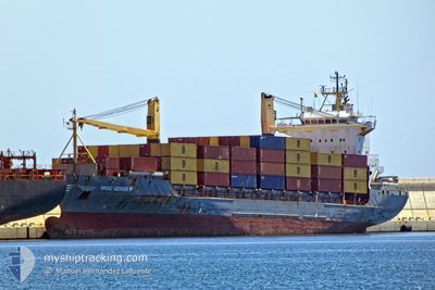
MSC IZMIR F
Container Ship
Current Trip
| Time Travelled | 16 h, 41 mins |
|---|---|
| Remaining Time | --- |
| Distance Travelled | 170.05 nm |
| Remaining Distance | --- |
| AVG Speed | 15.2 Knots |
| MAX Speed | 17.8 Knots |
| AVG Wind | 5.2 knots |
| MAX Wind | 10.3 knots |
| MIN Temp | 11.2°C / 52.16°F |
| MAX Temp | 16.6°C / 61.88°F |
| Draught | 7.2 m |
| Position Received | 8 h, 30 m ago |
Current Position
| Longitude | 15.22253° |
|---|---|
| Latitude | 36.50182° |
| Status | Under way using engine |
| Speed | 15.2 Knots |
| Course | 214.7° |
| Area | Mediterranean Sea - Eastern Basin |
| Station | T-AIS |
| Position Received | 8 h, 30 m ago |
Info
Information
The current position of MSC IZMIR F is in Mediterranean Sea - Eastern Basin with coordinates 36.50182° / 15.22253° as reported on 2025-12-15 01:32 by AIS to our vessel tracker app. The vessel's current speed is 15.2 Knots
The vessel MSC IZMIR F (IMO: 9127021, MMSI: 636017878) is a Container Ship that was built in 1996 ( 29 years old ). It's sailing under the flag of [LR] Liberia.
In this page you can find informations about the vessels current position, last detected port calls, and current voyage information. If the vessels is not in coverage by AIS you will find the latest position.
The current position of MSC IZMIR F is detected by our AIS receivers and we are not responsible for the reliability of the data. The last position was recorded while the vessel was in Coverage by the Ais receivers of our vessel tracking app.
The current draught of MSC IZMIR F as reported by AIS is 7.2 meters
Weather
| Temperature | 16.6°C / 61.88°F |
|---|---|
| Wind Speed | 10 knots |
| Direction | 123° ESE |
| Pressure | 1026.4 hPa |
| Humidity | 69.2 % |
| Cloud Coverage | 100 % |
Featured Company
Last Port Calls
| Port | Arrival | Departure | Time In Port |
|---|---|---|---|
| 2025-12-13 22:15 | 2025-12-14 18:21 | 20 h | |
| 2025-12-09 06:45 | 2025-12-11 13:05 | 2 d | |
| 2025-12-06 09:29 | 2025-12-07 06:43 | 21 h | |
| 2025-12-02 01:07 | 2025-12-03 13:59 | 1 d | |
| 2025-11-28 18:43 | 2025-11-30 08:37 | 1 d | |
| 2025-11-17 18:36 | 2025-11-17 18:41 | 5 m | |
| 2025-11-11 11:13 | 2025-11-12 13:29 | 1 d | |
| 2025-11-09 08:25 | 2025-11-10 20:45 | 1 d | |
| 2025-10-29 17:09 | 2025-10-30 13:57 | 20 h | |
| 2025-10-27 23:57 | 2025-10-29 08:09 | 1 d |
Most Visited Ports (Last year)
| Port | Arrivals | |
|---|---|---|
| 48 | ||
| 29 | ||
| 22 | ||
| 13 | ||
| 12 | ||
| 12 |
Last Trips
| Origin | Departure | Destination | Arrival | Distance | |
|---|---|---|---|---|---|
| 2025-12-11 13:05 | 2025-12-13 22:15 | 569.50 nm | |||
| 2025-12-07 06:43 | 2025-12-09 06:45 | 337.65 nm | |||
| 2025-12-03 13:59 | 2025-12-06 09:29 | 779.04 nm | |||
| 2025-11-30 08:37 | 2025-12-02 01:07 | 535.99 nm | |||
| 2025-11-17 18:41 | 2025-11-28 18:43 | 3542.25 nm | |||
| 2025-11-12 13:29 | 2025-11-17 18:36 | 1397.85 nm | |||
| 2025-11-10 20:45 | 2025-11-11 11:13 | 133.29 nm | |||
| 2025-10-30 13:57 | 2025-11-09 08:25 | 992.69 nm | |||
| 2025-10-29 08:09 | 2025-10-29 17:09 | 114.32 nm | |||
| 2025-10-17 20:37 | 2025-10-27 23:57 | 1231.73 nm |
Events
| Time | Event | Details | Position / Dest | Info |
|---|---|---|---|---|
| 2025-12-15 05:18 | STOP Moving | 11.37 nm, East of MARSAXLOKK |
35.87653 / 14.77076
MTMLA
|
Speed: Course: -1° |
| 2025-12-15 01:38 | Status Changed | Default Under way using engine |
36.48062 / 15.20319
MTMLA
|
Speed: 15.2 kn Course: 214.7° |
| 2025-12-15 01:32 | OUT of Coverage |
36.50182 / 15.22253
Mediterranean Sea - Eastern Basin
MTMLA
|
Speed: 15.2 kn Course: 214.7° |
|
| 2025-12-15 01:13 | Status Changed | Under way using engine Default |
36.56959 / 15.27335
MTMLA
|
Speed: 15 kn Course: 209° |
| 2025-12-15 01:10 | Status Changed | Default Under way using engine |
36.58016 / 15.28068
MTMLA
|
Speed: 15 kn Course: 201.3° |
| 2025-12-15 01:05 | Status Changed | Under way using engine Default |
36.59891 / 15.29088
MTMLA
|
Speed: 15.1 kn Course: 195° |
| 2025-12-15 01:02 | Status Changed | Default Under way using engine |
36.61218 / 15.29599
MTMLA
|
Speed: 15.3 kn Course: 194.4° |
| 2025-12-15 00:55 | Change Sea Area | Italian part of the Mediterranean Sea - Eastern Basin Italian part of the Ionian Sea |
36.64014 / 15.30517
Mediterranean Sea - Eastern Basin
MTMLA
|
Speed: 15.3 kn Course: 194.4° |
| 2025-12-15 00:19 | ETA Changed | 2025/12/15 06:00 2025/12/15 07:00 |
36.78592 / 15.36024
MTMLA
|
Speed: 15.2 kn Course: 197.5° |
| 2025-12-14 22:56 | Status Changed | Under way using engine Default |
37.13164 / 15.46733
MTMLA
|
Speed: 15.9 kn Course: 183° |