
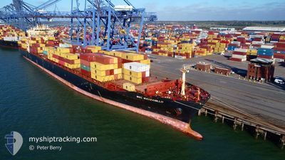
MSC MANZANILLO V
Container Ship
Current Trip
| Time Travelled | 5 h, 29 mins |
|---|---|
| Remaining Time | 3 days |
| Distance Travelled | 70.97 nm |
| Remaining Distance | 1382.63 nm |
| AVG Speed | 13.2 Knots |
| MAX Speed | 16.7 Knots |
| AVG Wind | 8.1 knots |
| MAX Wind | 20.2 knots |
| MIN Temp | 17.3°C / 63.14°F |
| MAX Temp | 19.5°C / 67.1°F |
| Draught | 12.1 m |
| Position Received | 3 h, 29 m ago |
Current Position
| Longitude | 113.80325° |
|---|---|
| Latitude | 22.25477° |
| Status | Under way using engine |
| Speed | 14.8 Knots |
| Course | 164.8° |
| Area | South China Sea |
| Station | T-AIS |
| Position Received | 3 h, 29 m ago |
Info
Information
The current position of MSC MANZANILLO V is in South China Sea with coordinates 22.25477° / 113.80325° as reported on 2025-12-14 16:57 by AIS to our vessel tracker app. The vessel's current speed is 14.8 Knots and is heading at the port of SINGAPORE. The estimated time of arrival as calculated by MyShipTracking vessel tracking app is 2025-12-19 02:51 LT
The vessel MSC MANZANILLO V (IMO: 9289960, MMSI: 255792000) is a Container Ship that was built in 2005 ( 20 years old ). It's sailing under the flag of [PT] Portugal.
In this page you can find informations about the vessels current position, last detected port calls, and current voyage information. If the vessels is not in coverage by AIS you will find the latest position.
The current position of MSC MANZANILLO V is detected by our AIS receivers and we are not responsible for the reliability of the data. The last position was recorded while the vessel was in Coverage by the Ais receivers of our vessel tracking app.
The current draught of MSC MANZANILLO V as reported by AIS is 12.1 meters
Weather
| Temperature | 19.5°C / 67.1°F |
|---|---|
| Wind Speed | 20 knots |
| Direction | 62° ENE |
| Pressure | 1019.4 hPa |
| Humidity | 72.1 % |
| Cloud Coverage | 98 % |
Featured Company
Last Trips
| Origin | Departure | Destination | Arrival | Distance |
|---|
Events
| Time | Event | Details | Position / Dest | Info |
|---|---|---|---|---|
| 2025-12-14 17:06 | Status Changed | Default Under way using engine |
22.21949 / 113.81193
SGSIN
|
Speed: 14.8 kn Course: 164.8° |
| 2025-12-14 16:57 | OUT of Coverage |
22.25477 / 113.80325
South China Sea
SGSIN
|
Speed: 14.8 kn Course: 164.8° |
|
| 2025-12-14 16:31 | Draught Changed | 12.1 10.6 |
22.33613 / 113.79320
SGSIN
|
Speed: 10.9 kn Course: 169.1° |
| 2025-12-14 16:31 | Destination Changed | SGSIN CNNGB>>>CNNSA |
22.33613 / 113.79320
SGSIN
|
Speed: 10.9 kn Course: 169.1° |
| 2025-12-14 16:31 | ETA Changed | 2025/12/18 12:00 2025/12/13 22:00 |
22.33613 / 113.79320
SGSIN
|
Speed: 10.9 kn Course: 169.1° |
| 2025-12-14 15:01 | START Moving | 2.86 nm, South of NANSHA |
22.62752 / 113.69213
CNNGB>>>CNNSA
|
Speed: 3.2 kn Course: 116° |
| 2025-12-14 14:58 | PORT DEPARTURE |
|
22.62759 / 113.68982
CNNGB>>>CNNSA
|
Speed: 2.4 kn Course: 74° |
| 2025-12-14 14:49 | Status Changed | Under way using engine Moored |
22.62483 / 113.68707
[CN] NANSHA
|
Speed: Course: 347° |
| 2025-12-14 13:30 | Status Changed | Moored Default |
22.62538 / 113.68684
[CN] NANSHA
|
Speed: Course: 347° |
| 2025-12-14 13:03 | Status Changed | Default Moored |
22.62489 / 113.68679
[CN] NANSHA
|
Speed: Course: 347° |