
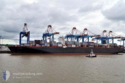
MSC NATASHA XIII
Container Ship
Current Trip
| Time Travelled | 3 days |
|---|---|
| Remaining Time | 1 day |
| Distance Travelled | 1144.27 nm |
| Remaining Distance | 587.54 nm |
| AVG Speed | 17.2 Knots |
| MAX Speed | 20.7 Knots |
| AVG Wind | 8.9 knots |
| MAX Wind | 15.2 knots |
| MIN Temp | 19.4°C / 66.92°F |
| MAX Temp | 29.6°C / 85.28°F |
| Draught | 10 m |
| Position Received | 8 d ago |
Current Position
| Longitude | 100.58886° |
|---|---|
| Latitude | 12.92082° |
| Status | Under way using engine |
| Speed | 20.3 Knots |
| Course | 193.9° |
| Area | Gulf of Thailand |
| Station | T-AIS |
| Position Received | 8 d ago |
Info
Information
The current position of MSC NATASHA XIII is in Gulf of Thailand with coordinates 12.92082° / 100.58886° as reported on 2025-02-23 10:49 by AIS to our vessel tracker app. The vessel's current speed is 20.3 Knots and is heading at the port of LAEM CHABANG. The estimated time of arrival as calculated by MyShipTracking vessel tracking app is 2025-03-04 17:41 LT
The vessel MSC NATASHA XIII (IMO: 9463035, MMSI: 636018385) is a Container Ship that was built in 2011 ( 14 years old ). It's sailing under the flag of [LR] Liberia.
In this page you can find informations about the vessels current position, last detected port calls, and current voyage information. If the vessels is not in coverage by AIS you will find the latest position.
The current position of MSC NATASHA XIII is detected by our AIS receivers and we are not responsible for the reliability of the data. The last position was recorded while the vessel was in Coverage by the Ais receivers of our vessel tracking app.
The current draught of MSC NATASHA XIII as reported by AIS is 10 meters
Weather
| Temperature | 26°C / 78.8°F |
|---|---|
| Wind Speed | 6 knots |
| Direction | 47° NE |
| Pressure | 1009.5 hPa |
| Humidity | 85.9 % |
| Cloud Coverage | 99 % |
Featured Company
Last Port Calls
| Port | Arrival | Departure | Time In Port |
|---|---|---|---|
| 2025-02-27 07:25 | 2025-02-28 04:49 | 21 h | |
| 2025-02-27 01:35 | 2025-02-27 06:49 | 5 h | |
| 2025-02-22 01:21 | 2025-02-23 09:37 | 1 d | |
| 2025-02-18 19:00 | 2025-02-19 22:58 | 1 d | |
| 2025-02-08 09:41 | 2025-02-09 06:29 | 20 h | |
| 2025-02-04 23:09 | 2025-02-05 18:48 | 19 h | |
| 2025-01-31 20:29 | 2025-02-02 13:53 | 1 d | |
| 2025-01-09 09:41 | 2025-01-10 10:17 | 1 d | |
| 2025-01-07 05:03 | 2025-01-07 17:55 | 12 h |
Last Trips
| Origin | Departure | Destination | Arrival | Distance | |
|---|---|---|---|---|---|
| 2025-02-27 14:49 | 2025-02-27 15:25 | 4.73 nm | |||
| 2025-02-23 16:37 | 2025-02-27 09:35 | 1567.76 nm | |||
| 2025-02-20 06:58 | 2025-02-22 08:21 | 856.08 nm | |||
| 2025-02-09 11:59 | 2025-02-19 03:00 | 1942.52 nm | |||
| 2025-02-06 00:18 | 2025-02-08 15:11 | 939.77 nm | |||
| 2025-02-02 19:23 | 2025-02-05 04:39 | 429.47 nm | |||
| 2025-01-10 10:17 | 2025-02-01 01:59 | 7683.92 nm | |||
| 2025-01-07 17:55 | 2025-01-09 09:41 | 481.35 nm | |||
| 2024-12-28 13:02 | 2025-01-07 05:03 | 2936.44 nm |
Events
| Time | Event | Details | Position / Dest | Info |
|---|---|---|---|---|
| 2025-03-02 22:57 | START Moving | 3.35 nm, South West of CAI MEP |
10.49309 / 106.99785
THLCH
|
Speed: 4.6 kn Course: 198° |
| 2025-03-02 09:53 | STOP Moving | 3.01 nm, South West of CAI MEP |
10.49855 / 106.99998
THLCH
|
Speed: 0.2 kn Course: 3° |
| 2025-02-28 04:49 | PORT DEPARTURE |
|
22.56188 / 114.28328
THLCH
|
Speed: 5.8 kn Course: 110° |
| 2025-02-28 04:46 | START Moving |
22.56348 / 114.27506
[CN] YANTIAN
|
Speed: 5.8 kn Course: 110° |
|
| 2025-02-27 07:25 | STOP Moving |
22.57082 / 114.27048
[CN] YANTIAN
|
Speed: Course: 320° |
|
| 2025-02-27 07:25 | PORT ARRIVAL |
|
22.57082 / 114.27048
[CN] YANTIAN
|
Speed: 11.7 kn Course: 65° |
| 2025-02-27 07:06 | START Moving | 3.65 nm, North East of YANTIAN |
22.60503 / 114.31619
THLCH
|
Speed: 11.6 kn Course: 320° |
| 2025-02-27 06:49 | PORT DEPARTURE |
|
22.60503 / 114.31619
THLCH
|
Speed: Course: 320° |
| 2025-02-27 02:05 | STOP Moving |
22.57102 / 114.27038
[CN] YANTIAN
|
Speed: Course: 319° |
|
| 2025-02-27 01:35 | PORT ARRIVAL |
|
22.57102 / 114.27038
[CN] YANTIAN
|
Speed: 6.1 kn Course: 267° |