

MSC TAMPA
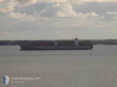
Container Ship

Current Trip
| Trip Time | 7 days |
|---|---|
| Trip Distance | 2946.01 nm |
| AVG Speed | 15.7 Knots |
| MAX Speed | 21.9 Knots |
| Draught | 11.8 m |
| AVG Wind | 10.5 knots |
| MAX Wind | 19 knots |
| MIN Temp | 8.7°C / 47.66°F |
| MAX Temp | 22°C / 71.6°F |
| Position Received | 3 m ago |
Current Position
| Longitude | 23.59933° |
|---|---|
| Latitude | 37.95672° |
| Status | Moored |
| Speed | |
| Course | 34° |
| Area | Aegean Sea |
| Station | T-AIS |
| Position Received | 3 m ago |
Information
The current position of MSC TAMPA is in Aegean Sea with coordinates 37.95672° / 23.59933° as reported on 2025-05-30 02:59 by AIS to our vessel tracker app. The vessel's current speed is 0 Knots and is currently inside the port of PIRAEUS.
The vessel MSC TAMPA (IMO: 9317925, MMSI: 636021760) is a Container Ship that was built in 2006 ( 19 years old ). It's sailing under the flag of [LR] Liberia.
In this page you can find informations about the vessels current position, last detected port calls, and current voyage information. If the vessels is not in coverage by AIS you will find the latest position.
The current position of MSC TAMPA is detected by our AIS receivers and we are not responsible for the reliability of the data. The last position was recorded while the vessel was in Coverage by the Ais receivers of our vessel tracking app.
The current draught of MSC TAMPA as reported by AIS is 9.8 meters
Weather
| Temperature | 17.9°C / 64.22°F |
|---|---|
| Wind Speed | 8 knots |
| Direction | 355° N |
| Pressure | 1009.9 hPa |
| Humidity | 68.4 % |
| Cloud Coverage | 100 % |


Featured Company
Last Port Calls
| Port | Arrival | Departure | Time In Port |
|---|---|---|---|
| 2025-05-29 23:08 | |||
| 2025-05-21 16:00 | 2025-05-22 19:22 | 1 d | |
| 2025-05-20 03:47 | 2025-05-21 00:18 | 20 h | |
| 2025-05-18 18:16 | 2025-05-19 19:30 | 1 d | |
| 2025-05-14 13:45 | 2025-05-16 00:53 | 1 d | |
| 2025-05-11 03:37 | 2025-05-11 20:12 | 16 h | |
| 2025-05-05 11:04 | 2025-05-05 23:30 | 12 h | |
| 2025-05-03 12:40 | 2025-05-04 15:35 | 1 d | |
| 2025-04-29 23:00 | 2025-04-30 11:07 | 12 h | |
| 2025-04-27 05:38 | 2025-04-28 12:38 | 1 d |
Last Trips
| Origin | Departure | Destination | Arrival | Distance | |
|---|---|---|---|---|---|
| 2025-05-22 19:22 | 2025-05-29 23:08 | 2946.01 nm | |||
| 2025-05-21 00:18 | 2025-05-21 16:00 | 183.29 nm | |||
| 2025-05-19 19:30 | 2025-05-20 03:47 | 147.18 nm | |||
| 2025-05-16 00:53 | 2025-05-18 18:16 | 747.79 nm | |||
| 2025-05-11 20:12 | 2025-05-14 13:45 | 1057.89 nm | |||
| 2025-05-05 23:30 | 2025-05-11 03:37 | 1773.29 nm | |||
| 2025-05-04 15:35 | 2025-05-05 11:04 | 301.65 nm | |||
| 2025-04-30 11:07 | 2025-05-03 12:40 | 177.39 nm | |||
| 2025-04-28 12:38 | 2025-04-29 23:00 | 310.69 nm | |||
| 2025-04-26 07:16 | 2025-04-27 05:38 | 249.77 nm |
Events
| Time | Event | Details | Position / Dest | Info |
|---|---|---|---|---|
| 2025-05-30 03:00 | ETA Changed | 2025/05/31 06:00 2026/01/01 06:00 |
37.95672 / 23.59933
[GR] PIRAEUS
|
Speed: Course: 34° |
| 2025-05-30 02:54 | ETA Changed | 2026/01/01 06:00 2025/05/31 06:00 |
37.95668 / 23.59929
[GR] PIRAEUS
|
Speed: Course: 34° |
| 2025-05-30 01:48 | ETA Changed | 2025/05/31 06:00 2026/01/01 06:00 |
37.95670 / 23.59931
[GR] PIRAEUS
|
Speed: Course: 34° |
| 2025-05-30 01:42 | ETA Changed | 2026/01/01 06:00 2025/05/31 06:00 |
37.95667 / 23.59939
[GR] PIRAEUS
|
Speed: Course: 34° |
| 2025-05-29 23:48 | ETA Changed | 2025/05/31 06:00 2026/01/01 06:00 |
37.95669 / 23.59933
[GR] PIRAEUS
|
Speed: Course: 34° |
| 2025-05-29 23:42 | ETA Changed | 2026/01/01 06:00 2025/05/31 06:00 |
37.95672 / 23.59934
[GR] PIRAEUS
|
Speed: Course: 34° |
| 2025-05-29 23:24 | ETA Changed | 2025/05/31 06:00 2026/01/01 06:00 |
37.95670 / 23.59933
[GR] PIRAEUS
|
Speed: Course: 34° |
| 2025-05-29 23:18 | ETA Changed | 2026/01/01 06:00 2025/05/31 06:00 |
37.95670 / 23.59935
[GR] PIRAEUS
|
Speed: Course: 34° |
| 2025-05-29 23:06 | ETA Changed | 2025/05/31 06:00 2026/01/01 06:00 |
37.95671 / 23.59937
[GR] PIRAEUS
|
Speed: Course: 34° |
| 2025-05-29 23:00 | ETA Changed | 2026/01/01 06:00 2025/05/31 06:00 |
37.95668 / 23.59931
[GR] PIRAEUS
|
Speed: Course: 34° |