
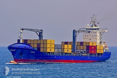
MSC TOKATA F
Cargo
Current Trip
| Time Travelled | 2 days |
|---|---|
| Remaining Time | 20 h, 16 mins |
| Distance Travelled | 320.80 nm |
| Remaining Distance | 169.49 nm |
| AVG Speed | 6.9 Knots |
| MAX Speed | 9.6 Knots |
| AVG Wind | 7.6 knots |
| MAX Wind | 20.8 knots |
| MIN Temp | 19.2°C / 66.56°F |
| MAX Temp | 24.7°C / 76.46°F |
| Draught | 8 m |
| Position Received | 1 d ago |
Current Position
| Longitude | 25.69177° |
|---|---|
| Latitude | -34.11875° |
| Status | Under way using engine |
| Speed | 8.1 Knots |
| Course | 247° |
| Area | Indian Ocean |
| Station | T-AIS |
| Position Received | 1 d ago |
Info
Information
The current position of MSC TOKATA F is in Indian Ocean with coordinates -34.11875° / 25.69177° as reported on 2025-02-04 23:21 by AIS to our vessel tracker app. The vessel's current speed is 8.1 Knots and is heading at the port of CAPE TOWN. The estimated time of arrival as calculated by MyShipTracking vessel tracking app is 2025-02-07 01:03 LT
The vessel MSC TOKATA F (MMSI: 636021859) is a Cargo It's sailing under the flag of [LR] Liberia.
In this page you can find informations about the vessels current position, last detected port calls, and current voyage information. If the vessels is not in coverage by AIS you will find the latest position.
The current position of MSC TOKATA F is detected by our AIS receivers and we are not responsible for the reliability of the data. The last position was recorded while the vessel was in Coverage by the Ais receivers of our vessel tracking app.
The current draught of MSC TOKATA F as reported by AIS is 8 meters
Weather
| Temperature | 19.7°C / 67.46°F |
|---|---|
| Wind Speed | 11 knots |
| Direction | 160° SSE |
| Pressure | 1018 hPa |
| Humidity | 54 % |
| Cloud Coverage | 100 % |
Featured Company
Last Port Calls
| Port | Arrival | Departure | Time In Port |
|---|---|---|---|
| 2025-02-02 10:45 | 2025-02-03 13:58 | 1 d | |
| 2025-01-30 20:19 | 2025-01-31 20:54 | 1 d | |
| 2025-01-29 07:27 | 2025-01-30 05:20 | 21 h | |
| 2025-01-16 18:43 | 2025-01-17 12:31 | 17 h | |
| 2025-01-15 11:08 | 2025-01-16 01:56 | 14 h | |
| 2025-01-10 12:29 | 2025-01-11 13:31 | 1 d | |
| 2025-01-06 23:20 | 2025-01-08 05:24 | 1 d | |
| 2025-01-01 19:02 | 2025-01-04 15:49 | 2 d | |
| 2024-12-28 20:23 | 2024-12-30 06:22 | 1 d | |
| 2024-12-26 21:02 | 2024-12-28 07:13 | 1 d |
Most Visited Ports (Last year)
| Port | Arrivals | |
|---|---|---|
| 22 | ||
| 16 | ||
| 8 | ||
| 6 | ||
| 4 | ||
| 2 |
Last Trips
| Origin | Departure | Destination | Arrival | Distance | |
|---|---|---|---|---|---|
| 2025-01-31 22:54 | 2025-02-02 12:45 | 182.13 nm | |||
| 2025-01-30 07:20 | 2025-01-30 22:19 | 138.18 nm | |||
| 2025-01-17 14:31 | 2025-01-29 09:27 | 165.34 nm | |||
| 2025-01-16 03:56 | 2025-01-16 20:43 | 137.94 nm | |||
| 2025-01-11 15:31 | 2025-01-15 13:08 | 469.64 nm | |||
| 2025-01-08 07:24 | 2025-01-10 14:29 | 436.37 nm | |||
| 2025-01-04 17:49 | 2025-01-07 01:20 | 469.24 nm | |||
| 2024-12-30 08:22 | 2025-01-01 21:02 | 553.28 nm | |||
| 2024-12-28 09:13 | 2024-12-28 22:23 | 137.19 nm | |||
| 2024-12-23 09:54 | 2024-12-26 23:02 | 471.96 nm |
Events
| Time | Event | Details | Position / Dest | Info |
|---|---|---|---|---|
| 2025-02-04 23:27 | Status Changed | Default Under way using engine |
-34.12404 / 25.67675
ZACPT
|
Speed: 8.1 kn Course: 247° |
| 2025-02-04 23:21 | OUT of Coverage |
-34.11875 / 25.69177
Indian Ocean
|
Speed: 8.1 kn Course: 247° |
|
| 2025-02-04 20:49 | Status Changed | Under way using engine Default |
-34.00447 / 25.96041
ZACPT
|
Speed: 1.7 kn Course: 187° |
| 2025-02-04 20:48 | Status Changed | Default Under way using engine |
-34.00381 / 25.96025
ZACPT
|
Speed: 1.7 kn Course: 185° |
| 2025-02-04 20:32 | Status Changed | Under way using engine Default |
-33.99625 / 25.95868
ZACPT
|
Speed: 1.9 kn Course: 188° |
| 2025-02-04 19:52 | Status Changed | Default Under way using engine |
-33.97467 / 25.95498
ZACPT
|
Speed: 1.9 kn Course: 189° |
| 2025-02-04 17:23 | START Moving | 15.46 nm, East of PORT ELIZABETH |
-33.95723 / 25.95183
ZACPT
|
Speed: 3.2 kn Course: 7° |
| 2025-02-04 16:59 | Status Changed | Under way using engine Default |
-33.95143 / 25.94946
ZACPT
|
Speed: 1.3 kn Course: 178° |
| 2025-02-04 16:56 | Status Changed | Default Under way using engine |
-33.95011 / 25.94941
ZACPT
|
Speed: 1.4 kn Course: 177° |
| 2025-02-04 16:49 | Status Changed | Under way using engine Default |
-33.94742 / 25.94944
ZACPT
|
Speed: 1.4 kn Course: 178° |