

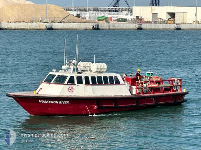
MUSKEGON RIVER
Port Tender

Current Trip
EAST ROCKAWAY NY
| Time Travelled | 2 days |
|---|---|
| Remaining Time | --- |
| Distance Travelled | 194.03 nm |
| Remaining Distance | --- |
| AVG Speed | 14.7 Knots |
| MAX Speed | 19 Knots |
| AVG Wind | 8.7 knots |
| MAX Wind | 13.9 knots |
| MIN Temp | 24.5°C / 76.1°F |
| MAX Temp | 28.2°C / 82.76°F |
| Draught | 1.8 m |
| Position Received | 2 d ago |
Current Position
| Longitude | -87.45537° |
|---|---|
| Latitude | 30.26241° |
| Status | Default |
| Speed | 15.9 Knots |
| Course | 261.2° |
| Area | Gulf of Mexico |
| Station | T-AIS |
| Position Received | 2 d ago |
Information
The current position of MUSKEGON RIVER is in Gulf of Mexico with coordinates 30.26241° / -87.45537° as reported on 2025-05-22 16:26 by AIS to our vessel tracker app. The vessel's current speed is 15.9 Knots
The vessel MUSKEGON RIVER (MMSI: 367509760) is a Port Tender It's sailing under the flag of [US] USA.
In this page you can find informations about the vessels current position, last detected port calls, and current voyage information. If the vessels is not in coverage by AIS you will find the latest position.
The current position of MUSKEGON RIVER is detected by our AIS receivers and we are not responsible for the reliability of the data. The last position was recorded while the vessel was in Coverage by the Ais receivers of our vessel tracking app.
The current draught of MUSKEGON RIVER as reported by AIS is 1.8 meters
Weather
| Temperature | 27.4°C / 81.32°F |
|---|---|
| Wind Speed | 6 knots |
| Direction | 249° WSW |
| Pressure | 1019.5 hPa |
| Humidity | 75.1 % |
| Cloud Coverage | 5 % |


Featured Company
Last Port Calls
| Port | Arrival | Departure | Time In Port |
|---|---|---|---|
| 2025-05-22 19:00 | 2025-05-22 19:12 | 12 m | |
| 2025-05-17 19:02 | |||
| 2025-05-16 22:23 | 2025-05-17 10:37 | 12 h | |
| 2025-05-13 23:32 | 2025-05-16 11:42 | 2 d | |
| 2025-05-10 17:30 | 2025-05-13 22:10 | 3 d | |
| 2025-05-10 15:45 | 2025-05-10 17:10 | 1 h | |
| 2025-05-10 08:14 | 2025-05-10 15:17 | 7 h | |
| 2025-05-09 16:28 | 2025-05-10 07:59 | 15 h | |
| 2025-05-08 18:01 | 2025-05-09 16:04 | 22 h | |
| 2025-05-08 08:37 | 2025-05-08 17:28 | 8 h |
Most Visited Ports (Last year)
| Port | Arrivals | |
|---|---|---|
| 681 | ||
| 171 | ||
| 116 | ||
| 2 | ||
| 1 | ||
| 1 |
Last Trips
| Origin | Departure | Destination | Arrival | Distance | |
|---|---|---|---|---|---|
| 2025-05-17 06:37 | 2025-05-17 15:02 | 133.32 nm | |||
| 2025-05-16 07:42 | 2025-05-16 18:23 | 168.29 nm | |||
| 2025-05-13 18:10 | 2025-05-13 19:32 | 6.60 nm | |||
| 2025-05-10 13:10 | 2025-05-10 13:30 | 2.09 nm | |||
| 2025-05-10 11:17 | 2025-05-10 11:45 | 2.58 nm | |||
| 2025-05-10 03:59 | 2025-05-10 04:14 | 1.69 nm | |||
| 2025-05-09 12:04 | 2025-05-09 12:28 | 3.12 nm | |||
| 2025-05-08 13:28 | 2025-05-08 14:01 | 1.70 nm | |||
| 2025-05-08 03:59 | 2025-05-08 04:37 | 1.88 nm | |||
| 2025-05-07 11:56 | 2025-05-07 12:31 | 3.52 nm |
Events
| Time | Event | Details | Position / Dest | Info |
|---|---|---|---|---|
| 2025-05-25 14:25 | STOP Moving | 1.86 nm, West of DAUPHIN ISLAND |
30.25803 / -88.11615
EAST ROCKAWAY NY
|
Speed: Course: -1° |
| 2025-05-25 10:16 | START Moving | 3.34 nm, North West of DAUPHIN ISLAND |
30.28909 / -88.12882
EAST ROCKAWAY NY
|
Speed: 18.2 kn Course: 70° |
| 2025-05-25 08:40 | STOP Moving | 1.86 nm, West of DAUPHIN ISLAND |
30.25805 / -88.11616
EAST ROCKAWAY NY
|
Speed: Course: -1° |
| 2025-05-25 07:48 | START Moving | 3.68 nm, South East of DAUPHIN ISLAND |
30.19631 / -88.05096
EAST ROCKAWAY NY
|
Speed: 16.8 kn Course: 346° |
| 2025-05-25 06:09 | STOP Moving | 4.44 nm, South East of DAUPHIN ISLAND |
30.18366 / -88.04774
EAST ROCKAWAY NY
|
Speed: 0.1 kn Course: -1° |
| 2025-05-25 00:14 | STOP Moving | 1.86 nm, West of DAUPHIN ISLAND |
30.25805 / -88.11616
EAST ROCKAWAY NY
|
Speed: Course: -1° |
| 2025-05-24 12:06 | START Moving | 1.55 nm, South East of DAUPHIN ISLAND |
30.23261 / -88.06110
EAST ROCKAWAY NY
|
Speed: 17.1 kn Course: 344° |
| 2025-05-24 11:51 | STOP Moving | 4.46 nm, South of DAUPHIN ISLAND |
30.18248 / -88.05003
EAST ROCKAWAY NY
|
Speed: 0.1 kn Course: -1° |
| 2025-05-24 11:10 | START Moving | 3.57 nm, West of DAUPHIN ISLAND |
30.27315 / -88.14522
EAST ROCKAWAY NY
|
Speed: 17.4 kn Course: 301° |
| 2025-05-24 10:17 | STOP Moving | 1.86 nm, West of DAUPHIN ISLAND |
30.25804 / -88.11616
EAST ROCKAWAY NY
|
Speed: Course: -1° |