

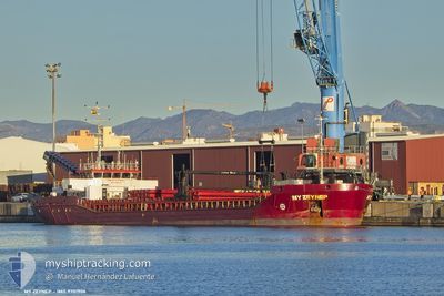
MY ZEYNEP
Cargo
Current Trip
| Time Travelled | 23 days |
|---|---|
| Remaining Time | --- |
| Distance Travelled | 2649.24 nm |
| Remaining Distance | --- |
| AVG Speed | 8.8 Knots |
| MAX Speed | 8.8 Knots |
| AVG Wind | 7.2 knots |
| MAX Wind | 25.6 knots |
| MIN Temp | 10.3°C / 50.54°F |
| MAX Temp | 30.1°C / 86.18°F |
| Draught | 3.9 m |
| Position Received | Now |
Current Position
| Longitude | 23.93630° |
|---|---|
| Latitude | 37.60351° |
| Status | Under way using engine |
| Speed | 7.8 Knots |
| Course | 287° |
| Area | Aegean Sea |
| Station | T-AIS |
| Position Received | Now |
Information
The current position of MY ZEYNEP is in Aegean Sea with coordinates 37.60351° / 23.93630° as reported on 2025-06-06 07:45 by AIS to our vessel tracker app. The vessel's current speed is 7.8 Knots and is heading at the port of PORTO NOGARO. The estimated time of arrival as calculated by MyShipTracking vessel tracking app is 2025-06-09 08:00 LT
The vessel MY ZEYNEP (IMO: 9701906, MMSI: 314830000) is a Cargo It's sailing under the flag of [BB] Barbados.
In this page you can find informations about the vessels current position, last detected port calls, and current voyage information. If the vessels is not in coverage by AIS you will find the latest position.
The current position of MY ZEYNEP is detected by our AIS receivers and we are not responsible for the reliability of the data. The last position was recorded while the vessel was in Coverage by the Ais receivers of our vessel tracking app.
The current draught of MY ZEYNEP as reported by AIS is 3.9 meters
Weather
| Temperature | 23.8°C / 74.84°F |
|---|---|
| Wind Speed | 11 knots |
| Direction | 349° N |
| Pressure | 1015.2 hPa |
| Humidity | 66.9 % |
| Cloud Coverage | --- |
Featured Company
Last Port Calls
| Port | Arrival | Departure | Time In Port |
|---|---|---|---|
| 2025-05-09 14:41 | 2025-05-13 16:02 | 4 d | |
| 2025-04-30 09:05 | 2025-05-02 20:15 | 2 d |
Most Visited Ports (Last year)
| Port | Arrivals | |
|---|---|---|
| 3 | ||
| 2 | ||
| 2 | ||
| 2 | ||
| 1 | ||
| 1 |
Last Trips
| Origin | Departure | Destination | Arrival | Distance | |
|---|---|---|---|---|---|
| 2025-05-02 20:15 | 2025-05-09 14:41 | 1105.36 nm | |||
| 2025-03-24 10:19 | 2025-04-30 09:05 | 3756.10 nm |
Events
| Time | Event | Details | Position / Dest | Info |
|---|---|---|---|---|
| 2025-06-06 00:38 | IN Coverage |
38.22322 / 24.74558
Aegean Sea
IT PNG
|
Speed: 7.9 kn Course: 208.8° |
|
| 2025-06-05 17:19 | OUT of Coverage |
39.08083 / 25.32773
Aegean Sea
IT PNG
|
Speed: 8 kn Course: 207.5° |
|
| 2025-06-05 11:26 | Detected in Sea | Greek part of the Aegean Sea |
39.76680 / 25.81270
Aegean Sea
IT PNG
|
Speed: 8.4 kn Course: 209.3° |
| 2025-06-05 11:26 | IN Coverage |
39.76680 / 25.81270
Aegean Sea
IT PNG
|
Speed: 8.4 kn Course: 209.3° |
|
| 2025-06-05 08:09 | OUT of Coverage |
40.04974 / 26.24179
Sea of Marmara
IT PNG
|
Speed: 10.6 kn Course: 236.6° |
|
| 2025-06-05 06:37 | IN Coverage |
40.22217 / 26.43803
Sea of Marmara
IT PNG
|
Speed: 9 kn Course: 234.8° |
|
| 2025-06-04 10:04 | OUT of Coverage |
40.66009 / 27.31860
Sea of Marmara
IT PNG
|
Speed: 8 kn Course: 241.2° |
|
| 2025-06-03 22:07 | Status Changed | Under way using engine At anchor |
40.84777 / 29.17989
IT PNG
|
Speed: 7.5 kn Course: 252.4° |
| 2025-06-03 21:49 | START Moving | 0.94 nm, South East of KARTAL |
40.86826 / 29.21415
IT PNG
|
Speed: 3.4 kn Course: 216° |
| 2025-06-03 16:55 | Status Changed | At anchor Under way using engine |
40.87152 / 29.21513
IT PNG
|
Speed: 0.6 kn Course: 282° |