

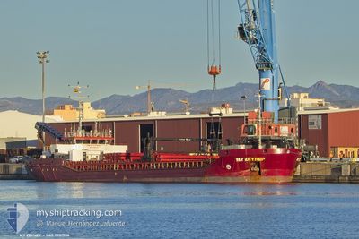
MY ZEYNEP
Cargo

Current Trip
| Time Travelled | 26 days |
|---|---|
| Remaining Time | 1 day |
| Distance Travelled | 3167.25 nm |
| Remaining Distance | 258.60 nm |
| AVG Speed | 8.5 Knopen |
| MAX Speed | 8.5 Knopen |
| AVG Wind | 7.1 knots |
| MAX Wind | 25.6 knots |
| MIN Temp | 10.3°C / 50.54°F |
| MAX Temp | 32°C / 89.6°F |
| Diepgang | 3.9 M |
| Positie ontvangen | 2 m geleden |
Current Position
| Lengtegraad | 15.67375° |
|---|---|
| Breedtegraat | 42.70320° |
| Status | Under way using engine |
| Snelheid | 7.4 Knopen |
| Koers | 321.5° |
| Gebied | Adriatic Sea |
| Station | T-AIS |
| Positie ontvangen | 2 m geleden |
Information
The current position of MY ZEYNEP is in Adriatic Sea with coordinates 42.70320° / 15.67375° as reported on 2025-06-09 07:15 by AIS to our vessel tracker app. The vessel's current speed is 7.4 Knopen and is heading at the port of PORTO NOGARO. The estimated time of arrival as calculated by MyShipTracking vessel tracking app is 2025-06-10 19:37 LT
The vessel MY ZEYNEP (IMO: 9701906, MMSI: 314830000) is a Cargo It's sailing under the flag of [BB] Barbados.
In this page you can find informations about the vessels current position, last detected port calls, and current voyage information. If the vessels is not in coverage by AIS you will find the latest position.
The current position of MY ZEYNEP is detected by our AIS receivers and we are not responsible for the reliability of the data. The last position was recorded while the vessel was in Coverage by the Ais receivers of our vessel tracking app.
The current draught of MY ZEYNEP as reported by AIS is 3.9 meters
Weather
| Temperature | 22.4°C / 72.32°F |
|---|---|
| Wind Speed | 6 knots |
| Direction | 358° N |
| Pressure | 1015.8 hPa |
| Humidity | 75.9 % |
| Cloud Coverage | --- |


Featured Company
Last Port Calls
| Port | Arrival | Departure | Time In Port |
|---|---|---|---|
| 2025-05-09 14:41 | 2025-05-13 16:02 | 4 d | |
| 2025-04-30 09:05 | 2025-05-02 20:15 | 2 d |
Most Visited Ports (Last year)
| Port | Arrivals | |
|---|---|---|
| 3 | ||
| 2 | ||
| 2 | ||
| 2 | ||
| 1 | ||
| 1 |
Last Trips
| Origin | Departure | Destination | Arrival | Distance | |
|---|---|---|---|---|---|
| 2025-05-02 20:15 | 2025-05-09 14:41 | 1105.36 nm | |||
| 2025-03-24 10:19 | 2025-04-30 09:05 | 3756.10 nm |
Events
| Tijd | Evenement | Details | Positie / Bestemming | Info |
|---|---|---|---|---|
| 2025-06-09 01:22 | Wijzig zee gebeid | Croatian part of the Adriatic Sea Italian part of the Adriatic Sea |
42.17528 / 16.35889
Adriatic Sea
IT PNG
|
Snelheid: 7.3 kn Koers: 315.7° |
| 2025-06-08 21:26 | Binnenbereik |
41.84826 / 16.78844
Adriatic Sea
IT PNG
|
Snelheid: 7.2 kn Koers: 315.7° |
|
| 2025-06-08 20:18 | Buitenbereik |
41.74938 / 16.91772
Adriatic Sea
IT PNG
|
Snelheid: 7.6 kn Koers: 316.3° |
|
| 2025-06-08 02:07 | Wijzig zee gebeid | Italian part of the Adriatic Sea Albanian part of the Adriatic Sea |
40.08756 / 18.98503
Adriatic Sea
IT PNG
|
Snelheid: 7.7 kn Koers: 322.9° |
| 2025-06-08 02:04 | Wijzig zee gebeid | Albanian part of the Adriatic Sea Greek part of the Adriatic Sea |
40.08224 / 18.99035
Adriatic Sea
IT PNG
|
Snelheid: 7.7 kn Koers: 322.3° |
| 2025-06-08 00:54 | Gevonden in zee | Greek part of the Adriatic Sea |
39.96923 / 19.10772
Adriatic Sea
IT PNG
|
Snelheid: 7.2 kn Koers: 321.6° |
| 2025-06-08 00:54 | Binnenbereik |
39.96923 / 19.10772
Adriatic Sea
IT PNG
|
Snelheid: 7.2 kn Koers: 321.6° |
|
| 2025-06-07 20:50 | Buitenbereik |
39.56641 / 19.50238
Ionian Sea
IT PNG
|
Snelheid: 7.2 kn Koers: 320.3° |
|
| 2025-06-07 14:47 | Binnenbereik |
38.99355 / 20.07507
Ionian Sea
IT PNG
|
Snelheid: 7 kn Koers: 325.1° |
|
| 2025-06-07 13:43 | Buitenbereik |
38.89228 / 20.17047
Ionian Sea
IT PNG
|
Snelheid: 6.9 kn Koers: 322.2° |