
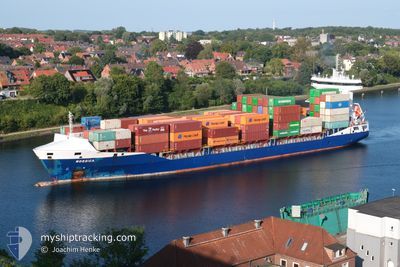
NORDICA
Container Ship
Current Trip
| Time Travelled | 2 days |
|---|---|
| Remaining Time | 1 h, 28 mins |
| Distance Travelled | 929.23 nm |
| Remaining Distance | 25.71 nm |
| AVG Speed | 11.2 Knots |
| MAX Speed | 16.3 Knots |
| AVG Wind | 15 knots |
| MAX Wind | 28 knots |
| MIN Temp | -1.5°C / 29.3°F |
| MAX Temp | 4.8°C / 40.64°F |
| Draught | 7.6 m |
| Position Received | 2 m ago |
Current Position
| Longitude | 24.80435° |
|---|---|
| Latitude | 59.78600° |
| Status | Under way using engine |
| Speed | 15.4 Knots |
| Course | 67.8° |
| Area | Gulf of Finland |
| Station | T-AIS |
| Position Received | 2 m ago |
Info
Information
The current position of NORDICA is in Gulf of Finland with coordinates 59.78600° / 24.80435° as reported on 2025-02-10 01:05 by AIS to our vessel tracker app. The vessel's current speed is 15.4 Knots and is heading at the port of HELSINKI. The estimated time of arrival as calculated by MyShipTracking vessel tracking app is 2025-02-10 04:35 LT
The vessel NORDICA (IMO: 9483695, MMSI: 244201000) is a Container Ship that was built in 2011 ( 14 years old ). It's sailing under the flag of [NL] Netherlands.
In this page you can find informations about the vessels current position, last detected port calls, and current voyage information. If the vessels is not in coverage by AIS you will find the latest position.
The current position of NORDICA is detected by our AIS receivers and we are not responsible for the reliability of the data. The last position was recorded while the vessel was in Coverage by the Ais receivers of our vessel tracking app.
The current draught of NORDICA as reported by AIS is 7.6 meters
Weather
| Temperature | -1.5°C / 29.3°F |
|---|---|
| Wind Speed | 5 knots |
| Direction | 18° NNE |
| Pressure | 1042.1 hPa |
| Humidity | 76 % |
| Cloud Coverage | 68 % |
Featured Company
Last Port Calls
| Port | Arrival | Departure | Time In Port |
|---|---|---|---|
| 2025-02-07 05:11 | 2025-02-07 05:16 | 4 m | |
| 2025-02-06 15:10 | 2025-02-07 03:55 | 12 h | |
| 2025-02-06 09:52 | 2025-02-06 13:14 | 3 h | |
| 2025-02-05 22:37 | 2025-02-06 09:46 | 11 h | |
| 2025-02-04 16:24 | 2025-02-05 03:48 | 11 h | |
| 2025-02-02 18:09 | 2025-02-04 07:10 | 1 d | |
| 2025-02-02 05:01 | 2025-02-02 05:45 | 43 m | |
| 2025-01-30 17:19 | 2025-01-31 16:27 | 23 h | |
| 2025-01-28 16:53 | 2025-01-29 09:06 | 16 h | |
| 2025-01-23 20:37 | 2025-01-25 03:44 | 1 d |
Most Visited Ports (Last year)
| Port | Arrivals | |
|---|---|---|
| 40 | ||
| 23 | ||
| 19 | ||
| 19 | ||
| 15 | ||
| 12 |
Last Trips
| Origin | Departure | Destination | Arrival | Distance | |
|---|---|---|---|---|---|
| 2025-02-07 03:55 | 2025-02-07 05:11 | 15.31 nm | |||
| 2025-02-06 13:14 | 2025-02-06 15:10 | 17.01 nm | |||
| 2025-02-06 09:46 | 2025-02-06 09:52 | 0.38 nm | |||
| 2025-02-05 03:48 | 2025-02-05 22:37 | 249.61 nm | |||
| 2025-02-04 07:10 | 2025-02-04 16:24 | 118.09 nm | |||
| 2025-02-02 05:45 | 2025-02-02 18:09 | 88.51 nm | |||
| 2025-01-31 16:27 | 2025-02-02 05:01 | 355.25 nm | |||
| 2025-01-29 09:06 | 2025-01-30 17:19 | 434.60 nm | |||
| 2025-01-25 03:44 | 2025-01-28 16:53 | 771.76 nm | |||
| 2025-01-23 11:41 | 2025-01-23 20:37 | 114.30 nm |
Events
| Time | Event | Details | Position / Dest | Info |
|---|---|---|---|---|
| 2025-02-10 00:58 | Status Changed | Under way using engine Default |
59.77508 / 24.75271
FIHEL
|
Speed: 15.6 kn Course: 66° |
| 2025-02-10 00:49 | Status Changed | Default Under way using engine |
59.76014 / 24.68291
FIHEL
|
Speed: 15.2 kn Course: 64.3° |
| 2025-02-10 00:44 | Status Changed | Under way using engine Default |
59.75099 / 24.64001
FIHEL
|
Speed: 15.3 kn Course: 67° |
| 2025-02-10 00:29 | Status Changed | Default Under way using engine |
59.73145 / 24.52716
FIHEL
|
Speed: 15.3 kn Course: 73.1° |
| 2025-02-10 00:23 | Status Changed | Under way using engine Default |
59.72377 / 24.47769
FIHEL
|
Speed: 15.2 kn Course: 73° |
| 2025-02-10 00:10 | Status Changed | Default Under way using engine |
59.70826 / 24.37170
FIHEL
|
Speed: 15.4 kn Course: 76.8° |
| 2025-02-10 00:07 | Change Sea Area | Estonian part of the Gulf of Finland Finnish part of the Gulf of Finland |
59.70569 / 24.35027
Gulf of Finland
FIHEL
|
Speed: 15.4 kn Course: 76.8° |
| 2025-02-10 00:07 | Status Changed | Under way using engine Default |
59.70532 / 24.34697
FIHEL
|
Speed: 15.1 kn Course: 73° |
| 2025-02-09 23:56 | IN Coverage |
59.70569 / 24.35027
Gulf of Finland
FIHEL
|
Speed: 15.4 kn Course: 76.8° |
|
| 2025-02-09 22:55 | OUT of Coverage |
59.62611 / 23.76371
Gulf of Finland
FIHEL
|
Speed: 15.4 kn Course: 70.5° |