

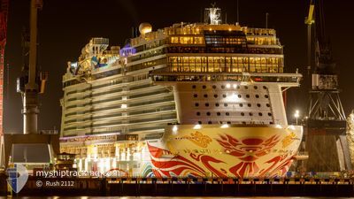
NORWEGIAN JOY
Passenger
Current Trip
| Time Travelled | 5 days |
|---|---|
| Remaining Time | 12 h, 52 mins |
| Distance Travelled | 1397.00 nm |
| Remaining Distance | 230.51 nm |
| AVG Speed | 16.4 Knots |
| MAX Speed | 21.9 Knots |
| AVG Wind | 8.2 knots |
| MAX Wind | 26.6 knots |
| MIN Temp | -0.6°C / 30.92°F |
| MAX Temp | 12°C / 53.6°F |
| Draught | 8.7 m |
| Position Received | 9 m ago |
Current Position
| Longitude | -128.18427° |
|---|---|
| Latitude | 49.85575° |
| Status | Under way using engine |
| Speed | 17.5 Knots |
| Course | 128.8° |
| Area | North Pacific Ocean |
| Station | T-AIS |
| Position Received | 9 m ago |
Information
The current position of NORWEGIAN JOY is in North Pacific Ocean with coordinates 49.85575° / -128.18427° as reported on 2025-06-07 23:59 by AIS to our vessel tracker app. The vessel's current speed is 17.5 Knots and is heading at the port of VICTORIA. The estimated time of arrival as calculated by MyShipTracking vessel tracking app is 2025-06-08 06:01 LT
The vessel NORWEGIAN JOY (IMO: 9703796, MMSI: 311000599) is a Passenger It's sailing under the flag of [BS] Bahamas.
In this page you can find informations about the vessels current position, last detected port calls, and current voyage information. If the vessels is not in coverage by AIS you will find the latest position.
The current position of NORWEGIAN JOY is detected by our AIS receivers and we are not responsible for the reliability of the data. The last position was recorded while the vessel was in Coverage by the Ais receivers of our vessel tracking app.
The current draught of NORWEGIAN JOY as reported by AIS is 8.7 meters
Weather
| Temperature | 12°C / 53.6°F |
|---|---|
| Wind Speed | 26 knots |
| Direction | 325° NW |
| Pressure | 1019.5 hPa |
| Humidity | 79.3 % |
| Cloud Coverage | --- |
Featured Company
Last Port Calls
| Port | Arrival | Departure | Time In Port |
|---|---|---|---|
| 2025-06-01 12:56 | 2025-06-01 22:28 | 9 h | |
| 2025-05-30 05:16 | 2025-05-30 16:04 | 10 h | |
| 2025-05-29 07:50 | 2025-05-29 22:58 | 15 h | |
| 2025-05-25 06:12 | 2025-05-25 19:56 | 13 h | |
| 2025-05-24 08:20 | 2025-05-24 22:32 | 14 h | |
| 2025-05-21 05:11 | 2025-05-21 16:30 | 11 h | |
| 2025-05-20 11:54 | 2025-05-20 23:41 | 11 h | |
| 2025-05-17 05:48 | 2025-05-17 17:56 | 12 h | |
| 2025-05-15 08:16 | 2025-05-15 22:16 | 14 h | |
| 2025-05-12 05:15 | 2025-05-12 16:16 | 11 h |
Most Visited Ports (Last year)
| Port | Arrivals | |
|---|---|---|
| 19 | ||
| 18 | ||
| 9 | ||
| 7 | ||
| 7 | ||
| 6 |
Last Trips
| Origin | Departure | Destination | Arrival | Distance | |
|---|---|---|---|---|---|
| 2025-05-30 16:04 | 2025-06-01 12:56 | 891.33 nm | |||
| 2025-05-29 22:58 | 2025-05-30 05:16 | 83.98 nm | |||
| 2025-05-25 19:56 | 2025-05-29 07:50 | 1133.40 nm | |||
| 2025-05-24 22:32 | 2025-05-25 06:12 | 97.78 nm | |||
| 2025-05-21 16:30 | 2025-05-24 08:20 | 1057.89 nm | |||
| 2025-05-20 23:41 | 2025-05-21 05:11 | 83.36 nm | |||
| 2025-05-17 17:56 | 2025-05-20 11:54 | 1031.70 nm | |||
| 2025-05-15 22:16 | 2025-05-17 05:48 | 323.89 nm | |||
| 2025-05-12 16:16 | 2025-05-15 08:16 | 949.51 nm | |||
| 2025-05-11 22:45 | 2025-05-12 05:15 | 83.53 nm |
Events
| Time | Event | Details | Position / Dest | Info |
|---|---|---|---|---|
| 2025-06-08 00:03 | Status Changed | Default Under way using engine |
49.84331 / -128.16038
VICTORIA, B.C.
|
Speed: 17.5 kn Course: 128.8° |
| 2025-06-07 23:59 | Status Changed | Under way using engine Default |
49.85696 / -128.18660
VICTORIA, B.C.
|
Speed: 17.4 kn Course: 129° |
| 2025-06-07 23:52 | Status Changed | Default Under way using engine |
49.87876 / -128.22853
VICTORIA, B.C.
|
Speed: 17.3 kn Course: 127.8° |
| 2025-06-07 23:42 | Status Changed | Under way using engine Default |
49.91084 / -128.28322
VICTORIA, B.C.
|
Speed: 17.7 kn Course: 138° |
| 2025-06-07 23:05 | Status Changed | Default Under way using engine |
50.04201 / -128.47652
VICTORIA, B.C.
|
Speed: 16.9 kn Course: 133.9° |
| 2025-06-07 18:25 | Change Sea Area | Canadian part of the North Pacific Ocean Canadian part of the The Coastal Waters of Southeast Alaska and British Columbia |
51.14471 / -129.65879
North Pacific Ocean
VICTORIA, B.C.
|
Speed: 17.5 kn Course: 161.1° |
| 2025-06-07 13:24 | Status Changed | Under way using engine Default |
52.71442 / -130.49981
VICTORIA, B.C.
|
Speed: 21.6 kn Course: 162° |
| 2025-06-07 12:32 | Status Changed | Default Under way using engine |
53.00853 / -130.65784
VICTORIA, B.C.
|
Speed: 21.2 kn Course: 162.1° |
| 2025-06-07 12:31 | Status Changed | Under way using engine Default |
53.01029 / -130.65879
VICTORIA, B.C.
|
Speed: 21.1 kn Course: 162° |
| 2025-06-07 12:09 | Status Changed | Default Under way using engine |
53.13693 / -130.72685
VICTORIA, B.C.
|
Speed: 21.1 kn Course: 162.4° |