
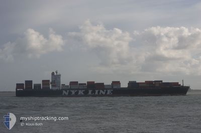
NYK DAEDALUS
Container Ship
Current Trip
| Time Travelled | 12 days |
|---|---|
| Remaining Time | 13 h, 21 mins |
| Distance Travelled | 5220.47 nm |
| Remaining Distance | 376.70 nm |
| AVG Speed | 16.2 Knots |
| MAX Speed | 21.9 Knots |
| AVG Wind | 18.1 knots |
| MAX Wind | 33 knots |
| MIN Temp | -3.5°C / 25.7°F |
| MAX Temp | 12.8°C / 55.04°F |
| Draught | 9.1 m |
| Position Received | 11 h, 41 m ago |
Current Position
| Longitude | 129.21242° |
|---|---|
| Latitude | 34.77125° |
| Status | Under way using engine |
| Speed | 17.5 Knots |
| Course | 240.9° |
| Area | Japan Sea |
| Station | T-AIS |
| Position Received | 11 h, 41 m ago |
Info
Information
The current position of NYK DAEDALUS is in Japan Sea with coordinates 34.77125° / 129.21242° as reported on 2025-02-26 05:24 by AIS to our vessel tracker app. The vessel's current speed is 17.5 Knots and is heading at the port of YANGSHAN. The estimated time of arrival as calculated by MyShipTracking vessel tracking app is 2025-02-27 14:27 LT
The vessel NYK DAEDALUS (IMO: 9337614, MMSI: 319200700) is a Container Ship that was built in 2007 ( 18 years old ). It's sailing under the flag of [KY] Cayman Is.
In this page you can find informations about the vessels current position, last detected port calls, and current voyage information. If the vessels is not in coverage by AIS you will find the latest position.
The current position of NYK DAEDALUS is detected by our AIS receivers and we are not responsible for the reliability of the data. The last position was recorded while the vessel was in Coverage by the Ais receivers of our vessel tracking app.
The current draught of NYK DAEDALUS as reported by AIS is 9.1 meters
Weather
| Temperature | 10.3°C / 50.54°F |
|---|---|
| Wind Speed | 4 knots |
| Direction | 316° NW |
| Pressure | 1025.5 hPa |
| Humidity | 53.9 % |
| Cloud Coverage | 100 % |
Featured Company
Last Port Calls
| Port | Arrival | Departure | Time In Port |
|---|---|---|---|
| 2025-02-11 16:47 | 2025-02-13 12:33 | 1 d | |
| 2025-02-06 05:05 | 2025-02-08 17:18 | 2 d | |
| 2025-01-28 18:02 | 2025-01-29 15:58 | 21 h | |
| 2025-01-21 04:02 | 2025-01-21 18:35 | 14 h | |
| 2025-01-21 03:30 | 2025-01-21 03:51 | 20 m | |
| 2025-01-06 03:58 | 2025-01-06 20:01 | 16 h | |
| 2024-12-31 18:54 | 2025-01-03 07:25 | 2 d | |
| 2024-12-29 11:33 | 2024-12-30 10:40 | 23 h | |
| 2024-12-19 23:46 | 2024-12-21 04:03 | 1 d | |
| 2024-12-16 18:04 | 2024-12-17 08:30 | 14 h |
Most Visited Ports (Last year)
| Port | Arrivals | |
|---|---|---|
| 6 | ||
| 6 | ||
| 6 | ||
| 5 | ||
| 5 | ||
| 5 |
Last Trips
| Origin | Departure | Destination | Arrival | Distance | |
|---|---|---|---|---|---|
| 2025-02-08 17:18 | 2025-02-11 16:47 | 562.59 nm | |||
| 2025-01-29 15:58 | 2025-02-06 05:05 | 2961.11 nm | |||
| 2025-01-21 18:35 | 2025-01-28 18:02 | 1339.71 nm | |||
| 2025-01-21 03:51 | 2025-01-21 04:02 | 0.62 nm | |||
| 2025-01-06 20:01 | 2025-01-21 03:30 | 4621.90 nm | |||
| 2025-01-03 07:25 | 2025-01-06 03:58 | 498.57 nm | |||
| 2024-12-30 10:40 | 2024-12-31 18:54 | 341.87 nm | |||
| 2024-12-21 04:03 | 2024-12-29 11:33 | 500.05 nm | |||
| 2024-12-17 08:30 | 2024-12-19 23:46 | 300.72 nm | |||
| 2024-12-10 13:48 | 2024-12-16 18:04 | 2620.79 nm |
Events
| Time | Event | Details | Position / Dest | Info |
|---|---|---|---|---|
| 2025-02-26 05:27 | Status Changed | Default Under way using engine |
34.76356 / 129.19684
CNYAN
|
Speed: 17.5 kn Course: 240.9° |
| 2025-02-26 05:24 | Status Changed | Under way using engine Default |
34.77125 / 129.21242
CNYAN
|
Speed: 17.3 kn Course: 241° |
| 2025-02-26 05:24 | OUT of Coverage |
34.77125 / 129.21242
Japan Sea
CNYAN
|
Speed: 17.5 kn Course: 240.9° |
|
| 2025-02-26 05:17 | IN Coverage |
34.77125 / 129.21242
Japan Sea
CNYAN
|
Speed: 17.5 kn Course: 240.9° |
|
| 2025-02-24 18:10 | Status Changed | Default Under way using engine |
41.00021 / 139.66730
CNYAN
|
Speed: 17.4 kn Course: 217.9° |
| 2025-02-24 18:01 | OUT of Coverage |
41.02975 / 139.70662
Japan Sea
CNYAN
|
Speed: 17.4 kn Course: 217.9° |
|
| 2025-02-24 16:48 | Status Changed | Under way using engine Default |
41.26638 / 140.07883
CNYAN
|
Speed: 17.2 kn Course: 236° |
| 2025-02-24 16:34 | Status Changed | Default Under way using engine |
41.30007 / 140.15312
CNYAN
|
Speed: 15.4 kn Course: 237.6° |
| 2025-02-24 12:56 | Change Sea Area | Japanese part of the Japan Sea Japanese part of the North Pacific Ocean |
41.65300 / 141.27103
Japan Sea
CNYAN
|
Speed: 16.3 kn Course: 269° |
| 2025-02-24 11:29 | Draught Changed | 9.1 9.4 |
41.68982 / 141.80889
CNYAN
|
Speed: 17.6 kn Course: 262.6° |