
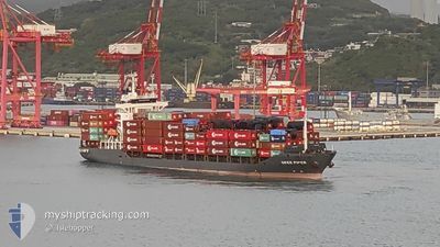
OKEE AURELIA
Cargo
Current Trip
| Trip Time | 2 days |
|---|---|
| Trip Distance | 919.80 nm |
| AVG Speed | 14.4 Knots |
| MAX Speed | 18.1 Knots |
| Draught | 7.3 m |
| AVG Wind | 13.4 knots |
| MAX Wind | 28 knots |
| MIN Temp | 10°C / 50°F |
| MAX Temp | 19.4°C / 66.92°F |
| Position Received | 7 h, 15 m ago |
Current Position
| Longitude | 136.79138° |
|---|---|
| Latitude | 35.00105° |
| Status | Under way using engine |
| Speed | 9.2 Knots |
| Course | 39° |
| Area | Philippine Sea |
| Station | T-AIS |
| Position Received | 7 h, 15 m ago |
Info
Information
The current position of OKEE AURELIA is in Philippine Sea with coordinates 35.00105° / 136.79138° as reported on 2025-12-18 02:53 by AIS to our vessel tracker app. The vessel's current speed is 9.2 Knots and is currently inside the port of NAGOYA.
The vessel OKEE AURELIA (IMO: 934366300, MMSI: 305002000) is a Cargo It's sailing under the flag of [AG] Antigua Barbuda.
In this page you can find informations about the vessels current position, last detected port calls, and current voyage information. If the vessels is not in coverage by AIS you will find the latest position.
The current position of OKEE AURELIA is detected by our AIS receivers and we are not responsible for the reliability of the data. The last position was recorded while the vessel was in Coverage by the Ais receivers of our vessel tracking app.
The current draught of OKEE AURELIA as reported by AIS is 7.3 meters
Weather
| Temperature | 10.9°C / 51.62°F |
|---|---|
| Wind Speed | 7 knots |
| Direction | 298° WNW |
| Pressure | 1025.1 hPa |
| Humidity | 43.4 % |
| Cloud Coverage | --- |
Featured Company
Last Port Calls
| Port | Arrival | Departure | Time In Port |
|---|---|---|---|
| 2025-12-18 03:02 | |||
| 2025-12-15 03:26 | 2025-12-15 12:19 | 8 h | |
| 2025-11-20 07:32 | 2025-11-20 13:28 | 5 h | |
| 2025-11-07 07:31 | 2025-11-08 07:53 | 1 d | |
| 2025-11-06 06:19 | 2025-11-06 14:45 | 8 h | |
| 2025-11-04 17:25 | 2025-11-05 07:04 | 13 h | |
| 2025-11-02 10:51 | 2025-11-03 10:46 | 23 h | |
| 2025-10-29 14:46 | 2025-10-31 08:16 | 1 d | |
| 2025-10-28 02:30 | 2025-10-28 15:47 | 13 h | |
| 2025-10-26 17:48 | 2025-10-27 15:06 | 21 h |
Last Trips
| Origin | Departure | Destination | Arrival | Distance | |
|---|---|---|---|---|---|
| 2025-12-15 20:19 | 2025-12-18 12:02 | 919.80 nm | |||
| 2025-11-20 21:28 | 2025-12-15 11:26 | 2511.26 nm | |||
| 2025-11-08 11:53 | 2025-11-20 15:32 | 3356.79 nm | |||
| 2025-11-06 18:45 | 2025-11-07 11:31 | 76.14 nm | |||
| 2025-11-05 11:04 | 2025-11-06 10:19 | 285.73 nm | |||
| 2025-11-03 14:46 | 2025-11-04 21:25 | 286.29 nm | |||
| 2025-10-31 12:16 | 2025-11-02 14:51 | 53.74 nm | |||
| 2025-10-28 19:47 | 2025-10-29 18:46 | 32.39 nm | |||
| 2025-10-27 19:06 | 2025-10-28 06:30 | 35.20 nm | |||
| 2025-10-26 12:21 | 2025-10-26 21:48 | 47.63 nm |
Events
| Time | Event | Details | Position / Dest | Info |
|---|---|---|---|---|
| 2025-12-18 03:30 | STOP Moving |
35.02715 / 136.78989
[JP] NAGOYA
|
Speed: Course: 310° |
|
| 2025-12-18 03:02 | PORT ARRIVAL |
|
35.01402 / 136.80180
[JP] NAGOYA
|
Speed: 8.7 kn Course: 38° |
| 2025-12-18 02:54 | Status Changed | Default Under way using engine |
35.00191 / 136.79222
JP NGO
|
Speed: 9.2 kn Course: 39° |
| 2025-12-18 02:53 | Status Changed | Under way using engine Default |
35.00105 / 136.79138
JP NGO
|
Speed: 10 kn Course: 38° |
| 2025-12-18 02:53 | OUT of Coverage |
35.00105 / 136.79138
Philippine Sea
[JP] NAGOYA
|
Speed: 9.2 kn Course: 39° |
|
| 2025-12-18 02:34 | Status Changed | Default Under way using engine |
34.95668 / 136.75915
JP NGO
|
Speed: 9.8 kn Course: 349° |
| 2025-12-18 02:19 | Draught Changed | 7.3 5.8 |
34.91703 / 136.76983
JP NGO
|
Speed: 11.2 kn Course: 2° |
| 2025-12-18 02:19 | Destination Changed | JP NGO CNSGH |
34.91703 / 136.76983
JP NGO
|
Speed: 11.2 kn Course: 2° |
| 2025-12-18 02:19 | ETA Changed | 2026/02/18 03:00 2025/12/06 07:00 |
34.91703 / 136.76983
JP NGO
|
Speed: 11.2 kn Course: 2° |
| 2025-12-18 02:18 | Change Sea Area | Japanese part of the Philippine Sea Malaysian part of the Singapore Strait |
34.91495 / 136.76970
Philippine Sea
|
Speed: 11.4 kn Course: 8° |