

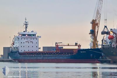
ORUBA
General Cargo

Current Trip
| Time Travelled | 6 days |
|---|---|
| Remaining Time | --- |
| Distance Travelled | 1201.50 nm |
| Remaining Distance | --- |
| AVG Speed | 8.6 Knots |
| MAX Speed | 10.2 Knots |
| AVG Wind | 11 knots |
| MAX Wind | 26.1 knots |
| MIN Temp | 16.1°C / 60.98°F |
| MAX Temp | 22.9°C / 73.22°F |
| Draught | 6.2 m |
| Position Received | 9 h, 32 m ago |
Current Position
| Longitude | 11.98595° |
|---|---|
| Latitude | 37.28778° |
| Status | Under way using engine |
| Speed | 8.2 Knots |
| Course | 290° |
| Area | Mediterranean Sea - Eastern Basin |
| Station | T-AIS |
| Position Received | 9 h, 32 m ago |
Information
The current position of ORUBA is in Mediterranean Sea - Eastern Basin with coordinates 37.28778° / 11.98595° as reported on 2025-05-20 23:05 by AIS to our vessel tracker app. The vessel's current speed is 8.2 Knots and is heading at the port of SAFI. The estimated time of arrival as calculated by MyShipTracking vessel tracking app is 2025-05-26 08:00 LT
The vessel ORUBA (IMO: 9430624, MMSI: 636020511) is a General Cargo that was built in 2007 ( 18 years old ). It's sailing under the flag of [LR] Liberia.
In this page you can find informations about the vessels current position, last detected port calls, and current voyage information. If the vessels is not in coverage by AIS you will find the latest position.
The current position of ORUBA is detected by our AIS receivers and we are not responsible for the reliability of the data. The last position was recorded while the vessel was in Coverage by the Ais receivers of our vessel tracking app.
The current draught of ORUBA as reported by AIS is 6.2 meters
Weather
| Temperature | 18.7°C / 65.66°F |
|---|---|
| Wind Speed | 17 knots |
| Direction | 290° WNW |
| Pressure | 1017.1 hPa |
| Humidity | 85.6 % |
| Cloud Coverage | 99 % |


Featured Company
Last Port Calls
| Port | Arrival | Departure | Time In Port |
|---|---|---|---|
| 2025-05-08 01:02 | 2025-05-15 04:26 | 7 d | |
| 2025-05-01 10:34 | 2025-05-03 09:58 | 1 d | |
| 2025-04-19 14:12 | 2025-04-25 08:52 | 5 d | |
| 2025-04-03 08:39 | 2025-04-08 11:50 | 5 d | |
| 2025-03-20 08:00 | 2025-03-22 13:29 | 2 d | |
| 2025-03-14 08:13 | 2025-03-17 08:28 | 3 d | |
| 2025-03-06 11:58 | 2025-03-10 15:51 | 4 d | |
| 2025-03-01 17:27 |
Last Trips
| Origin | Departure | Destination | Arrival | Distance | |
|---|---|---|---|---|---|
| 2025-05-03 11:58 | 2025-05-08 04:02 | 1052.95 nm | |||
| 2025-04-25 11:52 | 2025-05-01 12:34 | 845.20 nm | |||
| 2025-04-08 13:50 | 2025-04-19 17:12 | 1563.25 nm | |||
| 2025-03-22 15:29 | 2025-04-03 10:39 | 1212.53 nm | |||
| 2025-03-17 09:28 | 2025-03-20 10:00 | 313.90 nm | |||
| 2025-03-10 18:51 | 2025-03-14 09:13 | 641.90 nm | |||
| 2025-03-01 18:27 | 2025-03-06 14:58 | 723.86 nm |
Events
| Time | Event | Details | Position / Dest | Info |
|---|---|---|---|---|
| 2025-05-20 23:06 | Status Changed | Default Under way using engine |
37.28881 / 11.98240
MA SFI
|
Speed: 8.2 kn Course: 290° |
| 2025-05-20 23:05 | OUT of Coverage |
37.28778 / 11.98595
Mediterranean Sea - Eastern Basin
MA SFI
|
Speed: 8.2 kn Course: 290° |
|
| 2025-05-20 21:48 | IN Coverage |
37.22481 / 12.19567
Mediterranean Sea - Eastern Basin
MA SFI
|
Speed: 8.4 kn Course: 289.5° |
|
| 2025-05-20 21:47 | Status Changed | Under way using engine Default |
37.22293 / 12.20215
MA SFI
|
Speed: 8.4 kn Course: 289° |
| 2025-05-20 18:42 | Status Changed | Default Under way using engine |
37.07392 / 12.70437
MA SFI
|
Speed: 8.4 kn Course: 292.2° |
| 2025-05-20 18:33 | OUT of Coverage |
37.06651 / 12.72793
Mediterranean Sea - Eastern Basin
MA SFI
|
Speed: 8.4 kn Course: 292.2° |
|
| 2025-05-20 17:56 | ETA Changed | 2025/05/26 08:00 2025/05/25 22:00 |
37.03325 / 12.83317
MA SFI
|
Speed: 8.7 kn Course: 288.2° |
| 2025-05-20 14:00 | Status Changed | Under way using engine Default |
36.87540 / 13.52986
MA SFI
|
Speed: 9 kn Course: 286° |
| 2025-05-20 13:58 | Status Changed | Default Under way using engine |
36.87423 / 13.53493
MA SFI
|
Speed: 9 kn Course: 286.1° |
| 2025-05-20 13:57 | Status Changed | Under way using engine Default |
36.87351 / 13.53793
MA SFI
|
Speed: 9.2 kn Course: 286° |