
OSTRY
Wing in ground
Current Trip
| Time Travelled | 4 days |
|---|---|
| Remaining Time | 1 day |
| Distance Travelled | 268.07 nm |
| Remaining Distance | 148.81 nm |
| AVG Speed | 5.5 Knots |
| MAX Speed | 7.9 Knots |
| AVG Wind | 11.8 knots |
| MAX Wind | 19.7 knots |
| MIN Temp | -1.3°C / 29.66°F |
| MAX Temp | 6.5°C / 43.7°F |
| Draught | 1.8 m |
| Position Received | 9 m ago |
Current Position
| Longitude | 8.35643° |
|---|---|
| Latitude | 49.69384° |
| Status | Under way using engine |
| Speed | 4.7 Knots |
| Course | 203.1° |
| Area | North Sea |
| Station | T-AIS |
| Position Received | 9 m ago |
Info
Information
The current position of OSTRY is in North Sea with coordinates 49.69384° / 8.35643° as reported on 2026-01-04 13:54 by AIS to our vessel tracker app. The vessel's current speed is 4.7 Knots and is heading at the port of WEIL AM RHEIN. The estimated time of arrival as calculated by MyShipTracking vessel tracking app is 2026-01-05 19:32 LT
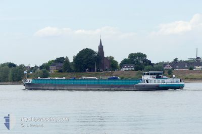
The vessel OSTRY (MMSI: 244670059) is a Wing in ground It's sailing under the flag of [NL] Netherlands.
In this page you can find informations about the vessels current position, last detected port calls, and current voyage information. If the vessels is not in coverage by AIS you will find the latest position.
The current position of OSTRY is detected by our AIS receivers and we are not responsible for the reliability of the data. The last position was recorded while the vessel was in Coverage by the Ais receivers of our vessel tracking app.
The current draught of OSTRY as reported by AIS is 1.8 meters
Weather
| Temperature | 0.1°C / 32.18°F |
|---|---|
| Wind Speed | 10 knots |
| Direction | 242° WSW |
| Pressure | 1012.6 hPa |
| Humidity | 70.8 % |
| Cloud Coverage | 60 % |
Featured Company
Last Port Calls
| Port | Arrival | Departure | Time In Port |
|---|---|---|---|
| 2025-12-30 16:33 | 2025-12-31 09:54 | 17 h | |
| 2025-12-30 08:36 | 2025-12-30 09:16 | 39 m | |
| 2025-12-29 18:16 | 2025-12-30 07:17 | 13 h | |
| 2025-12-22 16:10 | 2025-12-29 17:56 | 7 d | |
| 2025-12-22 10:37 | 2025-12-22 16:04 | 5 h | |
| 2025-12-19 14:11 | 2025-12-22 10:13 | 2 d | |
| 2025-12-19 11:51 | 2025-12-19 12:10 | 18 m | |
| 2025-12-18 21:04 | 2025-12-19 08:11 | 11 h | |
| 2025-12-11 22:09 | 2025-12-12 06:57 | 8 h | |
| 2025-12-09 16:29 | 2025-12-10 06:45 | 14 h |
Last Trips
| Origin | Departure | Destination | Arrival | Distance | |
|---|---|---|---|---|---|
| 2025-12-30 09:16 | 2025-12-30 16:33 | 45.30 nm | |||
| 2025-12-30 07:17 | 2025-12-30 08:36 | 11.15 nm | |||
| 2025-12-29 17:56 | 2025-12-29 18:16 | 2.02 nm | |||
| 2025-12-22 16:04 | 2025-12-22 16:10 | 1.05 nm | |||
| 2025-12-22 10:13 | 2025-12-22 10:37 | 1.12 nm | |||
| 2025-12-19 12:10 | 2025-12-19 14:11 | 13.91 nm | |||
| 2025-12-19 08:11 | 2025-12-19 11:51 | 26.48 nm | |||
| 2025-12-12 06:57 | 2025-12-18 21:04 | 325.01 nm | |||
| 2025-12-10 06:45 | 2025-12-11 22:09 | 126.63 nm | |||
| 2025-12-09 10:03 | 2025-12-09 16:29 | 27.96 nm |
Events
| Time | Event | Details | Position / Dest | Info |
|---|---|---|---|---|
| 2026-01-04 07:46 | Status Changed | Under way using engine Moored |
50.01756 / 8.09770
WEIL AM RHEIN
|
Speed: 1.4 kn Course: 511° |
| 2026-01-04 07:45 | Status Changed | Moored Under way using engine |
50.01747 / 8.09736
WEIL AM RHEIN
|
Speed: 0.7 kn Course: 511° |
| 2026-01-04 06:09 | START Moving | 11.59 nm, West of SCHIERSTEIN |
49.97181 / 7.91216
WEIL AM RHEIN
|
Speed: 4.1 kn Course: 70.1° |
| 2026-01-04 06:07 | Status Changed | Under way using engine Moored |
49.97122 / 7.91016
WEIL AM RHEIN
|
Speed: Course: 511° |
| 2026-01-03 15:30 | Status Changed | Moored Under way using engine |
49.97117 / 7.90937
WEIL AM RHEIN
|
Speed: 0.9 kn Course: 511° |
| 2026-01-03 15:30 | STOP Moving | 11.7 nm, West of SCHIERSTEIN |
49.97117 / 7.90937
WEIL AM RHEIN
|
Speed: 0.3 kn Course: 511° |
| 2026-01-03 11:35 | IN Coverage |
50.18388 / 7.64454
North Sea
WEIL AM RHEIN
|
Speed: 5.2 kn Course: 190.9° |
|
| 2026-01-02 17:23 | OUT of Coverage |
50.52333 / 7.29521
North Sea
WEIL AM RHEIN
|
Speed: 4.2 kn Course: 163.6° |
|
| 2026-01-02 15:20 | Status Changed | Under way using engine Default |
50.67125 / 7.19213
WEIL AM RHEIN
|
Speed: 5.1 kn Course: 151° |
| 2026-01-02 15:14 | Status Changed | Default Under way using engine |
50.67826 / 7.18635
WEIL AM RHEIN
|
Speed: 4.9 kn Course: 140.8° |