
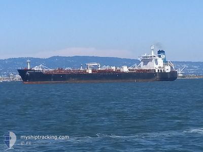
OVERSEAS HOUSTON
Tanker
Current Trip
| Time Travelled | 2 days |
|---|---|
| Remaining Time | --- |
| Distance Travelled | 968.57 nm |
| Remaining Distance | 2.63 nm |
| AVG Speed | 14 Knots |
| MAX Speed | 18.2 Knots |
| AVG Wind | 10.3 knots |
| MAX Wind | 15.8 knots |
| MIN Temp | 15.5°C / 59.9°F |
| MAX Temp | 24.2°C / 75.56°F |
| Draught | 11 m |
| Position Received | 1 m ago |
Current Position
| Longitude | -80.07455° |
|---|---|
| Latitude | 26.11657° |
| Status | At anchor |
| Speed | |
| Course | 153° |
| Area | North Atlantic Ocean |
| Station | T-AIS |
| Position Received | 1 m ago |
Info
Information
The current position of OVERSEAS HOUSTON is in North Atlantic Ocean with coordinates 26.11657° / -80.07455° as reported on 2025-02-06 09:44 by AIS to our vessel tracker app. The vessel's current speed is 0 Knots and is heading at the port of PORT EVERGLADES.
The vessel OVERSEAS HOUSTON (MMSI: 367109000) is a Tanker It's sailing under the flag of [US] USA.
In this page you can find informations about the vessels current position, last detected port calls, and current voyage information. If the vessels is not in coverage by AIS you will find the latest position.
The current position of OVERSEAS HOUSTON is detected by our AIS receivers and we are not responsible for the reliability of the data. The last position was recorded while the vessel was in Coverage by the Ais receivers of our vessel tracking app.
The current draught of OVERSEAS HOUSTON as reported by AIS is 11 meters
Weather
| Temperature | 23.1°C / 73.58°F |
|---|---|
| Wind Speed | 11 knots |
| Direction | 118° ESE |
| Pressure | 1020 hPa |
| Humidity | 72.5 % |
| Cloud Coverage | 8 % |
Featured Company
Last Port Calls
| Port | Arrival | Departure | Time In Port |
|---|---|---|---|
| 2025-02-01 17:37 | 2025-02-03 14:59 | 1 d | |
| 2025-01-27 02:02 | 2025-01-28 20:11 | 1 d | |
| 2025-01-25 20:49 | 2025-01-27 00:42 | 1 d | |
| 2025-01-19 15:44 | 2025-01-23 06:47 | 3 d | |
| 2025-01-14 14:28 | 2025-01-17 12:24 | 2 d | |
| 2025-01-09 14:32 | 2025-01-12 05:33 | 2 d | |
| 2024-12-28 07:23 | 2024-12-29 14:31 | 1 d | |
| 2024-12-24 16:08 | 2024-12-26 00:07 | 1 d | |
| 2024-12-13 19:17 | 2024-12-21 18:28 | 7 d | |
| 2024-12-05 16:32 | 2024-12-08 11:21 | 2 d |
Most Visited Ports (Last year)
| Port | Arrivals | |
|---|---|---|
| 9 | ||
| 5 | ||
| 4 | ||
| 3 | ||
| 3 | ||
| 2 |
Last Trips
| Origin | Departure | Destination | Arrival | Distance | |
|---|---|---|---|---|---|
| 2025-01-28 15:11 | 2025-02-01 11:37 | 713.94 nm | |||
| 2025-01-26 19:42 | 2025-01-26 21:02 | 13.66 nm | |||
| 2025-01-23 00:47 | 2025-01-25 15:49 | 704.08 nm | |||
| 2025-01-17 07:24 | 2025-01-19 09:44 | 706.37 nm | |||
| 2025-01-11 23:33 | 2025-01-14 09:28 | 709.12 nm | |||
| 2024-12-29 08:31 | 2025-01-09 08:32 | 2430.61 nm | |||
| 2024-12-25 19:07 | 2024-12-28 01:23 | 771.99 nm | |||
| 2024-12-21 12:28 | 2024-12-24 11:08 | 973.52 nm | |||
| 2024-12-08 07:21 | 2024-12-13 13:17 | 1867.04 nm | |||
| 2024-11-27 10:54 | 2024-12-05 12:32 | 1797.71 nm |
Events
| Time | Event | Details | Position / Dest | Info |
|---|---|---|---|---|
| 2025-02-06 08:41 | Status Changed | At anchor Under way using engine |
26.11524 / -80.07535
PORT EVERGLADES
|
Speed: 0.1 kn Course: 126° |
| 2025-02-06 08:35 | STOP Moving | 1.84 nm, East of FORT LAUDERDALE |
26.11532 / -80.07512
PORT EVERGLADES
|
Speed: Course: 160° |
| 2025-02-06 04:49 | Status Changed | Under way using engine Default |
25.31580 / -79.96048
PORT EVERGLADES
|
Speed: 16.7 kn Course: 30° |
| 2025-02-06 04:49 | IN Coverage |
25.31614 / -79.96027
North Atlantic Ocean
PORT EVERGLADES
|
Speed: 16.9 kn Course: 29.9° |
|
| 2025-02-06 03:15 | Status Changed | Default Under way using engine |
24.94333 / -80.19500
PORT EVERGLADES
|
Speed: 16.3 kn Course: 29.6° |
| 2025-02-06 03:12 | OUT of Coverage |
24.93019 / -80.20505
North Atlantic Ocean
PORT EVERGLADES
|
Speed: 16.3 kn Course: 29.6° |
|
| 2025-02-06 02:38 | Draught Changed | 11 8.2 |
24.80981 / -80.31755
PORT EVERGLADES
|
Speed: 17.3 kn Course: 47.9° |
| 2025-02-06 02:38 | Destination Changed | PORT EVERGLADES GALVESTON TX |
24.80981 / -80.31755
PORT EVERGLADES
|
Speed: 17.3 kn Course: 47.9° |
| 2025-02-06 02:38 | ETA Changed | 2025/02/06 04:00 2026/01/30 16:00 |
24.80981 / -80.31755
PORT EVERGLADES
|
Speed: 17.3 kn Course: 47.9° |
| 2025-02-06 01:40 | Change Sea Area | United States part of the North Atlantic Ocean United States part of the Gulf of Mexico |
24.61849 / -80.54754
North Atlantic Ocean
|
Speed: 17.3 kn Course: 47.5° |