
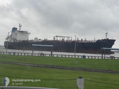
OVERSEAS NIKISKI
Oil/Chemical Tanker
Current Trip
| Time Travelled | 18 days |
|---|---|
| Remaining Time | 1 day |
| Distance Travelled | 4164.50 nm |
| Remaining Distance | 322.89 nm |
| AVG Speed | 12.7 Knots |
| MAX Speed | 16 Knots |
| AVG Wind | 7.9 knots |
| MAX Wind | 17.3 knots |
| MIN Temp | 18.3°C / 64.94°F |
| MAX Temp | 28.6°C / 83.48°F |
| Draught | 11.4 m |
| Position Received | 59 m ago |
Current Position
| Longitude | -116.44902° |
|---|---|
| Latitude | 28.50444° |
| Status | Under way using engine |
| Speed | 13.1 Knots |
| Course | 344.2° |
| Area | North Pacific Ocean |
| Station | T-AIS |
| Position Received | 59 m ago |
Info
Information
The current position of OVERSEAS NIKISKI is in North Pacific Ocean with coordinates 28.50444° / -116.44902° as reported on 2025-12-17 22:35 by AIS to our vessel tracker app. The vessel's current speed is 13.1 Knots and is heading at the port of LOS ANGELES. The estimated time of arrival as calculated by MyShipTracking vessel tracking app is 2025-12-18 15:48 LT
The vessel OVERSEAS NIKISKI (IMO: 9353577, MMSI: 368445000) is a Oil/Chemical Tanker that was built in 2009 ( 16 years old ). It's sailing under the flag of [US] USA.
In this page you can find informations about the vessels current position, last detected port calls, and current voyage information. If the vessels is not in coverage by AIS you will find the latest position.
The current position of OVERSEAS NIKISKI is detected by our AIS receivers and we are not responsible for the reliability of the data. The last position was recorded while the vessel was in Coverage by the Ais receivers of our vessel tracking app.
The current draught of OVERSEAS NIKISKI as reported by AIS is 11.4 meters
Weather
| Temperature | 18°C / 64.4°F |
|---|---|
| Wind Speed | 13 knots |
| Direction | 327° NNW |
| Pressure | 1014.4 hPa |
| Humidity | 85.9 % |
| Cloud Coverage | 6 % |
Featured Company
Last Port Calls
| Port | Arrival | Departure | Time In Port |
|---|---|---|---|
| 2025-11-26 15:31 | 2025-11-29 11:15 | 2 d | |
| 2025-11-24 12:11 | 2025-11-24 15:39 | 3 h | |
| 2025-11-17 21:39 | 2025-11-21 12:34 | 3 d | |
| 2025-10-26 09:48 | 2025-10-27 23:26 | 1 d | |
| 2025-10-15 18:11 | 2025-10-17 09:57 | 1 d |
Most Visited Ports (Last year)
| Port | Arrivals | |
|---|---|---|
| 13 | ||
| 7 | ||
| 7 | ||
| 3 | ||
| 2 | ||
| 1 |
Last Trips
| Origin | Departure | Destination | Arrival | Distance | |
|---|---|---|---|---|---|
| 2025-11-24 15:39 | 2025-11-26 15:31 | 114.64 nm | |||
| 2025-11-21 12:34 | 2025-11-24 12:11 | 935.51 nm | |||
| 2025-10-27 23:26 | 2025-11-17 21:39 | 5000.54 nm | |||
| 2025-10-17 09:57 | 2025-10-26 09:48 | 676.02 nm | |||
| 2025-09-27 13:26 | 2025-10-15 18:11 | 4561.83 nm |
Events
| Time | Event | Details | Position / Dest | Info |
|---|---|---|---|---|
| 2025-12-17 22:36 | Status Changed | Default Under way using engine |
28.50742 / -116.44994
USLGB
|
Speed: 13.1 kn Course: 344.2° |
| 2025-12-17 20:49 | Status Changed | Under way using engine Default |
28.13958 / -116.31705
USLGB
|
Speed: 13 kn Course: 322° |
| 2025-12-17 20:32 | Status Changed | Default Under way using engine |
28.09223 / -116.27503
USLGB
|
Speed: 13.1 kn Course: 321.2° |
| 2025-12-17 20:17 | Status Changed | Under way using engine Default |
28.04876 / -116.23643
USLGB
|
Speed: 13.2 kn Course: 322° |
| 2025-12-17 20:12 | Status Changed | Default Under way using engine |
28.03166 / -116.22127
USLGB
|
Speed: 13.3 kn Course: 321.3° |
| 2025-12-17 20:00 | Status Changed | Under way using engine Default |
27.99888 / -116.19213
USLGB
|
Speed: 13 kn Course: 321° |
| 2025-12-17 19:59 | IN Coverage |
27.99888 / -116.19213
North Pacific Ocean
USLGB
|
Speed: 13.3 kn Course: 322.2° |
|
| 2025-12-17 18:30 | Status Changed | Default Under way using engine |
27.73517 / -115.95851
USLGB
|
Speed: 13.5 kn Course: 322° |
| 2025-12-17 18:28 | Status Changed | Under way using engine Default |
27.72826 / -115.95239
USLGB
|
Speed: 13 kn Course: 321° |
| 2025-12-17 18:28 | OUT of Coverage |
27.72826 / -115.95239
North Pacific Ocean
USLGB
|
Speed: 13.5 kn Course: 322° |