

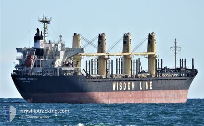
PAPORA WISDOM
Bulk Carrier

Current Trip
US CRM 1CH
| Time Travelled | 15 days |
|---|---|
| Remaining Time | --- |
| Distance Travelled | 4585.21 nm |
| Remaining Distance | --- |
| AVG Speed | 12 Knots |
| MAX Speed | 15.6 Knots |
| AVG Wind | 12.1 knots |
| MAX Wind | 30.4 knots |
| MIN Temp | 5.9°C / 42.62°F |
| MAX Temp | 30.6°C / 87.08°F |
| Draught | 7.6 m |
| Position Received | 5 d ago |
Current Position
| Longitude | 141.37751° |
|---|---|
| Latitude | 35.52137° |
| Status | Under way using engine |
| Speed | 11.9 Knots |
| Course | 58.4° |
| Area | North Pacific Ocean |
| Station | T-AIS |
| Position Received | 5 d ago |
Information
The current position of PAPORA WISDOM is in North Pacific Ocean with coordinates 35.52137° / 141.37751° as reported on 2025-06-02 01:54 by AIS to our vessel tracker app. The vessel's current speed is 11.9 Knots
The vessel PAPORA WISDOM (IMO: 9508718, MMSI: 352955000) is a Bulk Carrier that was built in 2009 ( 16 years old ). It's sailing under the flag of [PA] Panama.
In this page you can find informations about the vessels current position, last detected port calls, and current voyage information. If the vessels is not in coverage by AIS you will find the latest position.
The current position of PAPORA WISDOM is detected by our AIS receivers and we are not responsible for the reliability of the data. The last position was recorded while the vessel was in Coverage by the Ais receivers of our vessel tracking app.
The current draught of PAPORA WISDOM as reported by AIS is 7.6 meters
Weather
| Temperature | 7.4°C / 45.32°F |
|---|---|
| Wind Speed | 2 knots |
| Direction | 122° ESE |
| Pressure | 1024.2 hPa |
| Humidity | 91.1 % |
| Cloud Coverage | 100 % |


Featured Company
Last Port Calls
| Port | Arrival | Departure | Time In Port |
|---|---|---|---|
| 2025-05-21 07:42 | 2025-05-22 17:46 | 1 d | |
| 2025-05-14 04:23 | 2025-05-19 20:23 | 5 d | |
| 2025-05-06 12:37 | 2025-05-10 01:23 | 3 d | |
| 2025-04-17 08:23 | 2025-04-26 18:32 | 9 d | |
| 2025-04-11 15:16 | 2025-04-15 08:54 | 3 d | |
| 2025-04-05 09:17 |
Last Trips
| Origin | Departure | Destination | Arrival | Distance | |
|---|---|---|---|---|---|
| 2025-05-19 20:23 | 2025-05-21 07:42 | 45.07 nm | |||
| 2025-05-10 01:23 | 2025-05-14 04:23 | 913.88 nm | |||
| 2025-04-26 18:32 | 2025-05-06 12:37 | 2559.19 nm | |||
| 2025-04-15 08:54 | 2025-04-17 08:23 | 456.03 nm | |||
| 2025-04-05 09:17 | 2025-04-11 15:16 | 1724.20 nm |
Events
| Time | Event | Details | Position / Dest | Info |
|---|---|---|---|---|
| 2025-06-02 01:57 | Status Changed | Default Under way using engine |
35.52628 / 141.38675
US CRM 1CH
|
Speed: 11.9 kn Course: 58.4° |
| 2025-06-02 01:54 | OUT of Coverage |
35.52137 / 141.37751
North Pacific Ocean
US CRM 1CH
|
Speed: 11.9 kn Course: 58.4° |
|
| 2025-06-01 18:56 | Draught Changed | 7.6 6.5 |
34.71023 / 139.81198
US CRM 1CH
|
Speed: 13.8 kn Course: 63.1° |
| 2025-06-01 18:56 | Destination Changed | US CRM 1CH TH LCH |
34.71023 / 139.81198
US CRM 1CH
|
Speed: 13.8 kn Course: 63.1° |
| 2025-06-01 18:56 | ETA Changed | 2025/06/16 15:00 2025/05/19 19:00 |
34.71023 / 139.81198
US CRM 1CH
|
Speed: 13.8 kn Course: 63.1° |
| 2025-06-01 18:35 | Status Changed | Under way using engine Default |
34.66705 / 139.72915
TH LCH
|
Speed: 14.6 kn Course: 54° |
| 2025-06-01 18:28 | Status Changed | Default Under way using engine |
34.65017 / 139.70218
TH LCH
|
Speed: 14.3 kn Course: 55.6° |
| 2025-06-01 18:23 | Change Sea Area | Japanese part of the North Pacific Ocean Japanese part of the Philippine Sea |
34.63882 / 139.68267
North Pacific Ocean
|
Speed: 14.3 kn Course: 55.6° |
| 2025-06-01 18:23 | Status Changed | Under way using engine Default |
34.63882 / 139.68267
TH LCH
|
Speed: 14.3 kn Course: 58° |
| 2025-06-01 18:22 | Status Changed | Default Under way using engine |
34.63638 / 139.67818
TH LCH
|
Speed: 14 kn Course: 59.1° |