
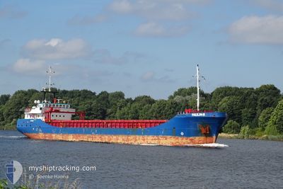
PAULIN-B
General Cargo
Current Trip
| Trip Time | 1 day |
|---|---|
| Trip Distance | 306.88 nm |
| AVG Speed | 8.4 Knots |
| MAX Speed | 11.7 Knots |
| Draught | 4.3 m |
| AVG Wind | 15.6 knots |
| MAX Wind | 22 knots |
| MIN Temp | 0.5°C / 32.9°F |
| MAX Temp | 3.9°C / 39.02°F |
| Position Received | 1 m ago |
Current Position
| Longitude | 9.97276° |
|---|---|
| Latitude | 57.06576° |
| Status | Moored |
| Speed | |
| Course | 21° |
| Area | Kattegat |
| Station | T-AIS |
| Position Received | 1 m ago |
Info
Information
The current position of PAULIN-B is in Kattegat with coordinates 57.06576° / 9.97276° as reported on 2025-02-09 08:55 by AIS to our vessel tracker app. The vessel's current speed is 0 Knots and is currently inside the port of AALBORG.
The vessel PAULIN-B (IMO: 9120102, MMSI: 211839040) is a General Cargo that was built in 1995 ( 30 years old ). It's sailing under the flag of [DE] Germany.
In this page you can find informations about the vessels current position, last detected port calls, and current voyage information. If the vessels is not in coverage by AIS you will find the latest position.
The current position of PAULIN-B is detected by our AIS receivers and we are not responsible for the reliability of the data. The last position was recorded while the vessel was in Coverage by the Ais receivers of our vessel tracking app.
The current draught of PAULIN-B as reported by AIS is 4.3 meters
Weather
| Temperature | 1.2°C / 34.16°F |
|---|---|
| Wind Speed | 8 knots |
| Direction | 52° NE |
| Pressure | 1037.5 hPa |
| Humidity | 79.9 % |
| Cloud Coverage | 100 % |
Featured Company
Last Port Calls
| Port | Arrival | Departure | Time In Port |
|---|---|---|---|
| 2025-02-08 13:49 | |||
| 2025-02-05 03:43 | 2025-02-06 23:28 | 1 d | |
| 2025-02-02 13:23 | 2025-02-04 16:33 | 2 d | |
| 2025-01-29 22:08 | 2025-01-31 12:47 | 1 d | |
| 2025-01-25 15:50 | 2025-01-28 16:50 | 3 d | |
| 2025-01-15 17:42 | 2025-01-21 13:42 | 5 d | |
| 2025-01-13 06:03 | 2025-01-15 05:23 | 1 d | |
| 2025-01-04 11:58 | 2025-01-05 12:53 | 1 d | |
| 2024-12-28 17:32 | 2024-12-29 10:57 | 17 h | |
| 2024-12-20 12:30 | 2024-12-28 14:14 | 8 d |
Last Trips
| Origin | Departure | Destination | Arrival | Distance | |
|---|---|---|---|---|---|
| 2025-02-07 00:28 | 2025-02-08 14:49 | 306.88 nm | |||
| 2025-02-04 17:33 | 2025-02-05 04:43 | 68.35 nm | |||
| 2025-01-31 13:47 | 2025-02-02 14:23 | 371.33 nm | |||
| 2025-01-28 16:50 | 2025-01-29 23:08 | 271.93 nm | |||
| 2025-01-21 14:42 | 2025-01-25 15:50 | 670.01 nm | |||
| 2025-01-15 06:23 | 2025-01-15 18:42 | 90.09 nm | |||
| 2025-01-05 13:53 | 2025-01-13 07:03 | 434.86 nm | |||
| 2024-12-29 11:57 | 2025-01-04 12:58 | 443.54 nm | |||
| 2024-12-28 15:14 | 2024-12-28 18:32 | 12.96 nm | |||
| 2024-12-19 08:19 | 2024-12-20 13:30 | 240.39 nm |
Events
| Time | Event | Details | Position / Dest | Info |
|---|---|---|---|---|
| 2025-02-08 14:43 | Status Changed | Moored Under way using engine |
57.06577 / 9.97265
[DK] AALBORG
|
Speed: Course: 21° |
| 2025-02-08 14:20 | STOP Moving |
57.06623 / 9.97177
[DK] AALBORG
|
Speed: 0.3 kn Course: 5° |
|
| 2025-02-08 13:49 | PORT ARRIVAL |
|
57.06248 / 10.04618
[DK] AALBORG
|
Speed: 9.2 kn Course: 327.1° |
| 2025-02-07 16:46 | Change Sea Area | Danish part of the Kattegat Danish part of the Baltic Sea |
54.80674 / 10.20235
Kattegat
DKAAL
|
Speed: 9.3 kn Course: 338.4° |
| 2025-02-07 16:25 | Change Sea Area | Danish part of the Baltic Sea German part of the Baltic Sea |
54.75604 / 10.22251
Baltic Sea
DKAAL
|
Speed: 8.9 kn Course: 356.1° |
| 2025-02-07 14:22 | Change Sea Area | German part of the Baltic Sea German part of the North Sea |
54.46738 / 10.24486
Baltic Sea
DKAAL
|
Speed: 8.6 kn Course: 354° |
| 2025-02-07 13:25 | START Moving | 1.32 nm, South West of STICKENHΟRN SPORT |
54.36500 / 10.14592
DKAAL
|
Speed: 4.6 kn Course: 105° |
| 2025-02-07 12:34 | STOP Moving | 1.37 nm, South West of STICKENHΟRN SPORT |
54.36552 / 10.14273
DKAAL
|
Speed: 0.3 kn Course: 100° |
| 2025-02-07 11:21 | START Moving | 6.75 nm, West of KIEL |
54.34228 / 9.96823
DKAAL
|
Speed: 3.1 kn Course: 77° |
| 2025-02-07 11:00 | STOP Moving | 7.03 nm, West of KIEL |
54.34136 / 9.96014
DKAAL
|
Speed: 0.3 kn Course: 76° |