
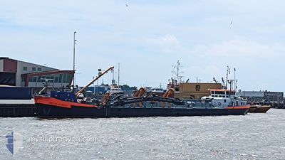
PIETER HUBERT
Dredging or underwater ops
Current Trip
AMELAND
| Time Travelled | 17 h, 44 mins |
|---|---|
| Remaining Time | --- |
| Distance Travelled | 31.28 nm |
| Remaining Distance | --- |
| AVG Speed | 5.2 Knots |
| MAX Speed | 8.8 Knots |
| AVG Wind | 25.9 knots |
| MAX Wind | 27.5 knots |
| MIN Temp | 3°C / 37.4°F |
| MAX Temp | 4.1°C / 39.38°F |
| Draught | 0 m |
| Position Received | 1 m ago |
Current Position
| Longitude | 5.80276° |
|---|---|
| Latitude | 53.42240° |
| Status | Under way using engine |
| Speed | |
| Course | --- |
| Area | North Sea |
| Station | T-AIS |
| Position Received | 1 m ago |
Info
Information
The current position of PIETER HUBERT is in North Sea with coordinates 53.42240° / 5.80276° as reported on 2025-02-11 01:26 by AIS to our vessel tracker app. The vessel's current speed is 0 Knots
The vessel PIETER HUBERT (MMSI: 244710846) is a Dredging or underwater ops It's sailing under the flag of [NL] Netherlands.
In this page you can find informations about the vessels current position, last detected port calls, and current voyage information. If the vessels is not in coverage by AIS you will find the latest position.
The current position of PIETER HUBERT is detected by our AIS receivers and we are not responsible for the reliability of the data. The last position was recorded while the vessel was in Coverage by the Ais receivers of our vessel tracking app.
Weather
| Temperature | 3.2°C / 37.76°F |
|---|---|
| Wind Speed | 31 knots |
| Direction | 89° E |
| Pressure | 1021.8 hPa |
| Humidity | 76.5 % |
| Cloud Coverage | 100 % |
Featured Company
Last Port Calls
| Port | Arrival | Departure | Time In Port |
|---|---|---|---|
| 2025-02-07 10:10 | 2025-02-10 07:43 | 2 d | |
| 2025-01-31 10:09 | 2025-02-03 08:22 | 2 d | |
| 2025-01-24 08:58 | 2025-01-27 08:59 | 3 d | |
| 2025-01-17 10:46 | 2025-01-20 08:20 | 2 d | |
| 2025-01-15 17:55 | 2025-01-16 05:24 | 11 h | |
| 2025-01-14 12:09 | 2025-01-14 12:23 | 14 m | |
| 2025-01-14 11:40 | 2025-01-14 11:53 | 13 m | |
| 2025-01-10 10:10 | 2025-01-13 08:46 | 2 d | |
| 2024-12-20 09:31 | 2025-01-06 08:48 | 16 d | |
| 2024-12-19 18:58 | 2024-12-20 05:13 | 10 h |
Last Trips
| Origin | Departure | Destination | Arrival | Distance | |
|---|---|---|---|---|---|
| 2025-02-03 09:22 | 2025-02-07 11:10 | 215.69 nm | |||
| 2025-01-27 09:59 | 2025-01-31 11:09 | 211.73 nm | |||
| 2025-01-20 09:20 | 2025-01-24 09:58 | 211.34 nm | |||
| 2025-01-16 06:24 | 2025-01-17 11:46 | 67.94 nm | |||
| 2025-01-14 13:23 | 2025-01-15 18:55 | 83.30 nm | |||
| 2025-01-14 12:53 | 2025-01-14 13:09 | 1.25 nm | |||
| 2025-01-13 09:46 | 2025-01-14 12:40 | 75.45 nm | |||
| 2025-01-06 09:48 | 2025-01-10 11:10 | 216.74 nm | |||
| 2024-12-20 06:13 | 2024-12-20 10:31 | 20.02 nm | |||
| 2024-12-18 06:16 | 2024-12-19 19:58 | 101.07 nm |
Events
| Time | Event | Details | Position / Dest | Info |
|---|---|---|---|---|
| 2025-02-10 19:34 | STOP Moving | 2.17 nm, East of AMELAND |
53.42288 / 5.80355
AMELAND
|
Speed: 0.3 kn Course: 511° |
| 2025-02-10 19:25 | START Moving | 1.84 nm, South East of AMELAND |
53.42280 / 5.79336
AMELAND
|
Speed: 3.1 kn Course: 21.1° |
| 2025-02-10 18:51 | STOP Moving | 2.3 nm, South East of AMELAND |
53.41476 / 5.80022
AMELAND
|
Speed: 0.2 kn Course: 511° |
| 2025-02-10 18:27 | START Moving | 1.95 nm, East of AMELAND |
53.42368 / 5.79735
AMELAND
|
Speed: 3.4 kn Course: 286.4° |
| 2025-02-10 18:19 | STOP Moving | 2.09 nm, East of AMELAND |
53.42313 / 5.80124
AMELAND
|
Speed: 0.3 kn Course: 511° |
| 2025-02-10 17:20 | START Moving | 2.01 nm, South East of AMELAND |
53.42009 / 5.79624
AMELAND
|
Speed: 3.5 kn Course: 137.1° |
| 2025-02-10 17:04 | STOP Moving | 2 nm, East of AMELAND |
53.42339 / 5.79877
AMELAND
|
Speed: 0.3 kn Course: 511° |
| 2025-02-10 16:59 | START Moving | 1.89 nm, South East of AMELAND |
53.42213 / 5.79442
AMELAND
|
Speed: 3.1 kn Course: 335.8° |
| 2025-02-10 16:46 | STOP Moving | 2.05 nm, South East of AMELAND |
53.41966 / 5.79711
AMELAND
|
Speed: 0.3 kn Course: 511° |
| 2025-02-10 16:45 | START Moving | 2.1 nm, South East of AMELAND |
53.41889 / 5.79816
AMELAND
|
Speed: 3.1 kn Course: 325.8° |