
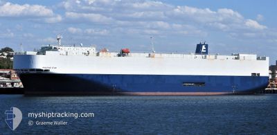
POSITIVE STAR
Vehicles Carrier
Current Trip
| Trip Time | 1 day |
|---|---|
| Trip Distance | 345.31 nm |
| AVG Speed | 14.7 Knots |
| MAX Speed | 18 Knots |
| Draught | 8.1 m |
| AVG Wind | 13 knots |
| MAX Wind | 28 knots |
| MIN Temp | 9.7°C / 49.46°F |
| MAX Temp | 16.6°C / 61.88°F |
| Position Received | 19 h, 8 m ago |
Current Position
| Longitude | 141.15183° |
|---|---|
| Latitude | 35.59853° |
| Status | Under way using engine |
| Speed | 16.1 Knots |
| Course | 57° |
| Area | North Pacific Ocean |
| Station | T-AIS |
| Position Received | 19 h, 8 m ago |
Info
Information
The current position of POSITIVE STAR is in North Pacific Ocean with coordinates 35.59853° / 141.15183° as reported on 2025-03-12 05:07 by AIS to our vessel tracker app. The vessel's current speed is 16.1 Knots and is currently inside the port of HITACHINAKA.
The vessel POSITIVE STAR (IMO: 9304502, MMSI: 355615000) is a Vehicles Carrier that was built in 2004 ( 21 years old ). It's sailing under the flag of [PA] Panama.
In this page you can find informations about the vessels current position, last detected port calls, and current voyage information. If the vessels is not in coverage by AIS you will find the latest position.
The current position of POSITIVE STAR is detected by our AIS receivers and we are not responsible for the reliability of the data. The last position was recorded while the vessel was in Coverage by the Ais receivers of our vessel tracking app.
The current draught of POSITIVE STAR as reported by AIS is 8.1 meters
Weather
| Temperature | 14.3°C / 57.74°F |
|---|---|
| Wind Speed | 6 knots |
| Direction | 322° NW |
| Pressure | 1012.2 hPa |
| Humidity | 61.2 % |
| Cloud Coverage | 100 % |
Featured Company
Last Port Calls
| Port | Arrival | Departure | Time In Port |
|---|---|---|---|
| 2025-03-12 21:37 | |||
| 2025-03-09 04:09 | 2025-03-11 13:01 | 2 d | |
| 2025-02-17 07:54 | 2025-02-17 12:21 | 4 h | |
| 2025-02-14 21:22 | 2025-02-15 09:08 | 11 h | |
| 2025-02-12 10:15 | 2025-02-14 15:36 | 2 d | |
| 2025-01-26 04:43 | 2025-01-27 14:33 | 1 d | |
| 2025-01-24 21:33 | 2025-01-25 06:33 | 9 h | |
| 2025-01-22 23:00 | 2025-01-23 09:13 | 10 h | |
| 2025-01-19 20:28 | 2025-01-20 07:25 | 10 h | |
| 2025-01-04 10:16 | 2025-01-04 21:32 | 11 h |
Last Trips
| Origin | Departure | Destination | Arrival | Distance | |
|---|---|---|---|---|---|
| 2025-03-11 22:01 | 2025-03-13 06:37 | 345.31 nm | |||
| 2025-02-17 15:21 | 2025-03-09 13:09 | 7193.37 nm | |||
| 2025-02-15 13:08 | 2025-02-17 10:54 | 589.24 nm | |||
| 2025-02-14 19:36 | 2025-02-15 01:22 | 63.02 nm | |||
| 2025-01-27 23:33 | 2025-02-12 14:15 | 6261.29 nm | |||
| 2025-01-25 15:33 | 2025-01-26 13:43 | 354.98 nm | |||
| 2025-01-23 18:13 | 2025-01-25 06:33 | 550.47 nm | |||
| 2025-01-20 15:25 | 2025-01-23 08:00 | 622.04 nm | |||
| 2025-01-05 01:32 | 2025-01-20 04:28 | 6047.92 nm | |||
| 2025-01-02 23:56 | 2025-01-04 14:16 | 654.08 nm |
Events
| Time | Event | Details | Position / Dest | Info |
|---|---|---|---|---|
| 2025-03-12 22:04 | STOP Moving |
36.43107 / 140.62048
[JP] HITACHINAKA
|
Speed: Course: 272° |
|
| 2025-03-12 21:37 | PORT ARRIVAL |
|
36.40398 / 140.63272
[JP] HITACHINAKA
|
Speed: 12.4 kn Course: 337° |
| 2025-03-12 05:14 | Status Changed | Default Under way using engine |
35.61548 / 141.18373
JP HIC
|
Speed: 16.1 kn Course: 57° |
| 2025-03-12 05:07 | OUT of Coverage |
35.59853 / 141.15183
North Pacific Ocean
JP HIC
|
Speed: 16.1 kn Course: 57° |
|
| 2025-03-11 23:45 | Status Changed | Under way using engine Default |
34.71343 / 139.67942
JP HIC
|
Speed: 16.5 kn Course: 73° |
| 2025-03-11 23:42 | Status Changed | Default Under way using engine |
34.70895 / 139.66092
JP HIC
|
Speed: 16.5 kn Course: 70° |
| 2025-03-11 23:36 | Change Sea Area | Japanese part of the North Pacific Ocean Japanese part of the Philippine Sea |
34.70127 / 139.63078
North Pacific Ocean
JP HIC
|
Speed: 16.5 kn Course: 70° |
| 2025-03-11 23:36 | Status Changed | Under way using engine Default |
34.70127 / 139.63078
JP HIC
|
Speed: 17 kn Course: 59° |
| 2025-03-11 23:26 | IN Coverage |
34.70127 / 139.63078
North Pacific Ocean
JP HIC
|
Speed: 16.5 kn Course: 70° |
|
| 2025-03-11 18:58 | OUT of Coverage |
34.47085 / 138.14368
Philippine Sea
JP HIC
|
Speed: 16.7 kn Course: 93° |